Camping in the Hunsrück
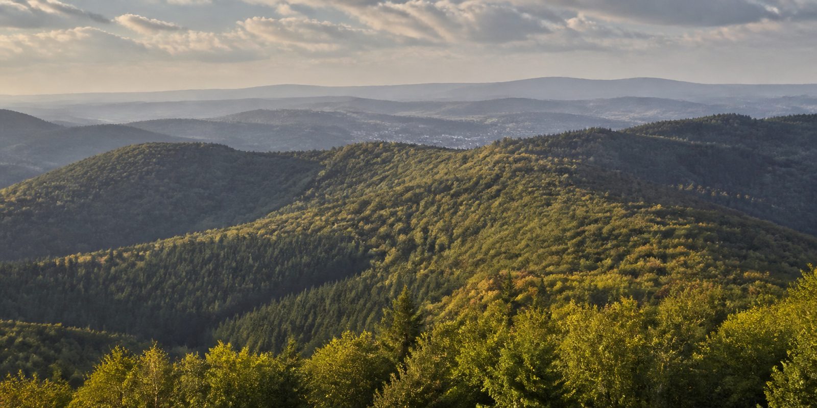
The Hunsrück is a slate and quartzite range between the Mosel, the Rhein, the Nahe and the Saar. It covers 2,703 square kilometers. Wooded quartzite ridges rise above its plateau of 400 to 500 meters, and at the Erbeskopf the range reaches 816.32 meters, the highest point in Rheinland-Pfalz and at the same time the highest German summit on the left bank of the Rhein. In beech forests rich in old timber lie the Hangbrücher, acidic spring and slope mires. The Rosselhalden of block scree reach down into the valleys. Around 100 wildcats live in the Hunsrück-Hochwald National Park, which makes it one of the wildcat strongholds of Europe.
86 places and units in this region
Places in this region

The year in this region
September: Red deer rut at Thranenweier
The red deer rut runs from mid-September to early October, marked by loud bellowing and occasional clashes between the stags. The national park runs guided wildlife-watching evenings in September, meeting at the Thranenweier parking lot on the K 49 near Börfink. From there, a short footpath leads to the wildlife observation point; the walks start around 6 p.m. and last about three hours.
In the middle of the month the sun rises at 7:05 AM and sets at 7:46 PM. That leaves 12 hours and 40 minutes of daylight.
Water and air: Open-Meteo, measured averages. How busy: share of school holidays 2027 across all sixteen federal states. Nature dates: German Weather Service, phenological observations 2014 to 2026 at 161 stations in the region, typical day.
Tours in this region
Marked tours that fit into a day from a site, and one multi day tour per kind.
- Hiking
Saar-Hunsrück-Steig
From Perl on the Mosel to Boppard on the Rhine, with a branch to Trier. In the Hunsrück the trail crosses the Erbeskopf, at 816 metres the highest summit of the range, and runs through the Hunsrück-Hochwald national park with its old beeches and hillside bogs. It then continues east past Idar-Oberstein until it drops towards the Rhine. Tarmac is rare.
379.6 kmMulti day tour
- Hiking
Nationalpark-Traumschleife Börfinker Ochsentour
A circuit around Börfink, deep in the national park, with the Ochsenbruch as its goal. A boardwalk crosses the hillside bog. Old beeches and spruces stand all around, and meadows open up in between with a wide view over the Hochwald ridges. The ground stays soft and natural nearly all the way.
9 kmLoop tour
- Hiking
Dollbergschleife
The start is the Köhlerhütte in Neuhütten, from where narrow paths climb to the ring fort of Otzenhausen, a stronghold of the Celtic Treveri begun around 400 BC and much enlarged in the last two centuries before Christ. Its walls of quartzite blocks now lie as wooded ramparts on the slope. Further down come the Züscher Hammer, a rebuilt water-powered iron forge on the stream, and the Nonnweiler reservoir. Almost half the distance is on footpaths.
11.3 kmLoop tour
- Hiking
Saar-Hunsrück-Traumschleife
Section Trauntal-Höhenweg
The Traun comes down from the Erbeskopf, and the loop follows it in the valley before climbing onto the heights above Rinzenberg and Buhlenberg. Up there the path crosses the Wehlenstein and runs along ribs of rock, down below there are beeches and a stream still finding its own course. A good third of the walking is on narrow paths. Kingfishers and dippers live on the Traun.
13.4 kmLoop tour
- Hiking
Traumschleife Gipfelrauschen
From the Hunsrückhaus the way climbs steeply straight to the Erbeskopf, where the sound sculpture Windklang stands. From the top the view runs across the Hunsrück ridges as far as the Eifel. After that the route keeps almost entirely to narrow, earthy forest paths and passes trees that are left where they fall inside the national park. Mostly you hear only the treetops.
7 kmLoop tour
- Hiking
Geierlayschleife
The loop starts in Mörsdorf and crosses the Geierlay, a suspension bridge 360 metres long that hangs nearly a hundred metres above the valley of the Mörsdorfer Bach. Underfoot there are wooden planks, and below them only forest. Then the path drops into the valley and climbs the far side, so the bridge is seen from beneath as well. The boards spring with every step.
8 kmLoop tour
- Cycling
Hunsrück-Radweg
Across the Hunsrück, from Saarburg on the Saar to Bacharach on the Rhine, passing close below the Erbeskopf, at 816 metres the highest summit in Rhineland-Palatinate. The start climbs, the middle between Hermeskeil and Simmern rolls over broad plateaus, and the finish drops into the Obere Mittelrheintal. Almost all of it is tarmac. The view moves from vineyards to spruce and beech forest and back to vines again.
156.5 kmMulti day tour
- Cycling
Ruwer-Hochwald-Radweg
The old Hochwaldbahn was closed long ago, its track bed was not. From Trier-Ruwer to Hermeskeil you roll on tarmac along the embankment, at roughly one per cent of gradient the whole way. Twenty bridges span the side valleys, and old station buildings still stand beside the route. Down in the Ruwertal vineyards climb the slopes, higher up it turns to forest. Climbing, you barely notice the climb.
54.5 km
Tours: © OpenStreetMap contributors, ODbL. Lengths computed from the mapped course, as of September 12, 2026.
Animals you can meet here
 all year
European wildcat
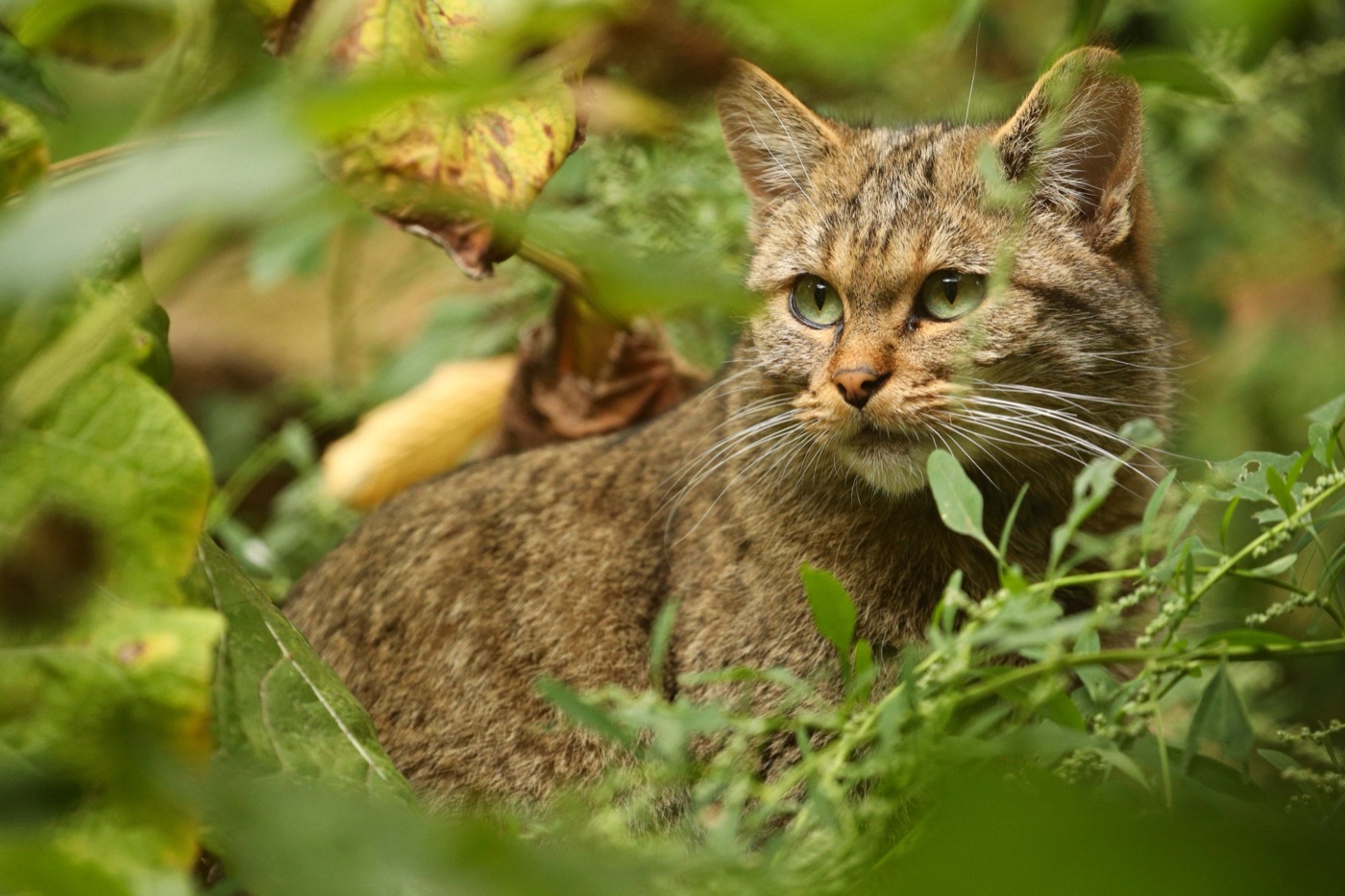
About 100 European wildcats live in the structurally rich mixed deciduous forests of the Hunsrück-Hochwald National Park, and the most reliable place to see one is the Wildenburg wildlife enclosure near Kempfeld. Its bushy tail with dark rings and a blunt black tip sets it apart from the domestic cat. In the wild it stays mostly hidden, and the Saar-Hunsrück Nature Park lists it as a shy species found throughout the Hunsrück.
 September to October
Red deer
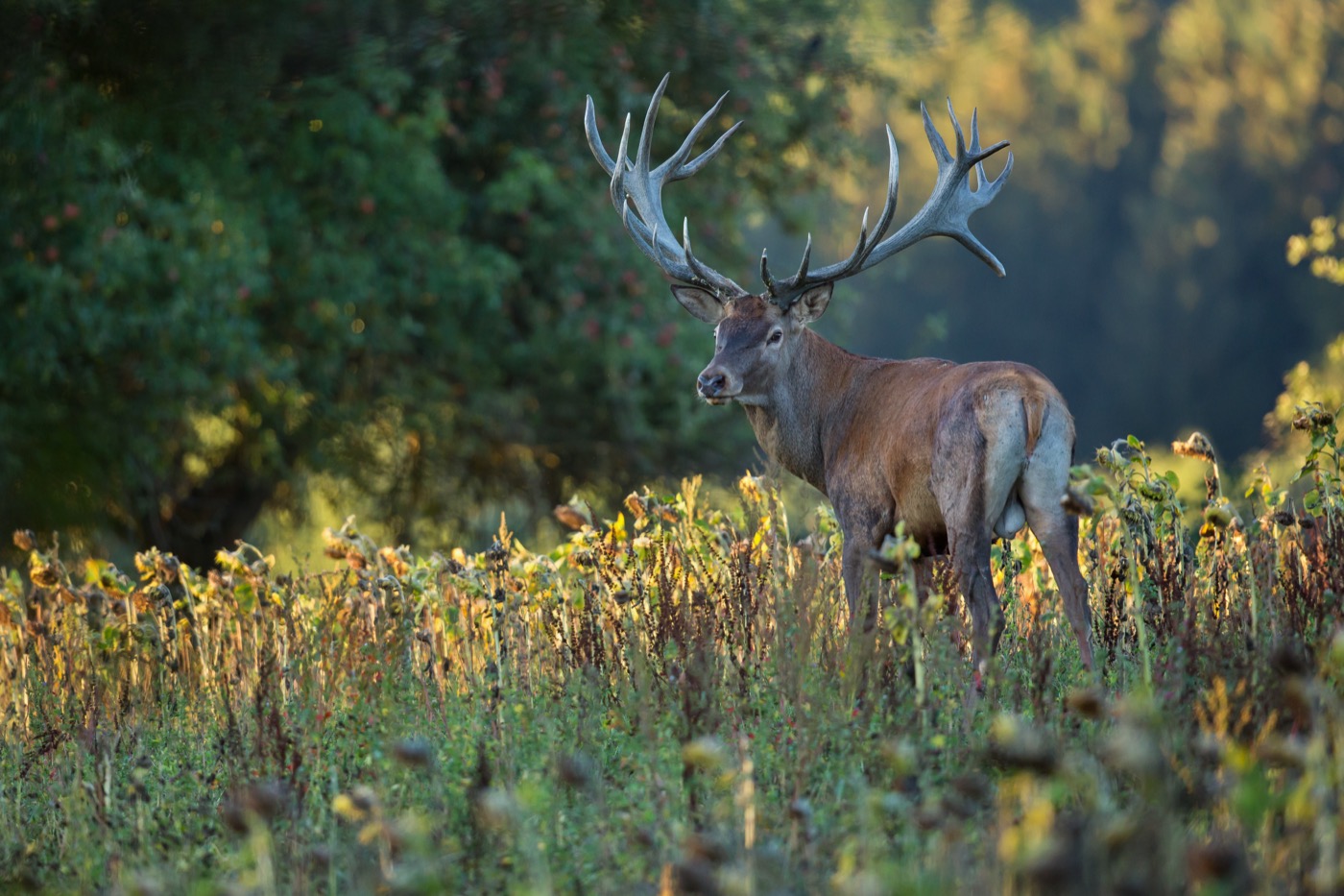
In the open land and light woodland of the national park, red deer show themselves most reliably at the wildlife observation point by the Thranenweier ranger meeting spot on the K 49 near Börfink. From mid-September to early October the stags roar during the rut, their calls carrying far across the terrain. The heavy antlers of the dominant stags make them recognizable from a distance at this time.
 March to May
Black woodpecker
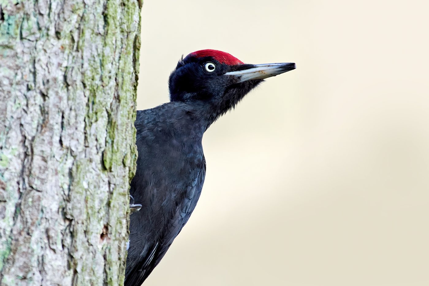
In the old-growth beech forests across the whole Hunsrück, the black woodpecker reaches its highest density anywhere in the state, as confirmed by Landesforsten Rheinland-Pfalz for the region and the Palatinate Forest. The largest native woodpecker, it is entirely black with a red patch on the head, and from March onward it drums and calls loudly enough to carry far. In early April it lays its eggs in cavities usually 8 to 20 metres up in old beech trees.
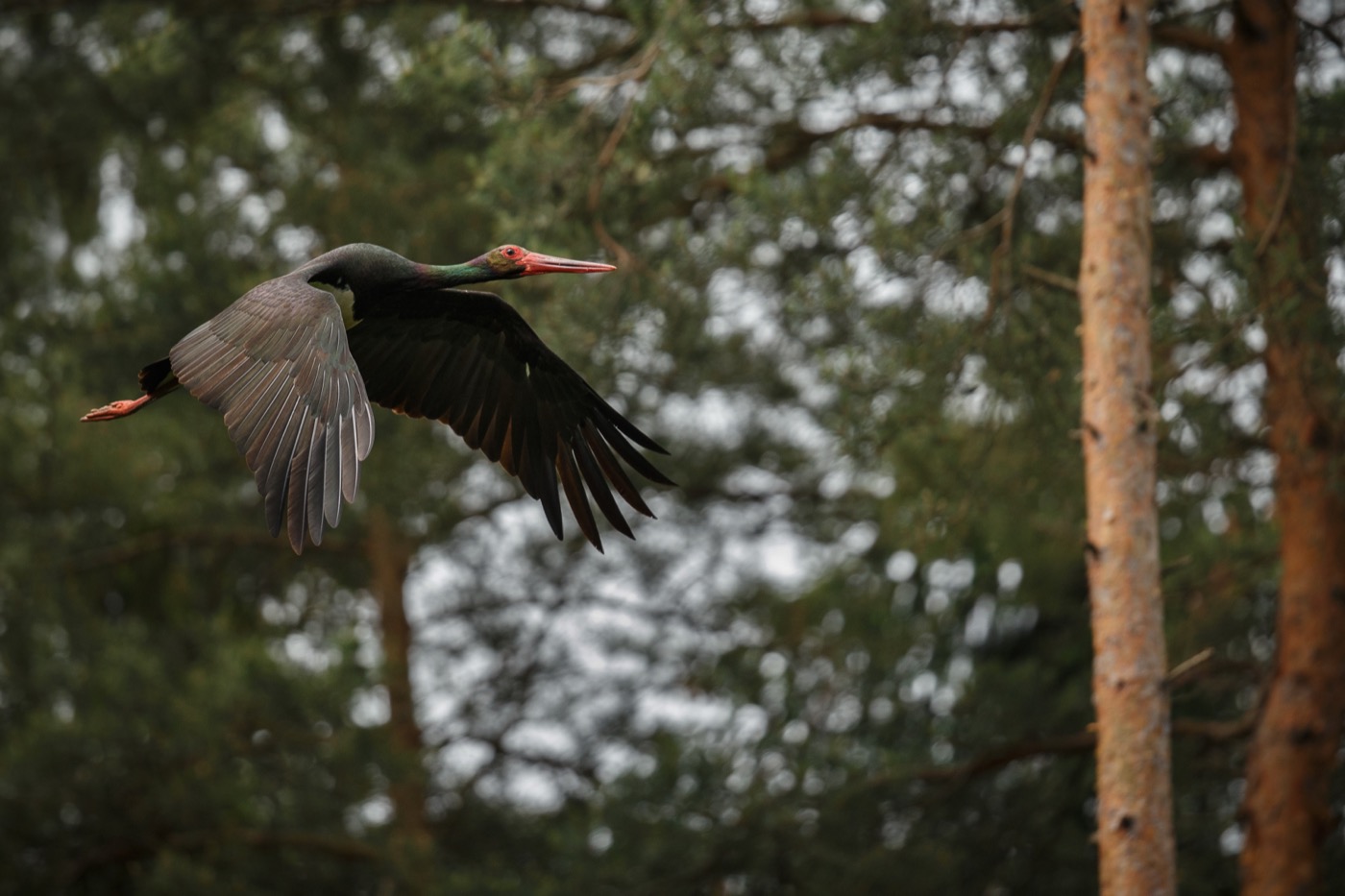 April to August
Black stork
The black stork breeds in old deciduous and mixed forests with streams, and the Hunsrück is one of the strongholds of the Rhineland-Palatinate breeding population of 30 to 40 pairs. Unlike its white relative it is shy and bound to the forest, recognizable by its dark, metallic-sheened plumage and red bill. In the second half of July the young black storks leave the nest and fledge.
Pictures: Freepik
Getting there
- 1 h 00 minKoblenz
- 1 h 30 minFrankfurt am Main
- 2 h 00 minKöln
- 4 h 45 minMünchen
- 5 h 45 minHamburg
- 6 h 30 minBerlin
Good to know
Dogs stay on the leash
Dogs must be kept on a leash in the national park, since dogs running loose can disturb rare and specially protected species. Dogs are allowed on the Geierlay suspension bridge but should be leashed for safety. At the Wildenburg wildlife park, leashed dogs are explicitly welcome.
Stay on marked trails
The national park asks visitors to experience nature from the marked hiking trails, so that refuge areas for sensitive species like the black stork stay undisturbed. Cyclists may use ten signposted national park bike crossings, but not forest machine tracks, skid trails, footpaths, or narrow trails. Hikers have right of way on all paths. Horseback riding in the forest is allowed only on roads and firm forestry access roads; the approved routes are marked in white on the trail map.
No open fires in the forest
Fires are not permitted in the forest, and this applies throughout the national park. No fire of any kind is allowed on the trekking platforms either, including camping stoves. Anyone wanting a hot meal should plan around the restaurants at the national park gateways, such as the cafe in the Hunsrückhaus at the Erbeskopf.
Overnight stays only at designated sites
For overnight stays outdoors, three trekking camps are available at the Wildenburg, Erbeskopf, and Keltenpark gateways, bookable from March 22 to October 31 for 15 euros per platform, reservation required. Wild camping outside these sites is not allowed. The region also offers conventional campgrounds and youth hostels as bookable accommodations.
Geierlay is freely accessible
The Geierlay suspension bridge between Mörsdorf and Sosberg is 360 meters long and hangs 100 meters above the valley. It can be crossed free of charge around the clock, year-round, in either direction. Strollers are not allowed because the bridge is narrow, and bicycles may be brought along but must be pushed across.
Still bodies of water are rare
The Naturpark Saar-Hunsrück describes still bodies of water in the region as fairly rare and, in some cases, artificially created. It lists the Riveristalsperre, Primstalsperre, and Steinbachtalsperre reservoirs, along with the Keller See, Losheimer See, and Bostalsee lakes. The Bostalsee near Nohfelden-Bosen in the Saarland is set up for swimming, with a beach area, sailing, pedal boats, kayaks, and SUP boards, plus a swimming season that runs until mid-September.
Protected landscapes
- National park
- Hunsrück-Hochwald
- Nature park
- Natur- und Geopark VulkaneifelSoonwald-NaheSaar-Hunsrück
Names and boundaries: © OpenStreetMap contributors.
About this region
The Hunsrück is a wooded low mountain range between the Moselle, Rhine, Nahe and Saar rivers in Rheinland-Pfalz and Saarland, with the Erbeskopf as the region's highest point and the Hunsrück-Hochwald National Park. Campsites and pitches are found at the national park gates, in river valleys and around the Geierlay suspension bridge.
It is busiest in mid September during the deer rut, and quietest in winter away from the ski lifts at the Erbeskopf. When a site is open is shown in each listing's calendar.
