Camping in Fischland-Darß-Zingst
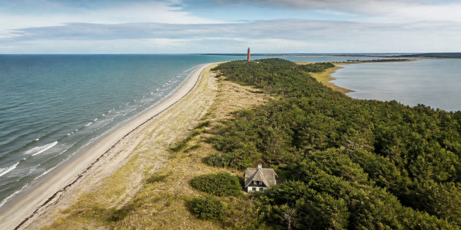
Fischland-Darß-Zingst is a peninsula 45 kilometers (28 miles) long between Rostock and Stralsund. It only took its current shape in 1874, when the Prerower Strom channel was closed for good and Zingst turned from a separate island into a spit of land. Six villages line the narrow strip: Wustrow, Ahrenshoop, Born a. Darß, Wieck a. Darß, Prerow, and Zingst. Between the open Baltic Sea to the north and the Darß-Zingst chain of boddens, the shallow lagoons behind the coast, to the south lies the 786-square-kilometer Vorpommersche Boddenlandschaft National Park, the largest national park in Mecklenburg-Vorpommern and the third largest in Germany. Along the west beach, 14 kilometers (9 miles) of unspoiled sandy shore run beside the Darßer Wald forest to the brick-red Darßer Ort lighthouse, in operation since 1849. In Ahrenshoop, the painter Paul Müller-Kaempff built a house and studio in 1892, laying the foundation for the artists' colony that is still active today, with its thatched-roof cottages. Every autumn, up to 70,000 resting common cranes make the Boddenlandschaft one of the most important bird stopover sites in central Europe.
14 places and units in this region
Places in this region

The year in this region
September: Red deer rut in the Darßwald
From mid-September, the red deer rut begins in the Darßwald forest, and their bellowing can be heard up close on guided walks run by the Förderverein Nationalpark Boddenlandschaft, the park's support association. The paths around the Buchhorster Maase, one of the main rutting grounds, are closed to visitors from September 1 to October 31.
In the middle of the month the sun rises at 6:41 AM and sets at 7:28 PM. That leaves 12 hours and 47 minutes of daylight.
Water and air: Open-Meteo, measured averages. How busy: share of school holidays 2027 across all sixteen federal states. Nature dates: German Weather Service, phenological observations 2014 to 2026 at 13 stations in the region, typical day.
Tours in this region
Marked tours that fit into a day from a site, and one multi day tour per kind.
- Hiking
Sundische Wiese Rundweg
The eastern end of Zingst belongs to the national park: salt meadows and dunes, wide open ground between Bodden and Baltic. The loop starts at the Ellerhof bicycle car park, reaches the Panoramasicht platform and carries on towards the Hohe Düne and Pramort at the far tip. Cranes rest here in autumn.
11.1 km
- Hiking
Wieker Weg - Rundweg
From the Wieker Weg car park the way leads north into the Osterwald. Fallow deer stand between the trunks. Over the Grenzweg and the Kavaliersschneise the loop swings west past a few giant sequoias near Müggenburg, and from the Boddendeich the view opens onto the island of Kirr.
13.2 km
- Cycling
Zingst Tour
First through the village and across the Zingster Strom to Müggenburg, then on a concrete track road as far as the Sundische Wiese and from there onto an asphalt road closed to cars. At Pramort you stand where Bodden meets Baltic, and the sea dyke brings you back. The surface stays firm throughout.
32.3 km
- Cycling
Rund um die Vinetastadt Barth
The ride starts at the harbour of Barth, where legend places the sunken town of Vineta out in the Bodden. It runs by way of Glöwitz, Dabitz, Küstrow and Kenz with its old brick church and comes back through Frauendorf and Divitz into the old centre. Mostly quiet roads, with firm field tracks between.
25.1 kmLoop tour
- Cycling
Die Fischland Tour
Fischland is a narrow strip between the Saaler Bodden and the Baltic, and the loop from Wustrow harbour uses both sides. At Ahrenshoop the route runs along the cliff edge with the sea in view and back to the Wustrow pier. The Schifferkirche sits half a kilometre off the route. Then the dyke carries on towards Dierhagen.
12.7 km
Tours: © OpenStreetMap contributors, ODbL. Lengths computed from the mapped course, as of September 12, 2026.
Animals you can meet here
 September to November
Common crane
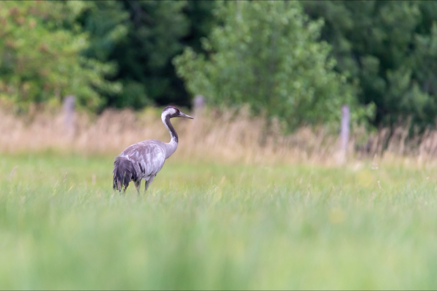
At the NABU Erlebniszentrum Kranichwelten with its Kranorama in the Günz district, the autumn crane migration can be followed up close without disturbing the birds. The grey bird with the red patch on its crown can be heard from far away by its trumpeting call. Between September and November, up to 70,000 birds rest here on their way south, with the peak usually around the middle of October.
 September to October
Red deer
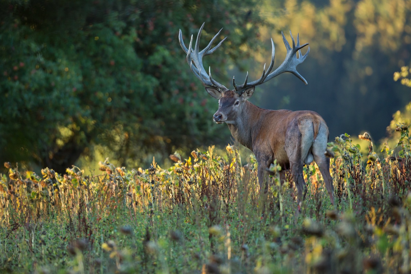
Around the Buchhorster Maase in the Darßwald, the roaring of red deer stags can be heard from mid-September, best of all on the guided walks run by the Förderverein Nationalpark Boddenlandschaft. The powerful stags with their wide-spreading antlers gather their harems and settle their contests with loud roaring. During the rut, the paths around the Maase are reserved for the guided groups until the end of October.
 December to May
White-tailed eagle
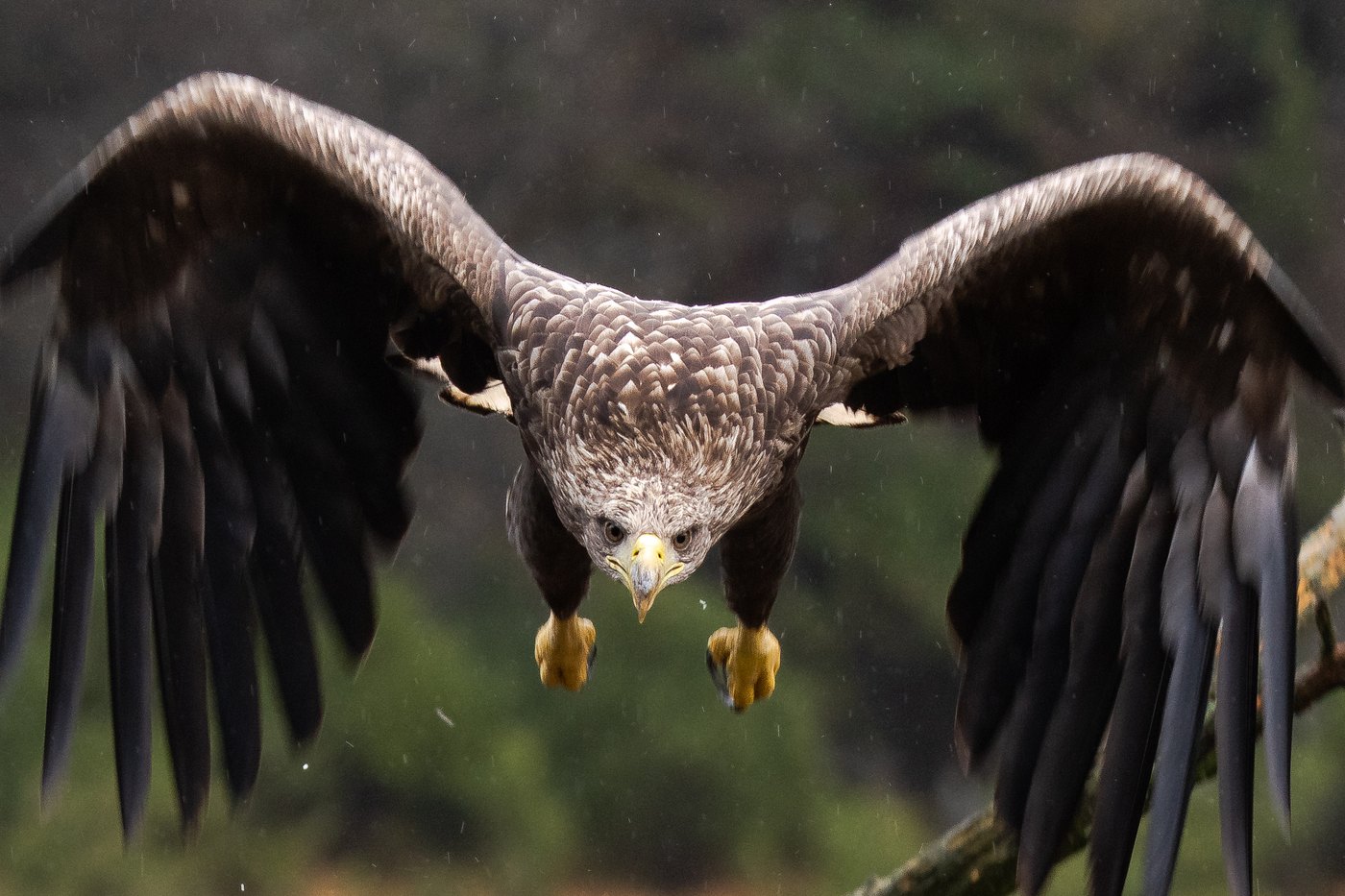
In the Bodden waters near the Sundische Wiese and off Prerow, the national park's white-tailed eagles can be watched up close. With a wingspan of over two meters and the white tail feathers of the adult birds, they stand out even from a distance. From late January they perform their courtship flights over the water and rest at length in between on posts and uninhabited sandbanks.
 April to July
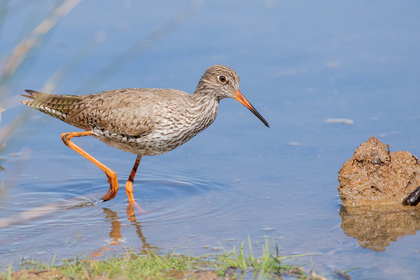
Common redshank
On the bird island of Kirr in the Barther Bodden, the courtship display of the redshanks begins in spring, recognizable by their bright orange-red legs and the pale wing band seen in flight. The island with its salt marshes and tidal creeks is one of the region's most important breeding sites and can only be viewed with binoculars from the shore or on guided boat tours. From April the birds are out over the meadows with their characteristic call.
Pictures: Freepik
Getting there
- 1 h 15 minRostock
- 3 h 00 minHamburg
- 3 h 15 minBerlin
- 7 h 00 minKöln
- 7 h 30 minFrankfurt am Main
- 8 h 30 minMünchen
Good to know
The Meiningenbrücke opens for boats
The L 21 between Bresewitz and Zingst runs over the Meiningenbrücke. In the summer season it opens within set time windows, but only when boats have registered in advance. Road traffic then waits for up to 30 minutes. In the winter season the bridge opens on Tuesdays only.
Leashes required in the national park
Dogs may not run free in the Vorpommersche Boddenlandschaft National Park, a rule set out explicitly in the national park regulation. On the Baltic beaches, many stretches are restricted from May to September to designated dog beach sections; outside that period, the beach can be used with dogs on a leash.
Observe bird islands from a distance
The breeding islands of the bodden chain, such as Kirr, Barther Oie, and Heuwiese, are closed to visitors and can only be viewed with binoculars from the shore or on guided boat tours. In the national park's core zones, visitors must also stay on marked paths at all times.
Zones for boats and canoes
Motorized watercraft may not enter the bodden waters outside the marked channels, as set out in the national park regulation. Canoes and sailboats are allowed in the so-called Green Zones, keeping a minimum distance from reeds and birds, while the Red Zones remain completely off-limits.
Designated sites, not free parking
Overnighting in a motorhome outside designated sites is largely prohibited on the peninsula; official sites, such as the one at the Wassersportzentrum Zingst, the water sports center, take guests even without a reservation. A visitor's tax, a parking fee, and quiet hours from 10 p.m. to 8 a.m. apply there.
Fires only on set occasions
Open fires on the beach are largely limited to set occasions such as the Easter bonfire; campfires and grilling are generally prohibited at campsites and motorhome sites. The traditional Easter bonfires burn in Zingst, Prerow, and Wustrow on Easter Saturday.
Protected landscapes
- National park
- Vorpommersche Boddenlandschaft
Names and boundaries: © OpenStreetMap contributors.
About this region
Fischland-Darß-Zingst is a 45 kilometer peninsula between Rostock and Stralsund, with the Baltic Sea to the north and the Bodden lagoons to the south. Beach campgrounds sit alongside quiet pitches by the Bodden.
The season starts at Easter and peaks in July and August, when water sports and beach life draw the crowds. Spring, autumn and winter are noticeably quieter on the peninsula.
