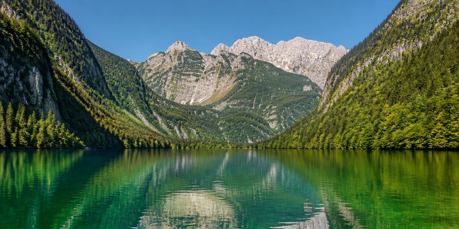
Camping in the Berchtesgadener Land
In the north lies the Rupertiwinkel, gently rolling. Southwards the Berchtesgadener Land reaches into the Nationalpark Berchtesgaden on the Austrian border, the only alpine national park in Germany. It covers 210 square kilometres between the Königssee at 603 metres and the Watzmann at 2,713 metres, and on three quarters of that, the core zone, nature is left to itself. Such a range of altitude in so little space shapes everything. The Blaueisgletscher is the northernmost glacier in the Alps, the Watzmann-Ostwand the longest unbroken rock face in the Eastern Alps. Recognised as a biosphere reserve in 1990, the region is the only one in Germany with alpine and pre-alpine habitats. Since the extension of June 2010 the reserve covers the entire district.
The year in this region
September: Ibex in the Hagengebirge
About 150 alpine ibex live in the region, descended from animals brought in from Switzerland starting in 1936 and released from their enclosure around 1944. They are most often found in the Hagengebirge around the Schneibstein and Kahlersberg, above the tree line on rock and grassy meadows. In late summer and early fall they still stay high up, before moving lower with the first snow.
In the middle of the month the sun rises at 6:45 AM and sets at 7:22 PM. That leaves 12 hours and 38 minutes of daylight.
What nature does this month
- Apple picking starts around September 28 (usually between September 19 and October 1)
Water and air: Open-Meteo, measured averages. How busy: share of school holidays 2027 across all sixteen federal states. Nature dates: German Weather Service, phenological observations 2014 to 2026 at 30 stations in the region, typical day.
Tours in this region
Marked tours that fit into a day from a site, and one multi day tour per kind.
- Hiking
SalzAlpenSteig
From lake to lake: from the Chiemsee past the Königssee to the Hallstätter See, through Bavaria, Salzburg and Upper Austria. Salt holds the route together. Along the way come the brine springs of Bad Reichenhall, the Ramsau valley below the Watzmann and, at the end, the Hallstätter See with its town on the steep slope.
236.6 kmMulti day tour
- Hiking
Wanderweg 1
Section Soleleitungsweg
The line of the old brine pipeline: from 1817 salty water ran from the Berchtesgaden salt mine over the Söldenköpfl down to the saltworks in Bad Reichenhall, through hollowed-out tree trunks known as Deicheln. Because the gradient had to stay tiny, the path runs almost level at mid-slope, open to the south. The view opens onto the Wimbachtal and the Ramsau.
20.8 km
- Hiking
Wanderweg 62a
Section Zauberwald-Rundweg
In the Zauberwald lie the blocks of a rockfall that broke away from the Dachstein limestone on the Hochkalter some three and a half thousand years ago and dammed the Klausbach. That is how the Hintersee came about. A narrow path leads close to the water between the moss-covered boulders, and panels explain how lake and forest were formed.
1.1 kmLoop tour
- Hiking
Wanderweg 60
Section Wimbachklamm-Rundweg
The gorge at the entrance to the Wimbachtal is about two hundred metres long. Over that short stretch the water shoots straight out of the rock walls and falls free into the ravine, while you walk on wooden walkways and bridges through the spray. The way back runs above it through the forest.
2.1 kmLoop tour
- Hiking
Malerwinkelrundweg
From the shore of the Königssee the path climbs in two wide bends through open mixed forest to a ledge above the water. St. Bartholomä lies a good four kilometres away. The pilgrimage church carries two onion towers and three red domes, with the east face of the Watzmann behind it. A side path, the Rabenwandsteig, leads to a viewpoint below the Rabenwand.
3.1 kmLoop tour
- Hiking
Almerlebnispfad
Three alpine pastures in the Lattengebirge above the Ramsau, linked by forest roads and narrower paths: the Mordaualm, the Lattenbergalm with no hut service and the Moosenalm. The meadows lie open to the south, with the Hochkalter across the valley. The way back runs over the Pioniersteig.
10.9 km
- Hiking
Thumseerundweg
At the Thumsee west of Bad Reichenhall the ground stays firm and almost level, running right along the shore. The water is clear and pleasant by early summer. A belt of reeds lines the edge, with sandy coves and plenty of benches between them. The Nesselgraben seeps away over its last three to four hundred metres and reaches the lake underground.
2.5 km
- Cycling
Bodensee-Königssee-Radweg
Section Region Berchtesgaden
The last piece of the route coming from the Bodensee runs out of Traunstein past Kloster Höglwörth, whose baroque church stands on a peninsula in its own small lake. Anger and Piding follow, then the Saalach valley. Beyond Bad Reichenhall the road climbs over Bayerisch Gmain and Bischofswiesen before rolling down to Berchtesgaden and the Königssee.
57.3 km560 m ascent
- Mountain biking
Berchtesgaden - Gotzenalm
On forest roads from Berchtesgaden via Hinterbrand and the Königsbachalm up to the plateau of the Gotzenalm, a good thousand metres above the Königssee. Pastures up top, the Steinernes Meer behind them. Walk the last few minutes to the Feuerpalfen on foot and you stand on the rim above the lake, facing the east face of the Watzmann.
12.1 km
Tours: © OpenStreetMap contributors, ODbL. Lengths computed from the mapped course, as of September 12, 2026.
Animals you can meet here
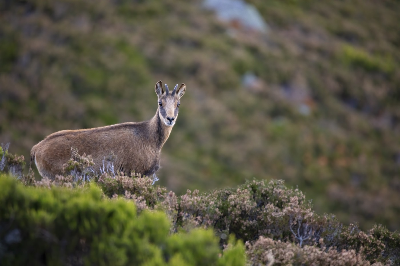 June to December
Chamois
The chamois lives in every mountain range of the Berchtesgaden Alps and stays above the tree line in summer, for example near the Schneibstein and its old snowfields. A dark stripe along its back and short, backward-hooked horns make it easy to identify. In November and December the bucks hold their rut on the steep slopes, and once snow sets in the animals move down into the lower mountain forests.
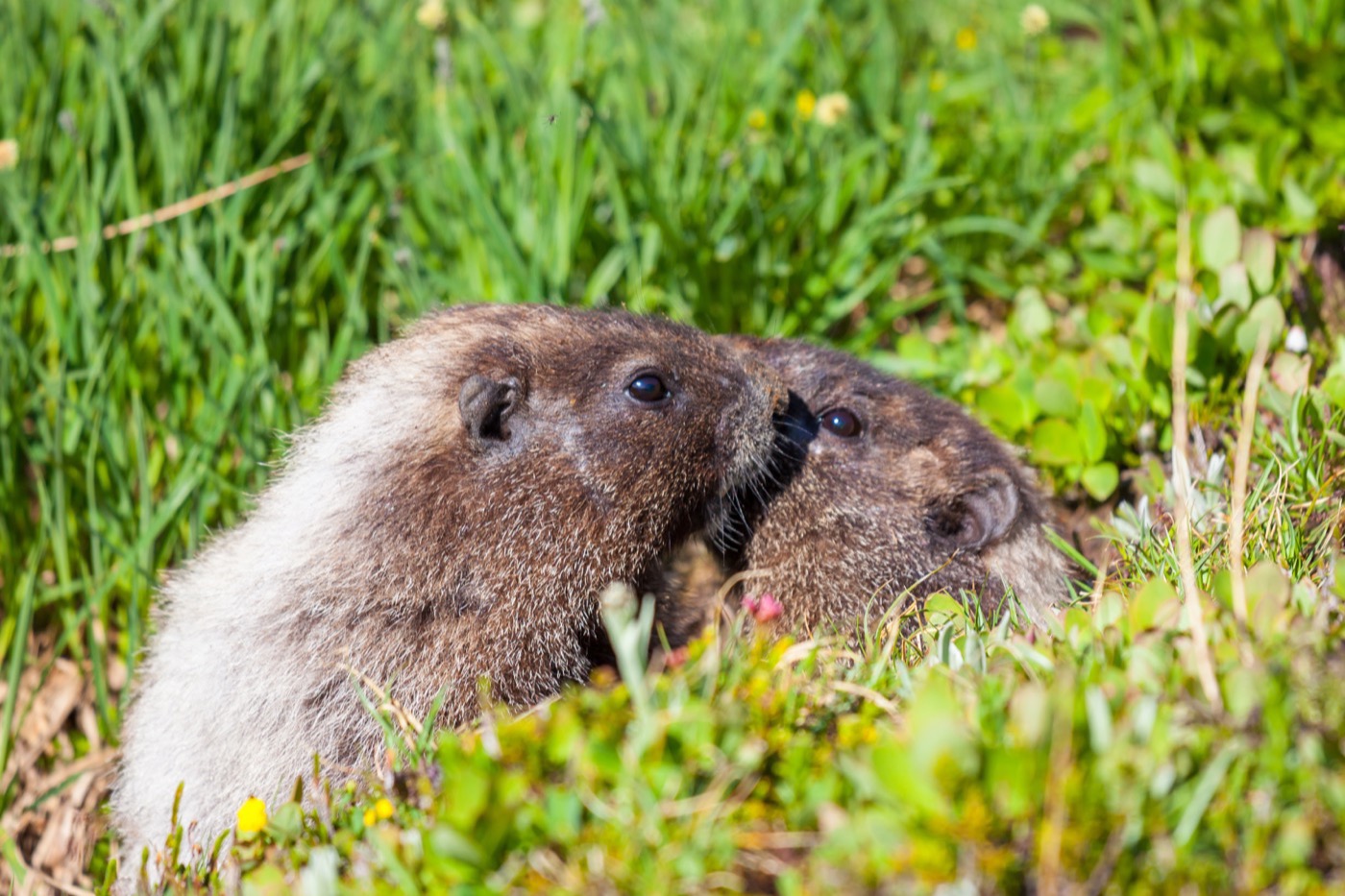 April to September
Alpine marmot
The Alpine marmot lives in colonies on the alpine meadows of Nationalpark Berchtesgaden, among them Königsbachalm, Kleine Reibn and the area around Funtensee near Kärlingerhaus. A sharp warning whistle from the lookout usually gives the grey-brown animals away before you spot them. From April to September they are active above ground, digging at their burrows and building up fat reserves for the next hibernation.
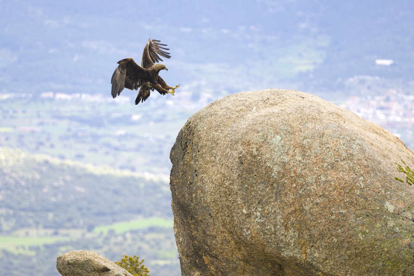 January to March
Golden eagle
Nationalpark Berchtesgaden currently holds five occupied golden eagle territories, and the bird shows itself most reliably above the Klausbachtal and the Wimbachtal. At the viewing point above Klausbachhaus at Hintersee, barely 20 minutes on foot, its broad, fingered wings set it apart from a common buzzard. From January to March it performs its conspicuous courtship flights over the valley flanks, with steep dives and looping glides.
 January to December
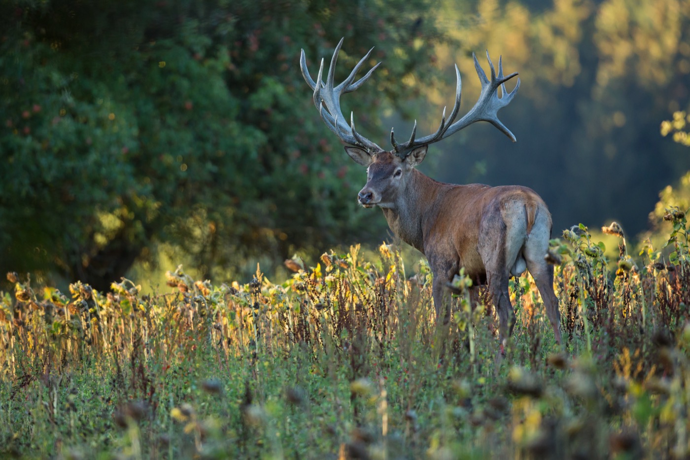
Red deer
In winter up to 50 red deer, hinds and calves gather at the feeding station in the Klausbachtal near Ramsau, easy to watch at close range inside an enclosure of about 45 hectares. They are recognizable by their reddish brown coat and, on the stags, an impressive set of antlers. In October the stags hold their rut in the mountain forests around Wasseralm, their roaring carrying through the woods at dusk.
Pictures: Freepik
Getting there
- 1 h 30 minMünchen
- 2 h 15 minAugsburg
- 5 h 00 minFrankfurt am Main
- 6 h 45 minKöln
- 7 h 00 minBerlin
- 8 h 45 minHamburg
Good to know
Dogs Must Be Leashed Year-Round
In the Nationalpark Berchtesgaden, dogs must be kept on a leash, and visitors must stay on marked trails and keep their distance from wildlife. Rangers patrol year-round, including early morning and late evening, and enforce the national park regulations.
No Open Fires, No Tents
Open fires, tents, and bivouacking outdoors are banned throughout the protected area. The national park administration checks for this especially around the Königssee and in the valleys and higher elevations. For overnight stays, the staffed mountain huts and the campgrounds and RV sites down in the valley are available.
Only Electric Boats on the Königssee
Boating is not allowed on the national park's waters, and this explicitly includes inflatable boats and air mattresses. The only boats on the water are those of the Bayerische Seenschifffahrt, which have run on electric power on the Königssee since 1909, along with their rental rowboats. Boats run to Salet at the south end, the access point for the Obersee and the Röthbachfall waterfall, from late April to mid-October, and the crossing to St. Bartholomä takes about 35 minutes.
RVs Only at Designated Sites
Overnight stays outdoors, including in a vehicle, are not permitted in the national park. The county has six campgrounds and three designated RV sites, including the Wohnmobilparkplatz Königssee in Schönau and the Stellplatz Götschenalm in Bischofswiesen. On private land, even at popular destinations, overnight stays are only possible with the explicit consent of the owner.
Winter Refuge Zones, No-Fly Areas Over Eagle Nests
For winter, the national park designates wildlife refuge zones that should be avoided on ski and snowshoe tours. Over the golden eagles' nesting areas, no-fly zones for paragliders are in effect during the breeding season. Drones and other flying objects are banned throughout the entire protected area.
Accessible Path with Suspension Bridge in the Klausbachtal
From the Klausbachhaus at Hintersee, a wide, gently graded path crosses a suspension bridge to the golden eagle and bearded vulture observation point, about a 20-minute walk. Accessible paths in the national park are marked in yellow and built with no risk of falls. The Klausbachhaus is open daily from 9 a.m. to 5 p.m., admission is free.
Protected landscapes
- National park
- Berchtesgaden
Names and boundaries: © OpenStreetMap contributors.
About this region
The Berchtesgadener Land lies in southeastern Bavaria, from the Rupertiwinkel to Berchtesgaden National Park on the Austrian border, with the Watzmann and the Königssee as its best known landmarks. Campsites and pitches sit in the valleys around Ramsau, Schönau and Bischofswiesen.
The busiest season is summer, when the mountain pastures are in use and the Königssee sees the most visitors. Spring and autumn are quieter, and the pastures open from late May.
