FeatureDestinations·3 min read
Staying high: three weeks in the Berchtesgaden Alps
Down in the basin you see the wall. Up top you see everything else. A route for people in no hurry.
Redaktion GROUNDS·Published on August 6, 2026
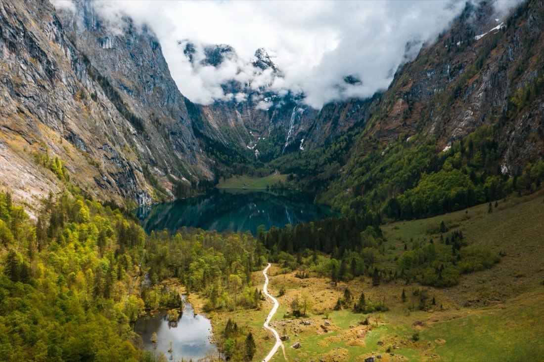
The Obersee lies behind the Königssee and can be reached only on foot or by boat. That is exactly what keeps it surprisingly empty on weekdays. You take the boat as far as Salet, walk a short stretch from there, and then the bustle stops. This is the beginning of a route that stretches over three weeks, because it leads upwards, and up there nobody is in a hurry.
The waterfall almost nobody knows
On the southern shore of the Obersee, the Röthbach drops four hundred and seventy metres. It is the highest waterfall in Germany, and it does not feature prominently in any guidebook, because you cannot take it in on the way past. The path runs about three kilometres along the lake from the boat landing, past steep faces, to the Fischunkelalm.
The fall clears the Röthwand in two main stages. That wall separates the basin of the Königssee and the Obersee from the Röth, the high plateau between the Steinernes Meer and the Hagengebirge. What looks like an end from below is in fact a threshold: behind it begins the altitude in which the rest of the route takes place.
Germany's only Alpine national park
Berchtesgaden is the only national park Germany has in the Alps. Its remoteness spared it the development that reached the valleys all around, and you notice that in the infrastructure: there are paths and huts, but no lifts into the interior. If you want to go up, you walk.
The coldest place in the country
On the plateau of the Steinernes Meer, at 1,633 metres, lies the Funtensee, and it carries a title that does not suit a bathing lake: on Christmas Eve 2001, minus 45.9 degrees were measured here, the lowest value Germany has ever recorded. The reason is the shape of the ground. The lake sits in a hollow, cold air is heavier than warm, it sinks and collects in this basin, from which it cannot drain away.
In summer none of this is noticeable, and the Funtensee is a walking destination with clear water. One detail stays visible even in July: the double tree line. No tree grows directly at the lake, low vegetation sets in further up, and above that there is forest again. The cold air at the bottom prevents what succeeds twenty metres higher.
Why three weeks and not three days
The route could be walked faster. The reason not to is the weather. At this altitude the morning decides whether the afternoon happens at all, and anyone with a fixed return date sets off in conditions in which they would have done better to stay put. Three weeks does not mean twenty-one days of walking, but enough days to sit the bad ones out.
Then there is the rhythm of the huts. If you stay on the plateau, you plan from one night to the next, and the distances are set not by kilometres but by where the next roof stands. Down in the valley, around Schönau and Ramsau, the sites take everything that arrives with a vehicle. They are the beginning and the end; the rest lies in between.
Sites in the Berchtesgadener Land

What stays with you
The valley basin shows the east face of the Watzmann, and everyone photographs it from the same spot. Higher up that single image disappears, because you are standing in the middle of it and see the same thing in every direction: rock, mountain pine, a lake in a hollow. It is less spectacular and it lasts longer.
More from this region: Camping in the Berchtesgadener Land
Image credits
- Cover image: teksomolika / Magnific
