Camping in the Westerwald
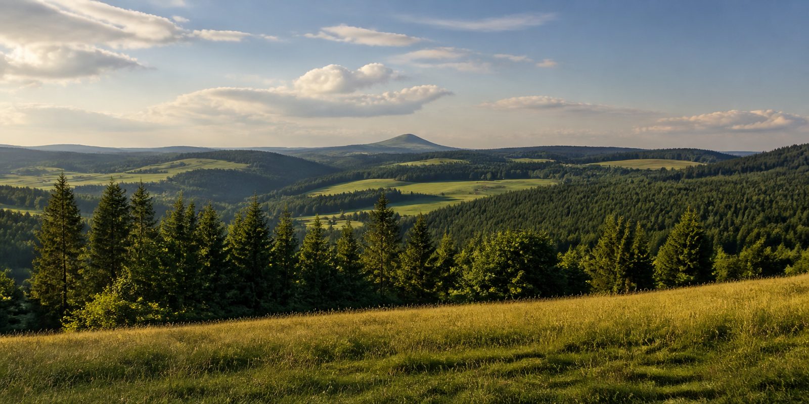
The Fuchskaute rises to 657 metres. It is the highest point of the Westerwald, a basalt dome in the Hoher Westerwald whose rock formed as Tertiary volcanic stone some 25 million years ago. Volcanoes shaped the whole upland landscape between Rhein, Lahn, Sieg and Dill. Limestone defines the Taunus, ore the Siegerland. Here basalt and slate of the Rheinisches Schiefergebirge carry the broad plateaus with their raw, bracing climate. Since 1962 the Naturpark Rhein-Westerwald, around 470 square kilometres in size, has protected much of the western slopes running down to the Rhein. At the centre lies the Westerwälder Seenplatte, whose largest standing water is the Dreifelder Weiher with 123 hectares. In the Kannenbäckerland around Höhr-Grenzhausen, grey-blue clay has been fired into salt-glazed stoneware since the 16th century, a craft recognised as intangible cultural heritage in 2016. Walkers follow the WesterwaldSteig, roughly 240 kilometres from Herborn to Bad Hönningen on the Rhein, sixteen stages across eight natural landscapes, among them the Kroppacher Schweiz and the Seenplatte. Ponds and reservoirs are spread across the plateaus, and single basalt cones stand above the gentle rounded hills.
The year in this region
September: Red Deer Rut at Wildpark Westerwald
Between mid-September and mid-October, red deer stags fight for rank and their bellowing carries for kilometers, including at Wildpark Westerwald in Gackenbach, which offers a guided rutting night walk each year. During the rut the animals eat very little and live off the fat reserves built up over summer.
In the middle of the month the sun rises at 7:03 AM and sets at 7:45 PM. That leaves 12 hours and 41 minutes of daylight.
Water and air: Open-Meteo, measured averages. How busy: share of school holidays 2027 across all sixteen federal states. Nature dates: German Weather Service, phenological observations 2014 to 2026 at 108 stations in the region, typical day.
Tours in this region
Marked tours that fit into a day from a site, and one multi day tour per kind.
- Hiking
Nord Süd Trail
Section Herborn - Westerburg
Herborn sits on the Dill, and from its old town the trail climbs into the Hoher Westerwald. Around Erdbach the ground is karst, with caves below. Up on the Fuchskaute, the highest point of the Westerwald, basalt carries a plateau of pasture, and after that come the Krombachtalsperre and the narrow Holzbachschlucht near Gemünden.
57.7 km
- Hiking
Nord Süd Trail
Section Westerburg - Hachenburg
Between Westerburg and Hachenburg the water lines up: the ponds of the Westerwälder Seenplatte near Dreifelden and the source of the Wied near Linden. The Stöffel at Enspel is an old basalt quarry. From there the trail follows the Nistertal to Bad Marienberg and finally to Hachenburg.
59 km
- Hiking
Lahnwanderweg - 19.
Section Bad Ems-Lahnstein
From the Kurhaus in Bad Ems the path runs along the Lahn and then climbs to the Lemberg, an old vineyard slope where Boer goats now graze. At Fachbach it takes up the old postal road. The last part goes through the Ruppertsklamm, a kilometre and a half squeezed between rock and water, until the Lahn meets the Rhine at Niederlahnstein.
15.6 km
- Cycling
Westerwald-Lahn-Radweg
Straight across the Westerwald, from the Sieg at Wissen to the Lahn at Bad Ems. Between Gebhardshain, Hachenburg, the ponds at Dreifelden and Montabaur it climbs again and again and then drops into the next valley. The plateaus in between are open and wide.
61.4 km1268 m ascent
- Cycling
Wiedradweg
The Wied rises near Linden, and the cycle route follows it from there to its mouth on the Rhine at Neuwied. Mostly it goes downhill. Up top there is still the Dreifelder Weiher, the largest of the Westerwald ponds, and further down the valley narrows and greens, past Steinebach and Ingelbach to Waldbreitbach and Altwied.
97.4 km
- Cross country skiing
Westerwaldloipe
From Bad Marienberg the track runs over Lautzenbrücken and Nisterberg up to the Fuchskaute, at 657 metres the highest point of the Westerwald. Under the snow lies basalt from a broad sheet of old lava flows, out of which erosion shaped this rounded summit. Up top it is wide and open.
17.6 km
Tours: © OpenStreetMap contributors, ODbL. Lengths computed from the mapped course, as of September 12, 2026.
Animals you can meet here
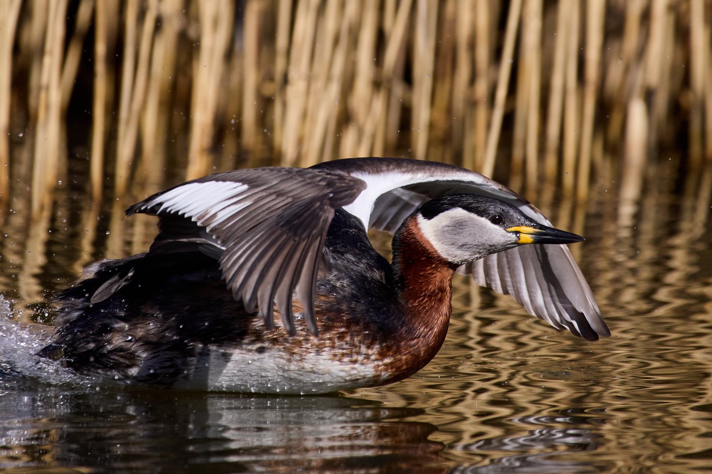 April to June
Red-necked grebe
The Dreifelder Weiher in the Westerwälder Seenplatte holds the only Red-necked Grebe population in Rheinland-Pfalz. From the observation platform on the shore, the birds show a rust-red neck and pale cheek patches. Between April and June, their shrill, whinnying courtship call carries across the water as the pairs begin laying eggs.
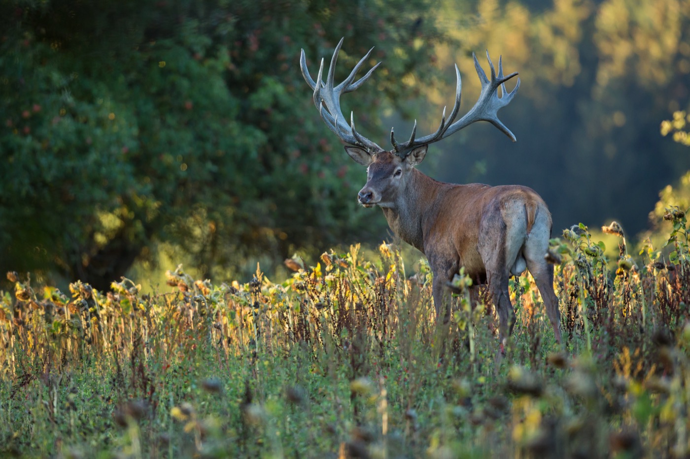 September to November
Red deer
At the Wildpark Westerwald in Gackenbach, the autumn rut can be followed at close range. The park runs guided tours for it, during which the red deer stand out for their massive antlers and powerful reddish-brown build. Between mid-September and mid-October, the stags fight loudly over the hinds, and their roaring carries far across the park.
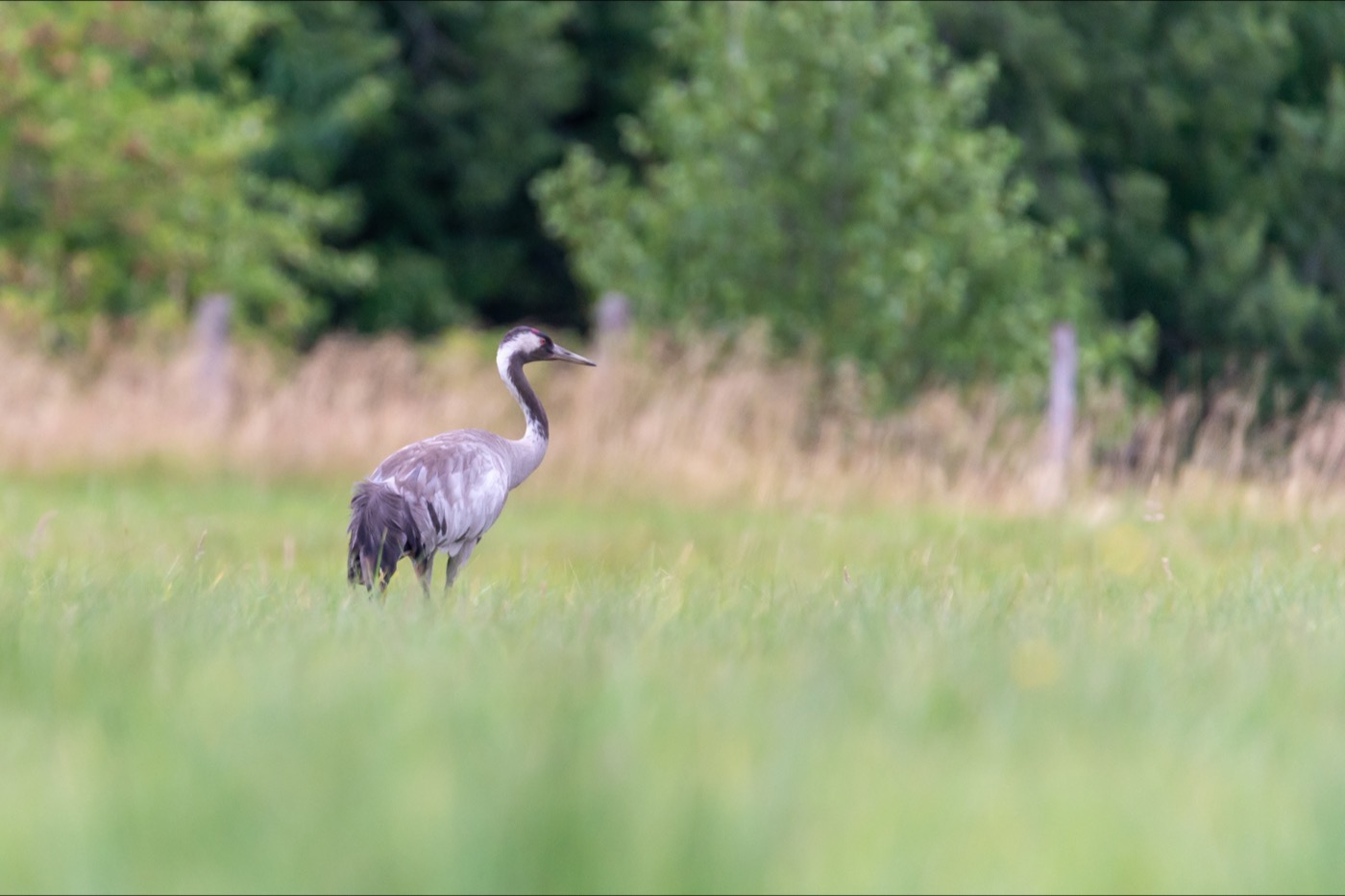 September to November
Common crane
Over the Gelbachtal in the Westerwald, large flocks of several hundred common cranes pass through in autumn, peaking in October. The tall grey birds are recognized by their long neck and legs and their trumpeting call, audible from far away. They are most active, and easiest to watch, around sunrise and sunset.
 November to February
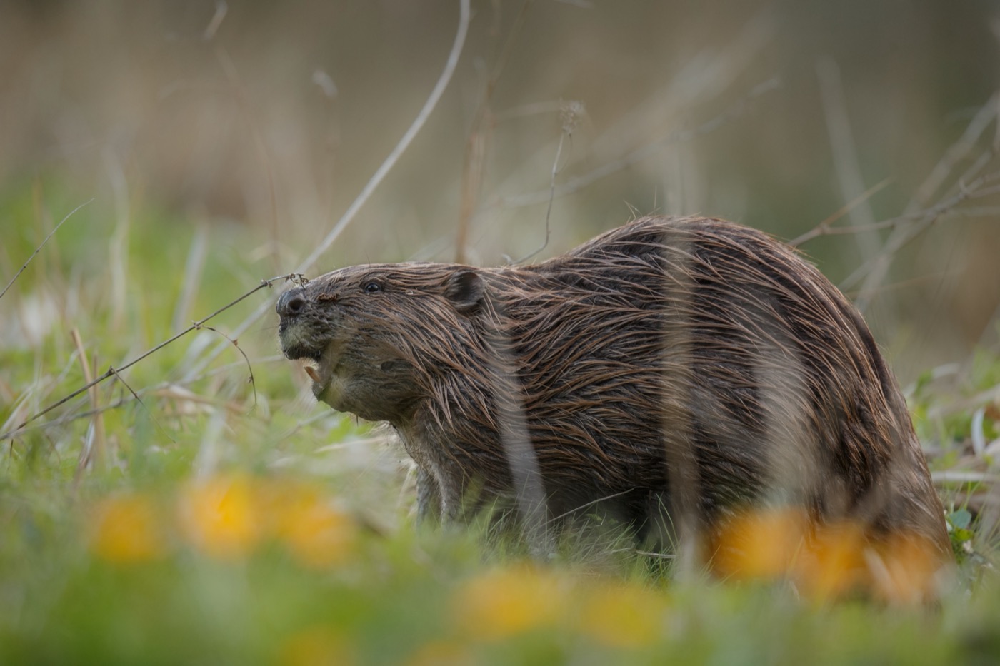
Eurasian beaver
Beavers have resettled the Nister in the Kroppacher Schweiz in recent years. When the leaves fall from the streamside trees in November, gnawed willows and alders and footprints in the soft mud along the bank become easy to spot. The animals themselves, active at dusk, are rarely seen, but their traces give them away all through the winter half of the year.
Pictures: Freepik
Getting there
- 0 h 30 minKoblenz
- 1 h 15 minKöln
- 1 h 15 minFrankfurt am Main
- 5 h 00 minMünchen
- 5 h 00 minHamburg
- 6 h 15 minBerlin
Good to know
Fire in the forest depends on the state
In Rheinland-Pfalz a fire may be lit in the forest, or within 100 metres of it, only with permission from the forestry office, and smoking there is prohibited all year. In the Hessian part of the Westerwald, fire belongs at the official fireplaces, and the smoking ban runs from March to October. The Naturpark advises against fire altogether.
Leash required in nature reserves
Dogs must stay on a leash in the nature reserves of the Naturpark Rhein-Westerwald. Neither people nor dogs may leave the paths there. At the Wiesensee there are separate accesses for dogs to swim. Elsewhere at the lakes the local municipality sets the rules.
Dreifelder Weiher Nature Reserve
At the Dreifelder Weiher, a nature reserve since 1983, swimming, boating, and entering the reed beds and open water are prohibited. Photographing and filming the nesting red-necked and black-necked grebes is allowed only from the designated observation platform.
Swimming Only at Designated Spots
In the Westerwaldkreis district, the officially approved swimming spots are the Waldsee Maroth, the Klingelwiese near Maxsain, the Postweiher near Freilingen, and the Krombachtalsperre reservoir near Rehe, whose water is tested for bacteria monthly during the swimming season. At the Krombachtalsperre, swimming and camping are limited to the grounds of the local campground.
Camping at the Krombachtalsperre
Overnight stays with an RV or tent at the Krombachtalsperre reservoir are permitted only at the managed campground between Rehe and Driedorf-Mademühlen; day visitors reach the sunbathing lawn and sandy beach through the campground grounds. Water sports are limited to designated zones to protect the reservoir's bird sanctuary areas.
Put-in and Take-out Points on the Lahn
Between Nassau and Lahnstein, canoeists use designated put-in and take-out points, such as the road bridge in Nassau. Near Dausenau and shortly before the Lahn's mouth at Lahnstein, the route passes through weirs with locks that are entered from the right.
Protected landscapes
- Nature park
- NassauRhein-WesterwaldSiebengebirge
Names and boundaries: © OpenStreetMap contributors.
About this region
The Westerwald lies between the Rhine, Lahn, Sieg and Dill rivers and is shaped by basalt cones, ponds and reservoirs. Around Höhr-Grenzhausen, clay has been worked into stoneware since the 16th century. Campsites sit by the ponds, pitches also in the Kannenbäckerland.
Summer is busiest at the Krombachtalsperre, while spring and autumn are quieter, with cranes crossing the region. When a site is open is shown in each listing's calendar.
