Camping in the Weserbergland
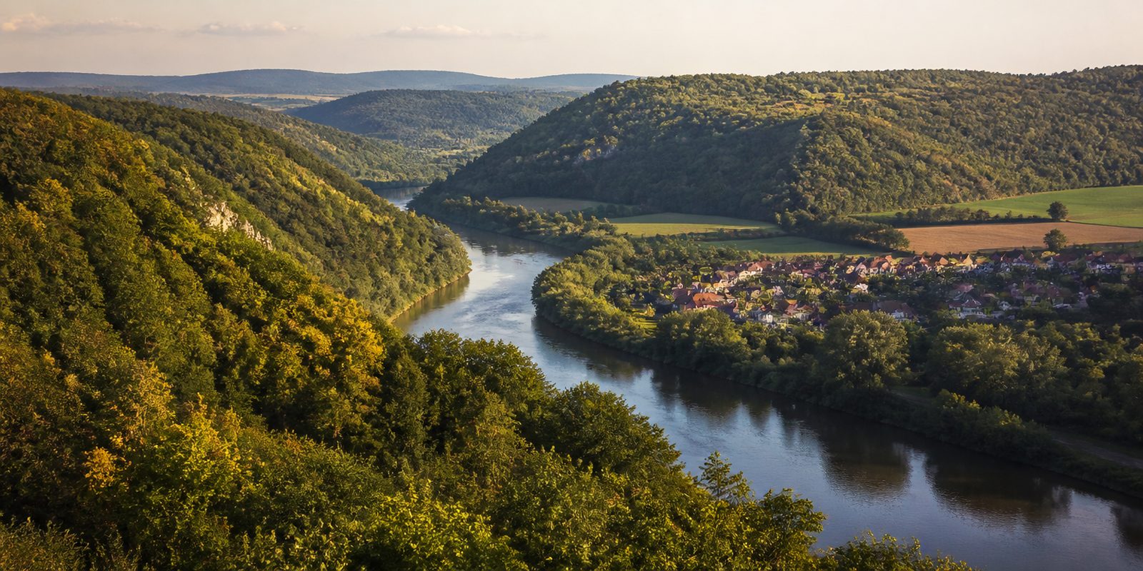
The Weserbergland begins where the Werra and Fulda rivers join to form the Weser at Hann. Münden, then stretches northward as wooded hill country to Rinteln. Limestone ridges such as the Ith, Süntel, Vogler, and Solling shape the terrain, and the Solling reaches over 500 meters at the Große Blöße. Half-timbered towns in the Weser Renaissance style line the river: Hameln, Bodenwerder, birthplace of Baron von Münchhausen, and Höxter, home to the Carolingian westwork of Kloster Corvey, a monastery and UNESCO World Heritage site since 2014. At Schloss Fürstenberg on the Weser, porcelain has been fired since 1747, in the second-oldest manufactory in the German-speaking world. The Naturpark Weserbergland Schaumburg-Hameln, founded in 1975, protects about 1,000 square kilometers of the landscape on its own, while the Naturpark Solling-Vogler to the south protects the forests around Holzminden. This close succession of river valley and half-timbered town, together with the unbroken beech forests on the ridges above, sets the Weserbergland apart from the flatter regions around it.
40 places and units in this region
Places in this region

The year in this region
September: Red Deer Rut at Wildpark Neuhaus
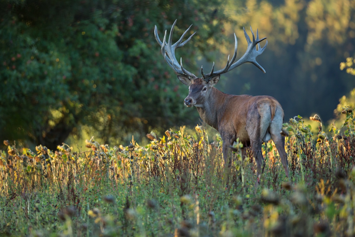
From mid-September to early October, red deer stags bellow across the Solling, and the Wildpark Neuhaus offers public rut walks during which a park team explains the animals' courtship behavior. Registration opens as early as August, since demand limits the number of spots on each walk.
In the middle of the month the sun rises at 6:57 AM and sets at 7:39 PM. That leaves 12 hours and 43 minutes of daylight.
Water and air: Open-Meteo, measured averages. How busy: share of school holidays 2027 across all sixteen federal states. Nature dates: German Weather Service, phenological observations 2014 to 2026 at 98 stations in the region, typical day.
Tours in this region
Marked tours that fit into a day from a site, and one multi day tour per kind.
- Cycling
Weser-Radweg
At Hann. Münden the Werra and Fulda come together. From there the cycle route stays beside the river in the narrow valley of the Weserbergland, mostly on asphalt and almost without climbs, between wooded slopes. Along the way come Höxter, Bodenwerder and Hameln with their Weser Renaissance gables, and Bad Karlshafen, laid out as a baroque planned town by Landgrave Carl in 1699.
523.4 kmMulti day tour
- Cycling
Schaumburger Land - Schlösser und Herrensitze
It begins on the market square in Bückeburg, the Residenzschloss at your back. After that, farm tracks and quiet side roads lead through the Schaumburger Land, past Bad Eilsen, the Arensburg, the Schaumburg and on to Gut Exten and Möllenbeck near Rinteln. It rolls quietly, with climbs up to the castles.
53.4 km
- Hiking
Upland-Weserbergland-Weg
From the Hochsauerland to the Weser, across northern Hesse. The X6 takes in the source of the Diemel on the way and carries on via Korbach, Bad Arolsen and Volkmarsen to Hofgeismar. Between the towns lie woodland and open uplands, and at the end Veckerhagen waits down by the river.
128.4 kmMulti day tour
- Hiking
Weg der Blicke
Nine sections through the northern Lippe hill country. From the Krubberg and the Kleeberg the view falls across the Kalletal towards Lemgo, and from Goldbeck, on a clear day, as far as the Wiehengebirge and the Porta Westfalica. At the end the Begatal opens up, with the castles of Barntrup and Wendlinghausen.
134.6 kmLoop tourMulti day tour
- Hiking
Hessenweg 11- Dornröschen-Route
Named after the fairy tale, the route runs from Gensungen on the Eder by way of Gudensberg and Niedenstein to Kassel, then through the Reinhardswald to the Weser at Bad Karlshafen. The Reinhardswald is the largest unbroken forest in Hesse, and in the middle of it stands the Sababurg, known as the Sleeping Beauty castle. Soft forest floor, plenty of shade.
114.8 kmMulti day tour
- Mountain biking
Naturpark Solling-Vogler, Tour 2
Section Rund um den Vogler
The start is the Stauweiher in Eschershausen. The loop around the Vogler runs mostly on gravel and forest floor, with a few stretches of asphalt in between, and between the Weser at Bodenwerder and the ridges it adds up to almost nine hundred metres of climbing. On the Ebersnacken stands a tower with half the Weserbergland in view.
36.4 kmLoop tour
- Cross country skiing
Loipe Hochsooling 3A
The tracks are set in the Hochsolling around Neuhaus and Silberborn, by volunteers from the two villages. They run between 350 and 520 metres on the sandstone plateau, and at a good four kilometres the 3A is one of the short ones. It is quiet up there.
4.5 km
Tours: © OpenStreetMap contributors, ODbL. Lengths computed from the mapped course, as of September 12, 2026.
Animals you can meet here
 February to June
Eagle owl
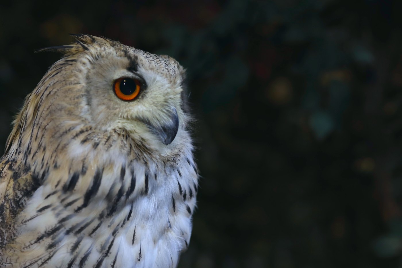
On the limestone cliffs of the Ith near Bisperode and Lüerdissen, the eagle-owl nests again from February, among other spots at the Bremker and Dohnser Klippe. Its large orange eyes and raised ear tufts are easy to spot, along with the deep call that carries far across the rock faces at dusk. Pairs raise their young here into early summer, which is why several climbing routes stay closed during this time.
 September to October
Red deer
At the Wildpark Neuhaus in the Solling, red deer stags roar during the rut from mid September to early October. They now carry their full antlers and reddish brown coat, and the deep bellowing can be heard from far away. A team from the wildlife park leads the rutting tours to the best viewing spots and explains the stags' courtship behavior.
 October to November
Common crane
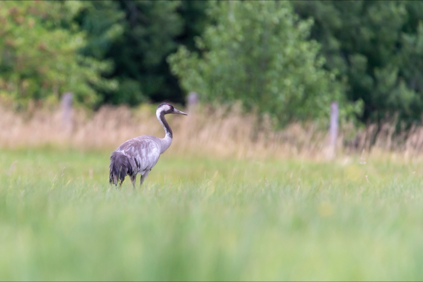
From the open ridge tops of the Ith, around Coppenbrügge, long chains of common cranes cross the Weserbergland heading south through October and November. Their outstretched necks and trailing legs in flight mark them out as cranes from far away, along with their trumpeting calls. The formations are best watched at dawn and dusk, when the main flock moves on from its staging grounds in northern Germany.
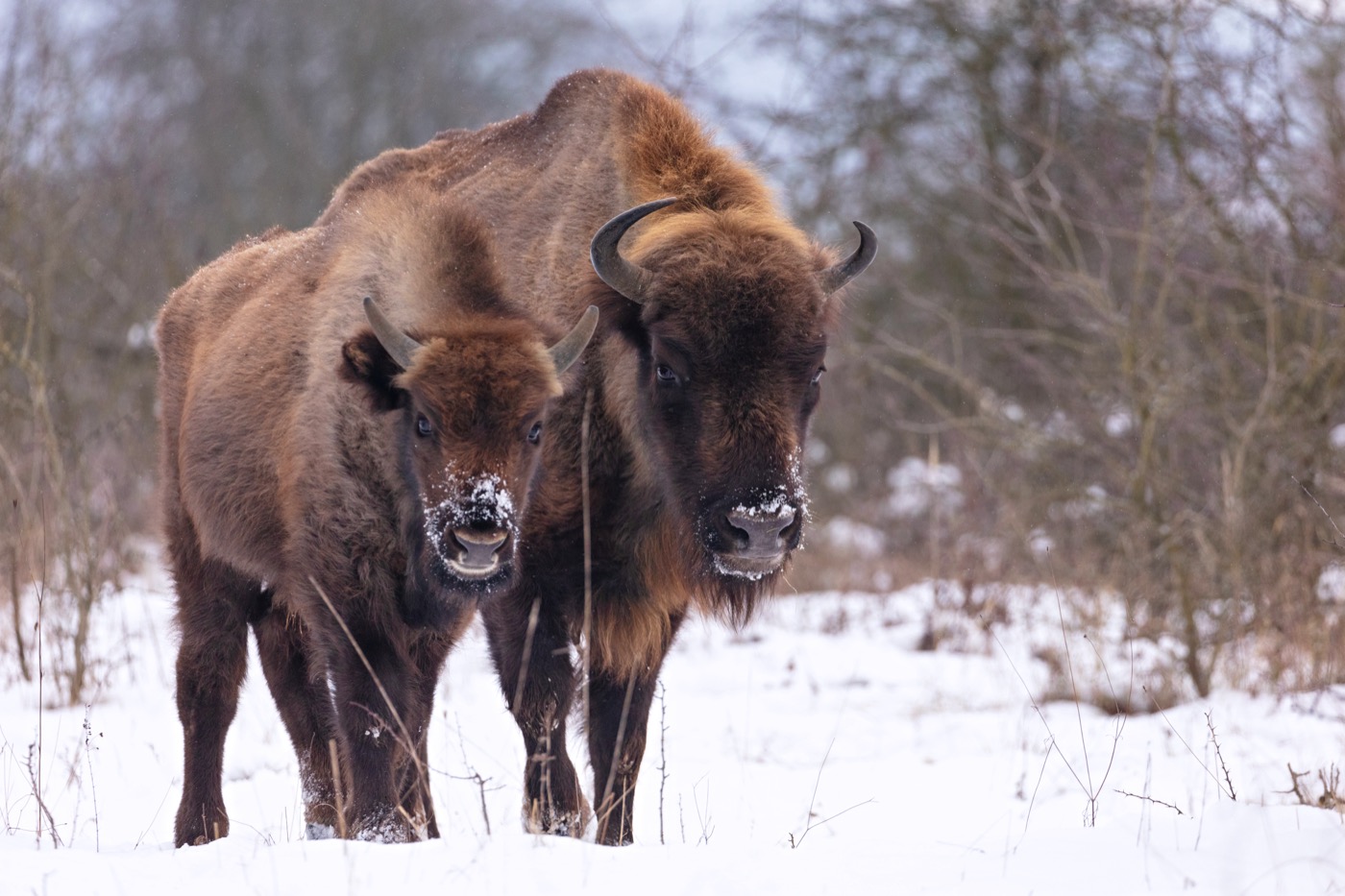 all year
European bison
At the Wisentgehege Springe on the Deister, the European bison can be seen year round along the six kilometer circular trail. Its massive shoulder hump, shaggy brown coat and short, inward curving horns set it apart from cattle at first glance. The animals graze in large enclosures that visitors walk around on foot, passing wolves and Przewalski's horses along the way.
Pictures: Freepik
Getting there
- 1 h 15 minBielefeld
- 2 h 45 minFrankfurt am Main
- 2 h 45 minKöln
- 3 h 00 minHamburg
- 4 h 15 minBerlin
- 5 h 45 minMünchen
Good to know
No Climbing During Breeding Season
On the limestone cliffs of the Ith, climbing bans apply to individual rock faces from February 1 to July 31 so that eagle owls and peregrine falcons can breed undisturbed. The affected routes are marked on site and coordinated with the Ökologische NABU-Station Oberes Wesertal.
Right of Way for Shipping
On the Oberweser, commercial vessels have the right of way over canoes and kayaks; when meeting one, paddlers move toward the inside of the bend. Entry and exit points are marked with the Gelbe Welle (Yellow Wave) system, and the first obstacle for paddlers is the Hamelner Wehr at river kilometer 134.8, which is bypassed via a lock or the canoe chute.
Leash Requirement in Field and Forest
In the Hameln-Pyrmont district, dogs must be kept on a leash in open countryside from April 1 to July 15, and year-round in nature reserves such as the Schweineberg. This is based on Section 33 of Lower Saxony's Forest and Landscape Act, which protects wildlife and their young.
RV Sites Along the Weser
Numerous motorhome sites lie directly on the river along the Weser-Radweg, including the site in Bad Karlshafen with 51 level pitches on the right bank of the Weser. The official information center for the Weser-Radweg keeps a continuously updated overview.
State Forest Fire Pits
In the Hochsolling, the Niedersächsische Landesforsten operate designated fire pits at the Wagenburg near Neuhaus, where firewood and charcoal are provided for a fee. A playground with a grill hut in the nearby Hutewald, a historic wood pasture, rounds out the offering for day visitors.
Ferries Instead of Bridges
Between Hann. Münden and Porta Westfalica, 13 ferries still stand in for missing bridges across the Weser, six of them carrying only passengers and bicycles. In the Weserbergland, these include the Wehrden-Fürstenberg and Wahmbeck-Gewissenruh ferries.
Protected landscapes
- Nature park
- Teutoburger Wald / EggegebirgeWeserbergland
Names and boundaries: © OpenStreetMap contributors.
About this region
The Weserbergland lies between Hann. Münden and Rinteln, a wooded hill country with limestone ridges such as Ith, Süntel and Solling. Half-timbered towns such as Hameln and Höxter line the river, surrounded by the Weserbergland and Solling-Vogler nature parks. Pitches line the Weser riverbank, and campsites are also found deep in the forest.
Summer is busiest, with the canoeing high season on the Oberweser, while winter is quietest. When a site is open is shown in each listing's calendar.
