Camping in the Uckermark
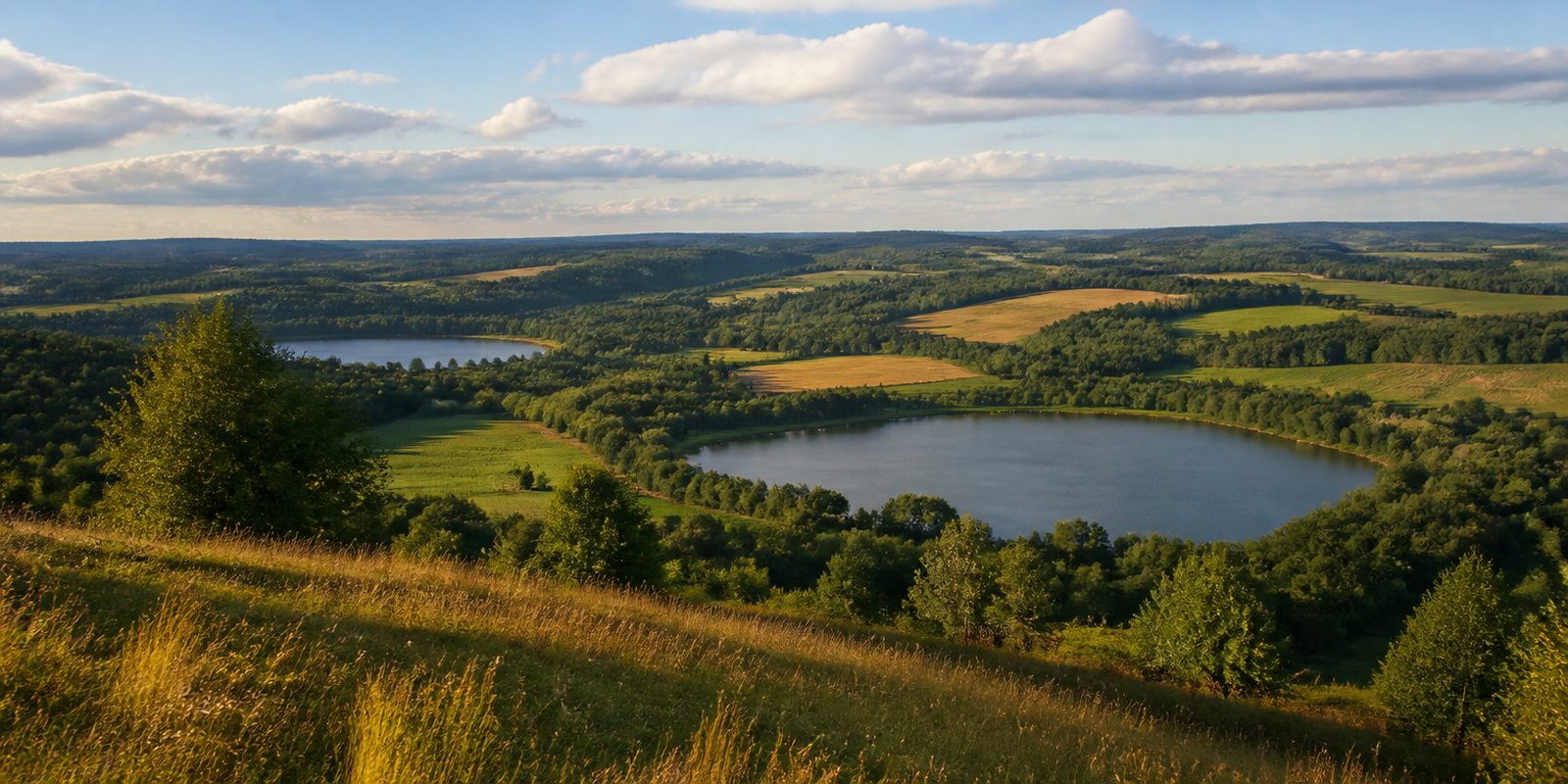
With 38 residents per square kilometer, the Uckermark is one of the most sparsely populated districts in Germany, and this openness defines the region. Across 3,077 square kilometers (1,188 square miles) lie three national natural landscapes side by side: Nationalpark Unteres Odertal, the Biosphärenreservat Schorfheide-Chorin, and the Naturpark Uckermärkische Seen, a combination no other district in Brandenburg can match. The Naturpark Uckermärkische Seen alone counts around 230 lakes across 897 square kilometers (346 square miles) and, by its own account, holds an unusually high breeding density of ospreys. Nationalpark Unteres Odertal contains the only still intact polder landscape in Germany, a system of summer and winter dikes that in autumn serves as a resting ground for up to 15,000 cranes at a time, and in peak years for up to 70,000 wild geese and cranes together. South of there, a beech forest grows in the Grumsiner Forst, its old stands part of the UNESCO World Heritage Site Ancient Beech Forests of Germany since 2011. And where roe deer now wander through tree-lined lanes, tobacco once grew on 4,400 hectares (about 10,870 acres) in the 18th century: around Vierraden near Schwedt, the Uckermark was once the largest contiguous tobacco-growing area in Germany, a history the brick tobacco barns still recall today.
15 places and units in this region
Places in this region

The year in this region
September: Red Deer Rut and First Cranes
In September, Nationalpark Unteres Odertal records the rut of the red deer along the wooded edges of the river lowland. At the same time, the first large flocks of cranes arrive; in 2025 the Crane Weeks, held jointly by the national park and NABU, ran from 26 to 28 September and from 3 to 5 October.
In the middle of the month the sun rises at 6:37 AM and sets at 7:22 PM. That leaves 12 hours and 45 minutes of daylight.
Water and air: Open-Meteo, measured averages. How busy: share of school holidays 2027 across all sixteen federal states. Nature dates: German Weather Service, phenological observations 2014 to 2026 at 55 stations in the region, typical day.
Tours in this region
Marked tours that fit into a day from a site, and one multi day tour per kind.
- Cycling
Uckermärkischer Radrundweg
The big loop out of Prenzlau touches three protected areas: the Uckermärkische Seen nature park, the Schorfheide-Chorin biosphere reserve and the Unteres Odertal national park. The country in between is thinly settled. In the south it rolls along separate asphalt paths, in the north country lanes and old cobbled stretches join in, and the castle and monastery of Boitzenburg and the town wall of Templin sit along the way.
302.2 kmMulti day tour
- Cycling
Naturpark Tour Nord "Auf der Spur der Steine"
From Lychen the loop runs by way of Templin, Boitzenburg, Fürstenwerder and Feldberg, flat at first, then hilly on the end moraines around Feldberg, always between clear lakes. The name comes from the stone. Barns and churches of field stone stand along the way, along with the old field stone wall and the boulder garden at Fürstenwerder. Part of the loop follows the embankment of the old railway.
108.9 km
- Hiking
Uckermärker Landrunde
A red dot on white leads out of Prenzlau through the Uckermärkische Seen nature park and the Schorfheide-Chorin biosphere reserve. The route crosses moraine hills, runs along fields lined with hedges and passes through woodland and moor, on field and forest tracks. You are on your own much of the time.
153.5 kmMulti day tour
- Hiking
Märkischer Landweg
The blue X leads from Feldberg or from Fürstenberg on the Havel to Mescherin on the Oder, and the two beginnings meet at Lychen. From there it cuts straight across the Uckermark, past the Grumsin beech forest and finally down into the Lower Oder valley with its polders and old river arms. The last two stages down there are closed at present, train and bus bridge them. Sand, avenues, lake shores and field paths alternate.
216.1 kmMulti day tour
- Hiking
Uferwanderweg Unteres Odertal
From Mescherin the way goes upstream to Lunow, always along the edge of the Unteres Odertal national park. Below lie the polder meadows with old river arms, willows and reeds, above on the moraine slopes the dry grassland with its flowers. From the slopes the view runs far.
52.2 km
- Hiking
Sechs-Seen-Rundweg
Six lakes in one round, starting at the town harbour of Templin: Stadtsee, Gleuensee, Bruchsee, Fährsee, Zaarsee and Lübbesee. In between come forest, meadows, fields and moor, over hills and through shallow hollows, part of it on asphalt and part on forest floor. On the shore you see where beavers worked.
23.4 kmLoop tour
- Hiking
Rundweg um den Templiner Stadtsee
Once around Stadtsee and Bruchsee, close to the water. The first kilometres to the Fährkrug are asphalt, then come a stretch of road and a woodland path, and the way back runs along the shore. The Lehmanngarten and the old Pionierbrücke sit beside the route, and in summer small bathing spots invite a swim.
10 kmLoop tour
- Hiking
Grumsiner Genusswanderweg
From Angermünde station by way of Sternfelde and Schmargendorf to Altkünkendorf, on field tracks, forest roads and old cobbles across gentle ground moraine. Near the end the ground gets lively. Deep hollows and short climbs run along the edge of the Grumsin beech forest, which is world natural heritage, and a juice press, a dairy farm and a distillery sit along the way.
7.3 km
Tours: © OpenStreetMap contributors, ODbL. Lengths computed from the mapped course, as of September 12, 2026.
Animals you can meet here
 September to November
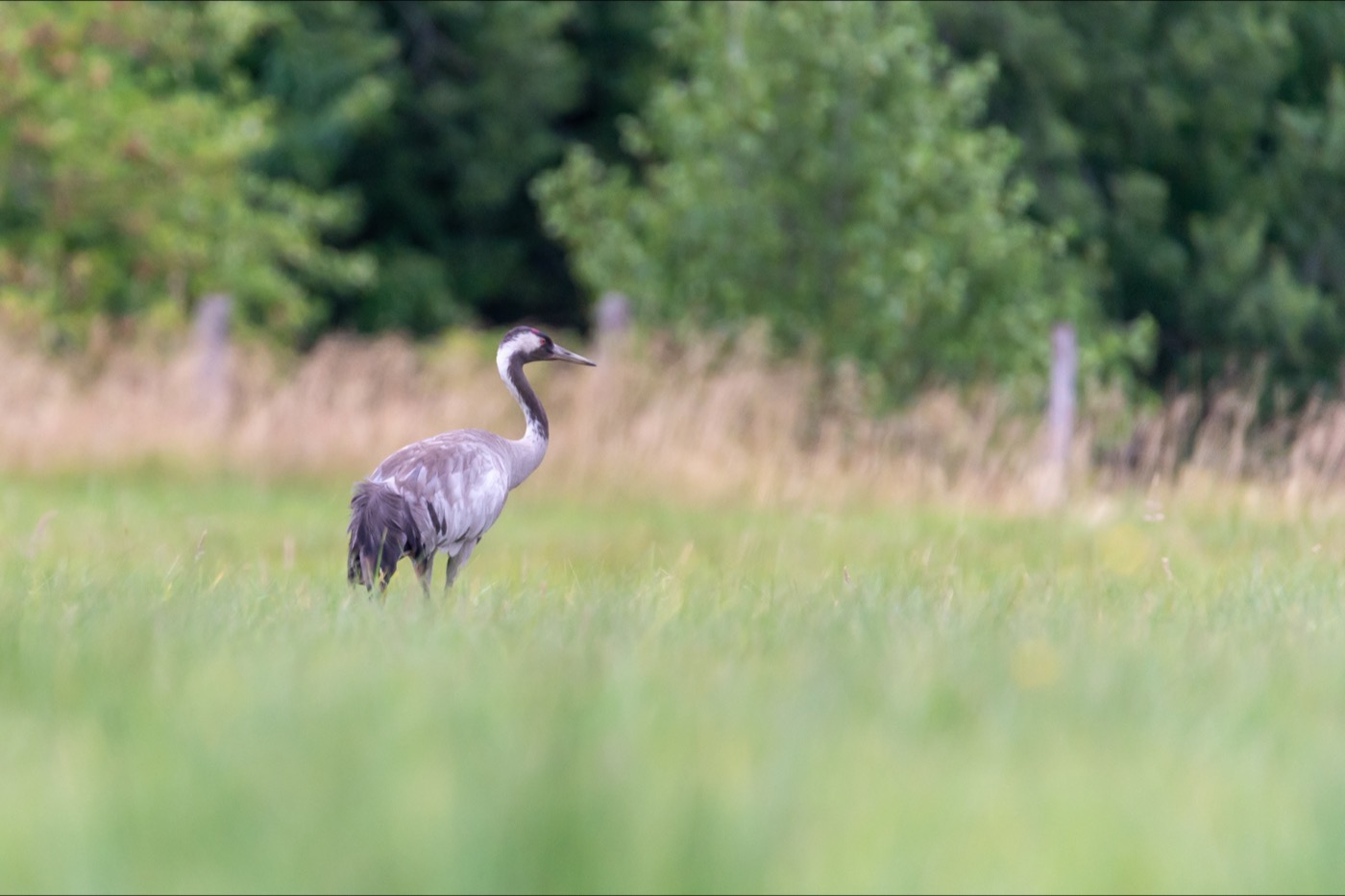
Common crane
At the Mescherin observation tower in Nationalpark Unteres Odertal, the first large flocks of cranes gather from late September. In October, up to 15,000 birds settle there for the night across the wide polder landscape, recognizable by their grey plumage, red crown patch, and far-carrying trumpeting call. Smaller groups keep passing through well into November before heading further south.
 March to September
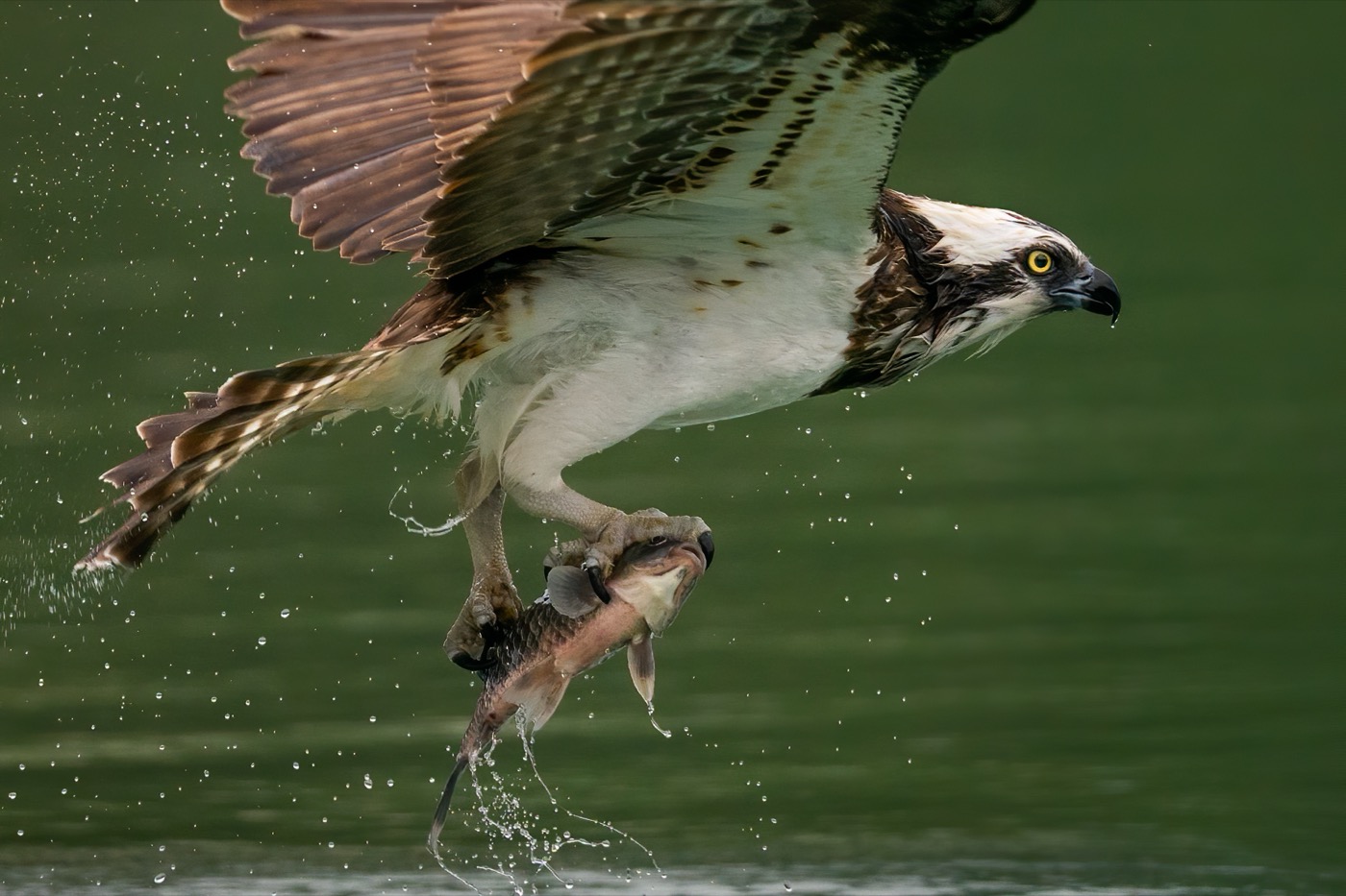
Osprey
In Naturpark Uckermärkische Seen, about 30 osprey pairs breed at nests scattered across the many lakes, an unusually high density for the region. The birds return from West Africa starting in mid-March, and the first chicks hatch in May after several weeks of incubation. The osprey is easy to spot over the lakes by its white and brown plumage, the black band across its eye, and its steep plunge straight into the water when hunting.
 October to February
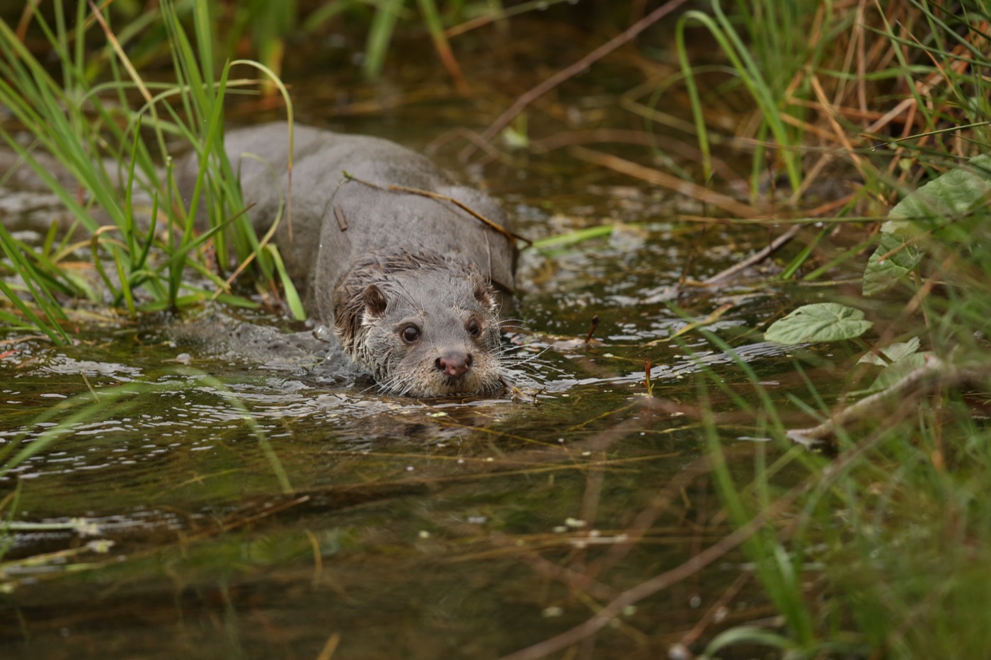
Otter
In the polder near Criewen in Nationalpark Unteres Odertal, the Eurasian otter has become established as a permanent resident again. From October to February it is usually recognized only by its footprints and slide marks in the snow along the icy or muddy edges of the drainage ditches, more rarely by the slender brown body itself. Here it benefits from the undisturbed water dynamics of Germany's only remaining intact polder landscape and roams the ditches in search of fish.
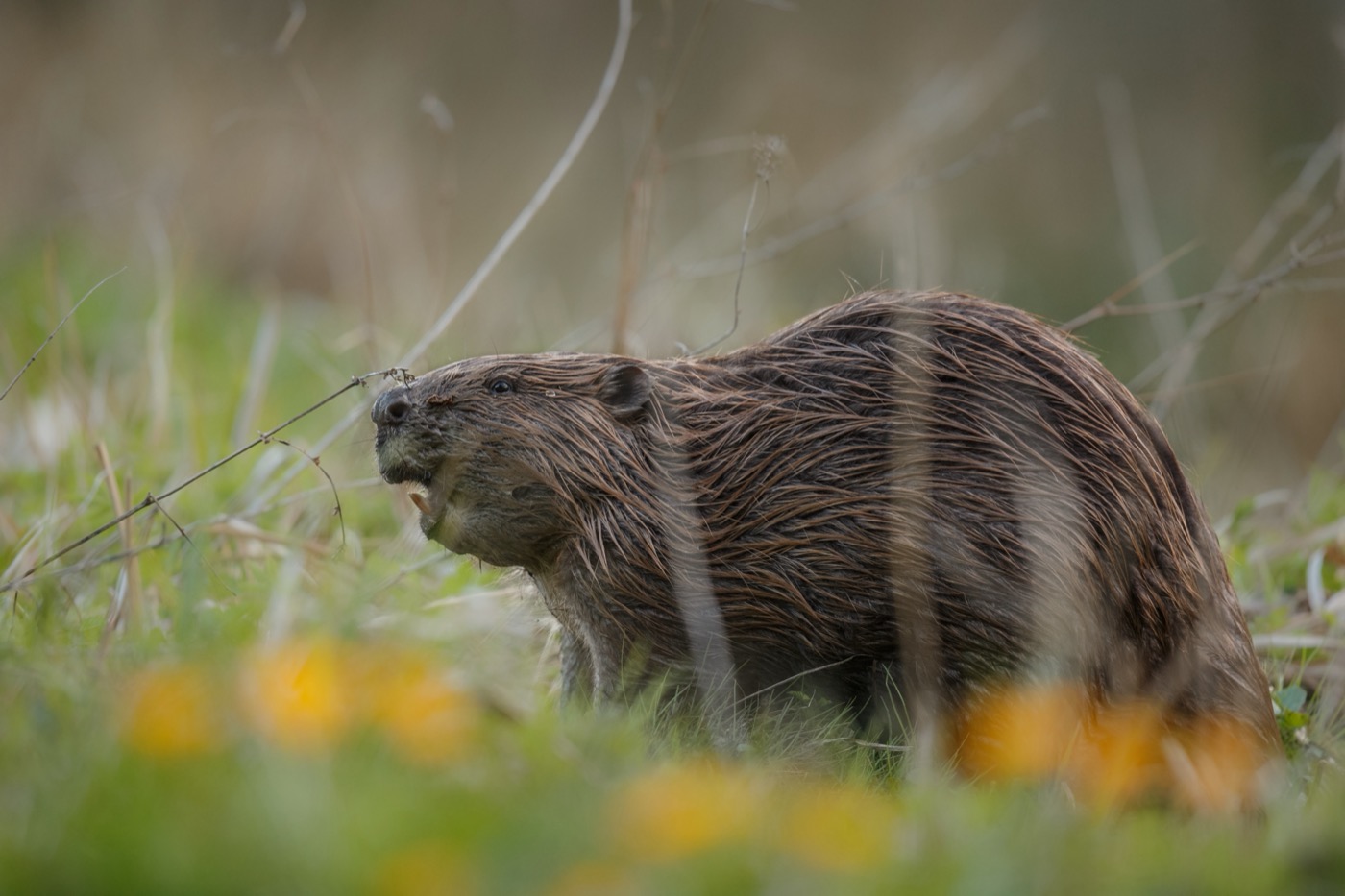 August to October
Eurasian beaver
Along the trail near Fährkrug around Templiner Stadtsee, cone-shaped gnawed tree stumps on the bank are the surest sign of beavers. From August to October, at dusk, they pull branches and whole boughs into the water to build up their winter food store. The Eurasian beaver is easy to tell apart from other water dwellers by its stocky body, blunt head, and broad, scaly tail.
Pictures: Freepik
Getting there
- 1 h 15 minBerlin
- 2 h 15 minRostock
- 3 h 45 minHamburg
- 6 h 30 minFrankfurt am Main
- 6 h 45 minKöln
- 7 h 00 minMünchen
Good to know
Dike paths and Oder border crossings
About half the cycle routes in the Unteres Odertal run along dikes. Some 31 kilometres lie in the wet polders and are passable only in summer, because the polders are flooded around 15 November. The bridge at Schwedt leads into Poland. The Mescherin crossing sits in the Zwischenoderland and closes at times when the Oder runs high.
Dogs Must Be Kept on a Leash in the National Park
In Nationalpark Unteres Odertal, dogs may only be walked on a leash, and this applies on every path in the park. The rule protects ground-nesting birds as well as resting wild geese and cranes from disturbance.
No Open Fires in the Protected Area
Open fires and grilling are prohibited in Nationalpark Unteres Odertal, as is camping or sleeping outdoors outside designated sites. Visitors are asked to stay on the paths and avoid making noise.
Give Resting Birds Their Space
Cranes, wild geese, and whooper swans are best observed from the fixed towers in Mescherin, Stützkow, and at the Wrechsee, without approaching the resting grounds themselves. The national park generally asks visitors not to disturb wildlife.
Canoeing Only Guided and Only in Season
Paddling on your own is not allowed in Nationalpark Unteres Odertal; canoe trips run only under guide and only between 15 July and 14 November, so as not to disturb the breeding season. The three round trips, between 7.2 and 11 kilometers (4.5 to 6.8 miles), are booked through the campsite at the water sports centre in Schwedt.
Camping Only at Designated Sites
Camping and sleeping outdoors are forbidden in Nationalpark Unteres Odertal. Motorhome and camping sites lie outside the protected area, including one at the water sports centre in Schwedt, from which the guided canoe trips also depart.
Protected landscapes
- National park
- Unteres Odertal
- Biosphere reserve
- Schorfheide-Chorin
- Nature park
- Feldberger SeenlandschaftUckermärkische Seen
Names and boundaries: © OpenStreetMap contributors.
About this region
The Uckermark lies in northeastern Brandenburg, sparsely populated and shaped by Nationalpark Unteres Odertal and Naturpark Uckermärkische Seen, with around 230 lakes. Campsites and pitches sit mostly by the lakes and the national park.
Summer is the busiest season, with swimming at the Oberuckersee and canoeing in the national park. Spring and late autumn are quieter, with cranes passing through. When a site is open is shown in each listing's calendar.
