Camping in the Thuringian Forest
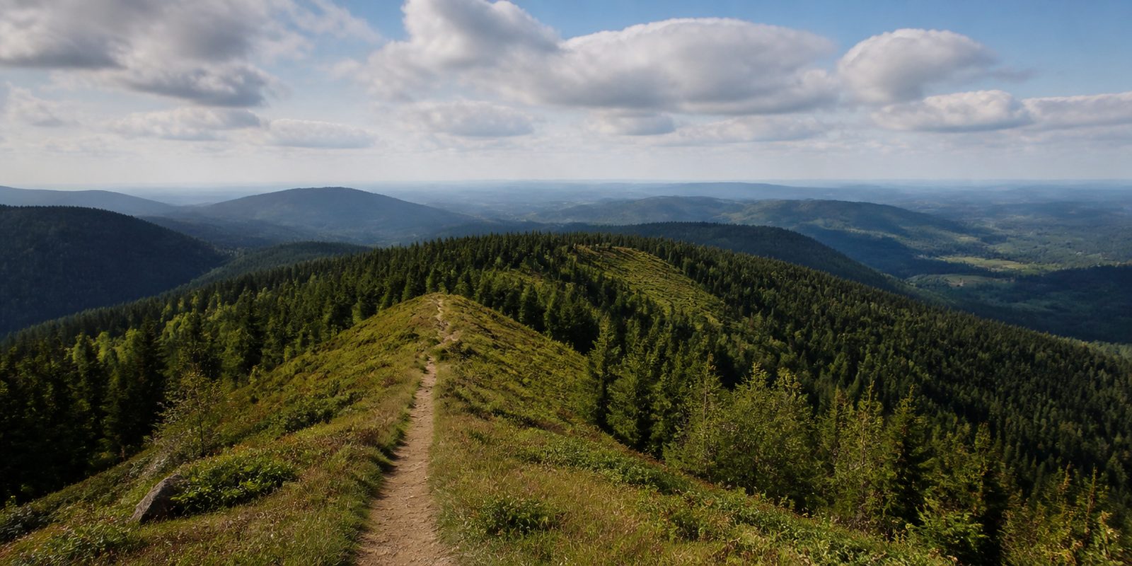
The Thüringer Wald is a narrow ridge. It runs some 70 kilometres from northwest to southeast, from the Werratal near Eisenach to the valleys of the Schleuse and the Wohlrose southeast of Ilmenau, and it rarely grows wider than 14 kilometres. The highest point is the Große Beerberg at 982.9 metres, with the neighbouring Schneekopf close behind. The Rennsteig follows the crest for its whole length. Over 169.3 kilometres between Hörschel and Blankenstein it counts as the oldest and best known ridge trail in Germany, and it traces the watershed between the Elbe, the Main and the Rhein, marked at the Dreistromstein near Siegmundsburg. In the middle of the range lies the Vessertal, designated in 1979 as the first biosphere reserve in Germany. The UNESCO reserve now covers 337 square kilometres between Suhl, Oberhof, Ilmenau and Schleusingen. Dense spruce plantations alternate with near-natural mixed mountain forest and stream valleys, and then there are the mountain meadows that gave the range its name. That is how it earned its reputation as one of the most wooded and water-rich uplands in eastern Germany.
20 places and units in this region
Places in this region

The year in this region
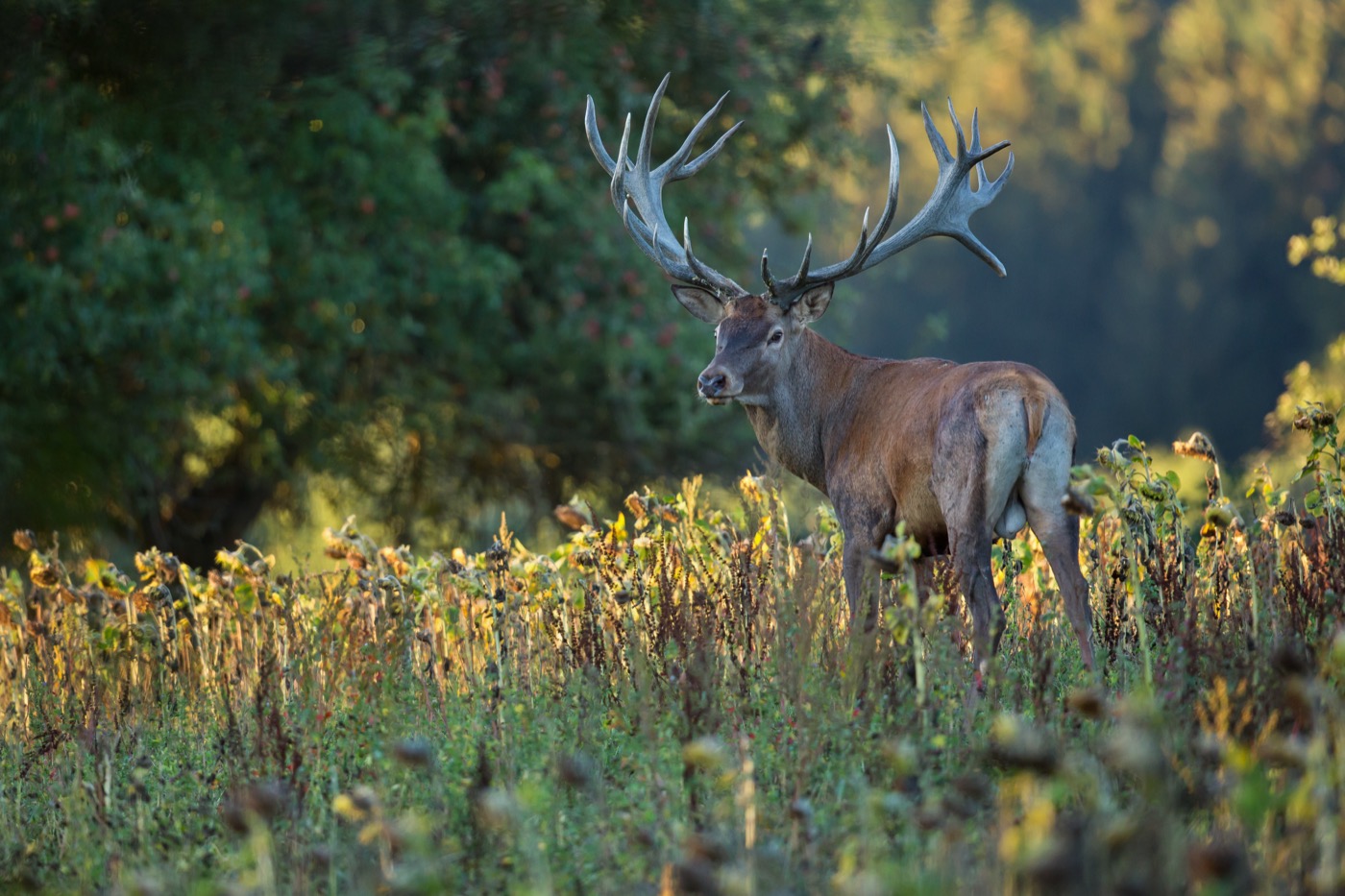
September: Red Deer Rutting Season Begins
The red deer rut begins along the Rennsteig in September and peaks in October. From the observation platform in Frauenwald, the bellowing stags can be watched up close on guided tours lasting two to three hours.
In the middle of the month the sun rises at 6:52 AM and sets at 7:33 PM. That leaves 12 hours and 41 minutes of daylight.
Water and air: Open-Meteo, measured averages. How busy: share of school holidays 2027 across all sixteen federal states. Nature dates: German Weather Service, phenological observations 2014 to 2026 at 81 stations in the region, typical day.
Tours in this region
Marked tours that fit into a day from a site, and one multi day tour per kind.
- Cycling
Rennsteig-Radwanderweg
From Hörschel on the Werra to Blankenstein on the Saale the route keeps to the ridge of the Thüringer Wald, though it avoids the steepest sections of the hiking trail. A little under half is asphalt, the rest forest tracks through spruce and beech. Nowhere is it flat.
199 kmMulti day tour
- Cycling
Ilmtal-Radweg
The route follows the Ilm from Allzunah near its source down to where it joins the Saale at Kaatschen-Weichau. Up in the Thüringer Wald the river is narrow. Further down the valley widens, Ilmenau and Weimar follow, and the riding is mostly on asphalt away from the main roads.
121.1 km
- Hiking
Rhön-Rennsteig-Weg
It begins on the Wasserkuppe, the Rhön's highest peak. Over the Heidelstein the trail passes the Rotes Moor and the Schwarzes Moor and then crosses the former inner German border into Thuringia. There the free standing summits of Geba and Dolmar follow, before the Thüringer Wald begins and the trail ends at Oberhof.
97.3 kmMulti day tour
- Hiking
Wanderweg der Deutschen Einheit
Section Neustadt am Rennsteig – Hörschel
The Thuringian section of the trail from Görlitz to Aachen drops from the ridge at Neustadt am Rennsteig down to Hörschel, where the Rennsteig also begins. It uses paths the hiking clubs already maintain and stays a long while in the forests of the Thüringer Wald. At the end you stand on the Werra.
89.5 kmMulti day tour
- Mountain biking
MTB-Strecke Rennsteig
Nineteen loops cross the Rennsteig again and again, between Hörschel on the Werra and Blankenstein on the Saale. Almost half of it is gravel. From the Werra valley at barely two hundred metres the route climbs to the Schneekopf, where its highest point lies at nine hundred and sixty metres, with unsurfaced trails through spruce forest in between.
239 kmMulti day tour
- Cross country skiing
Loipe Friedrichshöhe - Masserberg
The loop starts at the spa park in Masserberg at seven hundred and eighty metres and runs across the plateau along the Rennsteig. The tracks are wide, set for classic and skating. It passes the Heidehütte, the Rennsteigwarte and the Eisfelder Ausspanne, staying between seven hundred and forty and eight hundred and forty metres, mostly in spruce forest.
16.4 km177 m ascentLoop tour
- Canoeing
Kanuwandern auf der Werra
Between Schwallungen and Sallmanshausen the Werra valley opens out wide, with the summits of the Vorderrhön on one side and the hills of the Thüringer Wald on the other. The river swings through meadows in wide bends, and near Bad Salzungen the floodplain is under water every year and salt springs come to the surface. At the weirs the boat is carried.
176.6 kmMulti day tour
Tours: © OpenStreetMap contributors, ODbL. Lengths computed from the mapped course, as of September 12, 2026.
Animals you can meet here
 September to October
Red deer
From the observation platform in Frauenwald on the Rennsteig, red deer can be watched up close on guided tours. In September and October the rut begins here, powerful stags with broad antlers roar at dusk to call in the hinds. Their bellows carry far across the clearings of the biosphere reserve.
 April to August
Black stork
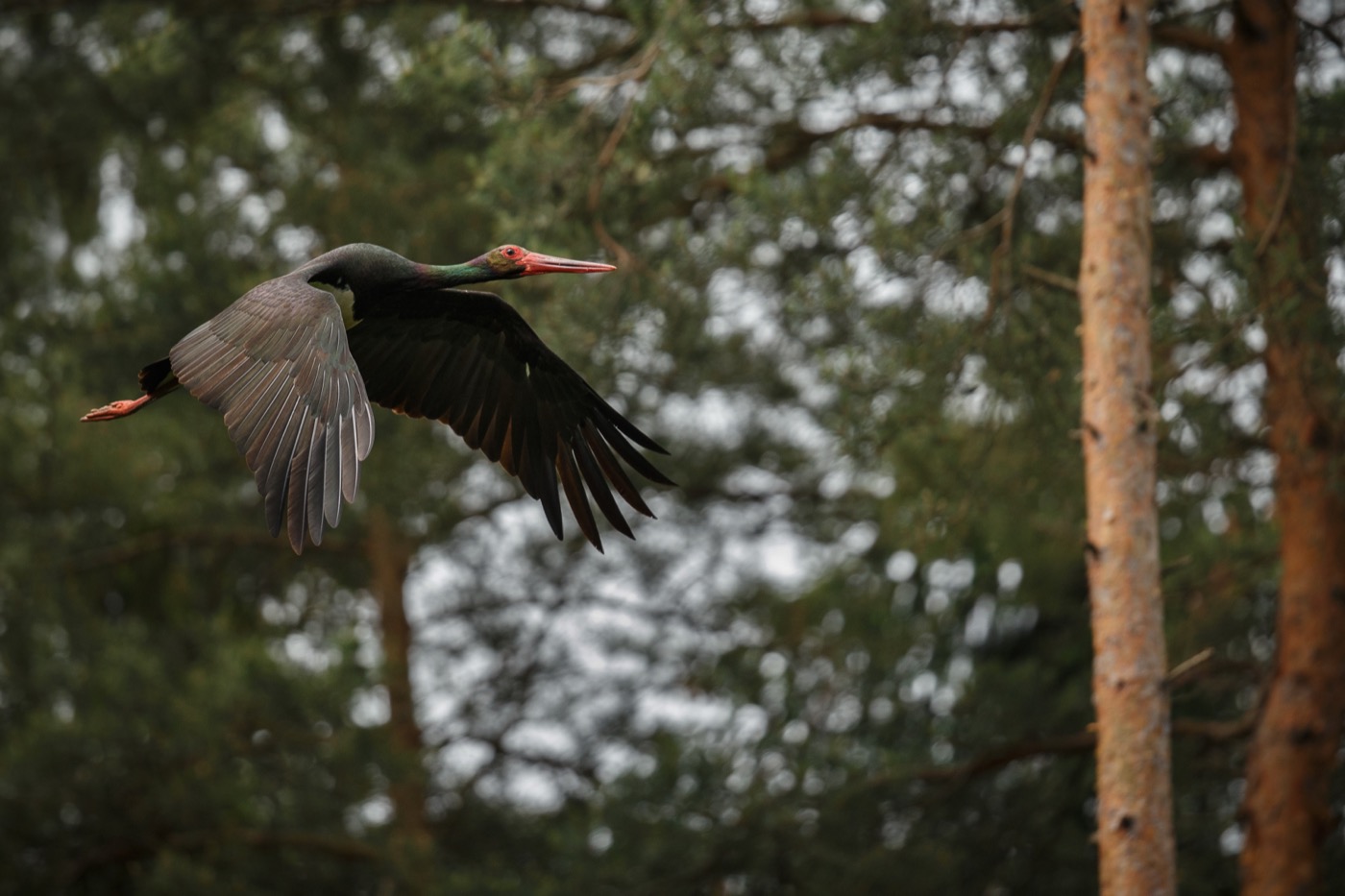
In the old spruce stands of the Finsterbergen forestry district near Friedrichroda, the black stork breeds in seclusion, far from any path. Unlike its white relative, it avoids the vicinity of villages, its plumage looking almost black from a distance with only the belly staying white. From April to August the forestry office halts logging there so the birds, sensitive to disturbance, can raise their young undisturbed.
 April to September
Fire salamander
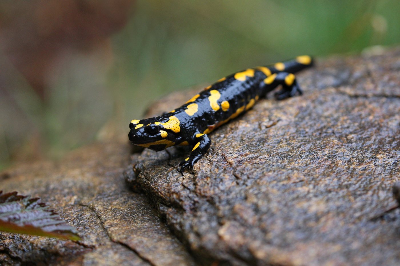
In the clear streams of the Vessertal core zone near Schmiedefeld, female fire salamanders release their larvae after spring rain. The glossy black animal with bright yellow spots shows itself most readily in damp weather, hidden by day in the leaf litter of the stream valleys. The species-rich stream fauna of the Vessertal gives the larvae good conditions to grow through late summer.
 April to October
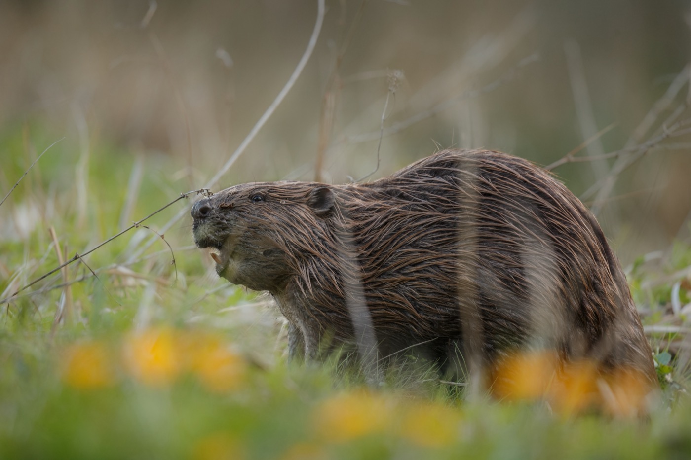
Eurasian beaver
On the Werra near Bad Salzungen, the beaver is best spotted at dusk. Its broad, black tail gives it away as it dives, and gnawed willows and poplars along the bank mark out its territory. It is regularly active here from April to October, gathering twigs and bark for food.
Pictures: Freepik
Getting there
- 1 h 15 minErfurt
- 3 h 15 minFrankfurt am Main
- 4 h 15 minBerlin
- 4 h 15 minKöln
- 4 h 30 minMünchen
- 5 h 00 minHamburg
Good to know
No open fire in the forest
The forest act of Thüringen bans open fire in the woods and within 100 metres of them. Only fire pits built or approved by the forestry authority are permitted. Smoking is prohibited in the forest and on forest tracks as well, all year round.
Leash required all year
In the forest a leash is required all year. The forest act of Thüringen extends this to forest tracks, forest meadows and clearings, and only hunting dogs at work are exempt. In built-up places such as Oberhof, the municipalities decide where a dog may run free.
RennsteigShuttle to Bahnhof Rennsteig
On weekends and public holidays the RennsteigShuttle runs from Erfurt via Arnstadt and Ilmenau up to Bahnhof Rennsteig at 747 metres. With a gradient of over 60 per mille, the stretch from Stützerbach is among the steepest railway lines in Germany. The hiking area starts at the platform.
Swimming at the Lütschetalsperre
The Lütschetalsperre near Frankenhain is open for swimming from June to the end of October and has a sandy beach as well as rowboat rental. The Alte Tambacher Talsperre, the Schmalwassertalsperre, and the Ohratalsperre near Luisenthal, by contrast, are not open for swimming.
Campground at the Lütsche
Right on the Lütschetalsperre near Frankenhain lies a campground with vacation cottages and dining facilities. The reservoir, put into operation in 1938, today serves mainly as a local recreation spot.
Protecting Black Stork Nests
The black stork nests secludedly in old spruce stands of the Thüringer Wald, for instance in the Finsterbergen forestry district, where the forest administration halts logging during the breeding season. As a species especially sensitive to disturbance, it needs quiet around known nest sites.
Caution During Capercaillie Displays
In spring, the rare capercaillie displays in the forests around Frauenwald at traditional sites in the early morning. The small population, threatened with extinction, has for several years been supported by birds released from Sweden, so the display grounds count as especially worth protecting.
Protected landscapes
- Nature park
- Thüringer Wald
Names and boundaries: © OpenStreetMap contributors.
About this region
The Thuringian Forest stretches as a narrow mountain ridge from the Werra valley near Eisenach to Ilmenau, with the Rennsteig running along the ridge and the Vessertal Biosphere Reserve at its center. Pitches and campsites here sit in towns like Masserberg, Oberhof and Frauenwald.
It gets busy from June to October, when the Lütschetalsperre near Frankenhain is open for swimming, and quieter in spring and late autumn. When a site is open is shown in each listing's calendar.
