Camping in the Taunus Mountains
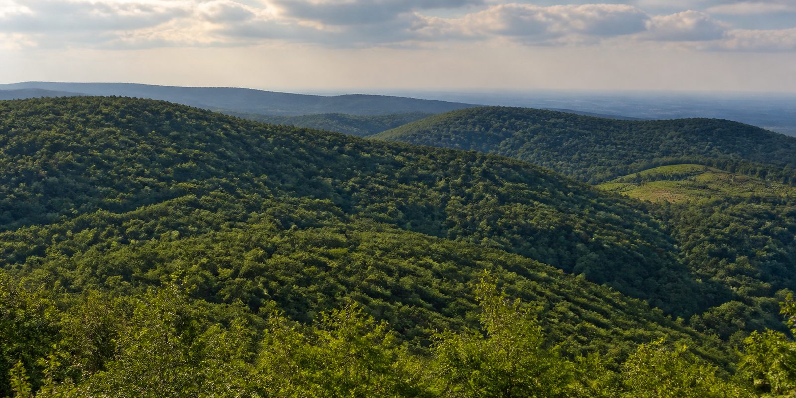
The Taunus is a continuously wooded ridge of quartzite and slate between the Rhein, the Lahn and the Main. From the bank of the Rhein at about 80 meters it climbs to 881 meters at the Großer Feldberg. To the south it drops into the vineyards of the Rheingau. Two nature parks meet here. Together they cover more than 2,100 square kilometers. The Rheingauer Hinterlandswald holds some 21,000 hectares, the largest stretch of forest in Hessen not cut through by major roads. Anyone climbing from the Rhein to the crest in spring meets the same season twice, because down by the river it starts about two weeks earlier than up top. Nowhere else in Hessen does that combination occur.
The year in this region
September: Mushroom season in the Taunus woods
Both nature park authorities regularly schedule their guided mushroom walks for September and October: the Naturpark Taunus offers a series called Walk into the World of Mushrooms, and the Naturpark RheinTaunus runs several mushroom walks with a certified mushroom expert. In the meadows, at the same time, the autumn crocus flowers, on 3 September on average at the Taunus stations.
In the middle of the month the sun rises at 7:02 AM and sets at 7:43 PM. That leaves 12 hours and 41 minutes of daylight.
What nature does this month
- Apple picking starts around September 28 (usually between September 18 and October 4)
Water and air: Open-Meteo, measured averages. How busy: share of school holidays 2027 across all sixteen federal states. Nature dates: German Weather Service, phenological observations 2014 to 2026 at 147 stations in the region, typical day.
Tours in this region
Marked tours that fit into a day from a site, and one multi day tour per kind.
- Hiking
Taunus Schinderhannes Steig
From the Gimbacher Hof near Kelkheim the trail climbs over Eppstein and Glashütten to the main Taunus ridge and ends at the Landsteiner Mühle in the Weil valley. A good half runs on natural paths. Along the way stand the Kaisertempel, Burg Eppstein, the Atzelbergturm and the Pferdskopfturm, from which the Frankfurt towers are in view. It is named after the robber Johannes Bückler.
38.9 km
- Hiking
Wispertalsteig
From the walkers' car park in Lorch-Espenschied the trail drops twice from the plateau into deeply cut stream valleys and climbs back out. Down below the Werkerbach and the Wisper run loud, at the Saurierfelsen slate slabs stand upright out of the ground, and at the Mehrholzblick stunted oaks grow on the rock. Behind Espenschied, lightly grazed meadows and pastures open up. Almost three quarters lie in forest.
14.3 kmLoop tour
- Hiking
Via Mattiacorum
From Idstein to Wiesbaden the route follows in Roman footsteps, mostly on small tracks and narrow paths. At the Kastell Zugmantel it crosses the Upper German and Raetian Limes, which is world heritage, and then runs over Wehen and the Jagdschloss Platte down to the Neroberg. Woods, fields and the rolling Taunus country take turns. Shortly before the end lies the Leichtweißhöhle in the Nerotal.
28.2 km
- Hiking
Rheinsteig
Section Rheingau
The Rheingau section sets off at the Niederwald monument in Rüdesheim and stays at first along the Taunus rim above the vineyards. From Kloster Eberbach it swings into the Taunus, past Schlangenbad, and then drops to Wiesbaden and Schloss Biebrich. Rocky and earthy paths dominate, with many side valleys and lookout points. The Rhine stays in sight for a long time.
56.3 km
- Hiking
Rheingauer Gebück-Wanderweg
Between Niederwalluf and the mouth of the Wisper at Lorch the route follows a medieval boundary defence: hornbeam and beech were bent over and woven together until an impenetrable hedge closed off the Rheingau. It was tended until 1771. The path rises and falls between 77 and 537 metres, and at twenty one stations boards explain the old defence, with remains of bulwarks and earthworks at a few of them. Old Gebück beeches still grow at the Wolfsrück.
60.3 kmMulti day tour
- Hiking
Rheingauer Rieslingpfad
Above the wine villages the path runs from Kaub on the Rhine to the Main at Flörsheim-Wicker, keeping for the most part to the upper edge of the vineyards. It brushes Assmannshausen, Rüdesheim and Johannisberg, passes Kloster Eberbach and carries on east over Kiedrich and Martinsthal, and past Hochheim near the end. Between the rows of vines the view opens again and again onto the Rhine valley. Riesling shapes almost every site here.
100.1 kmMulti day tour
- Cycling
Weiltalweg
The route starts near the source of the Weil at the Rotes Kreuz below the Großer Feldberg and follows the river to the Lahn at Weilburg. It is mostly gravelled and covers 560 metres of height, with the upper section dropping steeply. Between Weilmünster and Weilburg it lies on the bed of the former Weiltalbahn. At the end the Lahntal cycle route takes over.
48.4 km
- Mountain biking
Flowtrail Heidenrod - Der ultimative Trail im Taunus
In the forest near Heidenrod four sections run downhill, the Schlingnatter-Trail, the HeidenRide-Trail, the Fieberklee-Trail and the Wildcat-Trail, plus an enduro piece called Wurzelwerke. Riding is one way only, on natural earth, and the line rolls and dips like a roller coaster. A separate uphill takes you back to the top. The ground is loamy.
5.7 kmLoop tour
Tours: © OpenStreetMap contributors, ODbL. Lengths computed from the mapped course, as of September 12, 2026.
Animals you can meet here
 April to September
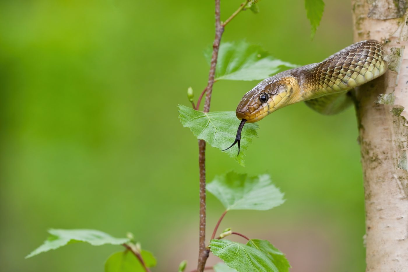
Aesculapian snake
Between Schlangenbad and Bad Schwalbach, the Aesculapian snake warms itself on sunny forest edges and dry stone walls of the Rheingautaunus, one of only four sites in Germany. It grows up to two metres long and has a glossy olive brown body with no bold markings. On still, muggy mornings it lies motionless in the sun, since late May to mid June is its mating season.
- May to September
Bechstein's bat
In the Wispertaunus and the Hinterlandswald within the RheinTaunus Nature Park, the number of known Bechstein's bat colonies has risen from six to 23, more than anywhere else in Germany. Its unusually long ears, held out to the sides in flight, set it apart from other mouse-eared bats. Guided evening walks give the best chance to see one leaving the old, cavity-rich beeches and oaks to hunt.
 March to October
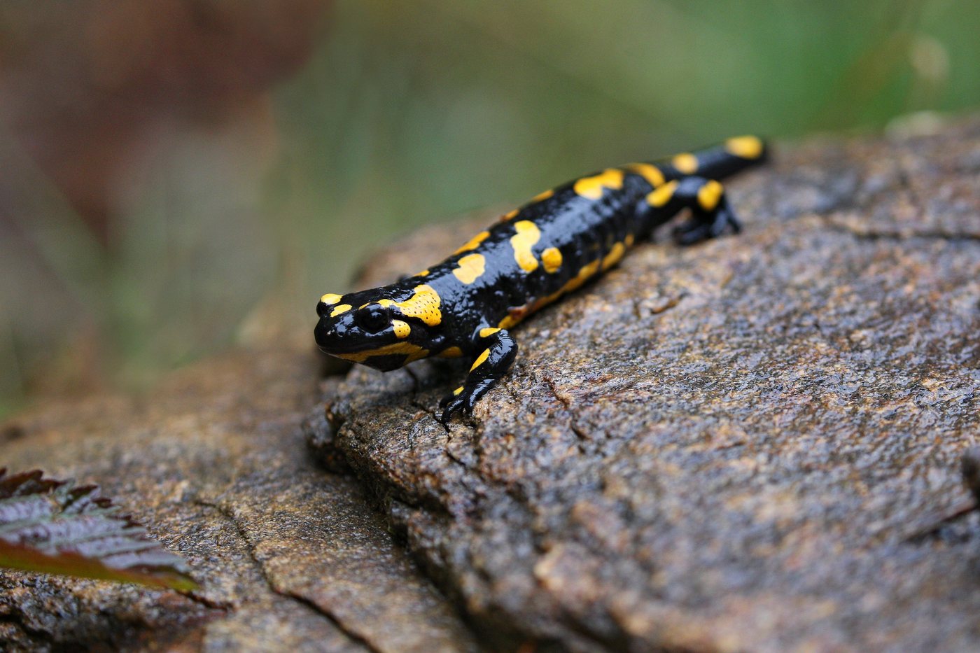
Fire salamander
In the narrow valleys of the Weil, Wisper, Aar and Emsbach streams, the fire salamander releases its larvae into small, fish-free brooks in spring. Black with bright yellow spots or stripes, it is unmistakable. After rain and at dusk it crosses the damp forest paths of these Taunus stream valleys.
 all year
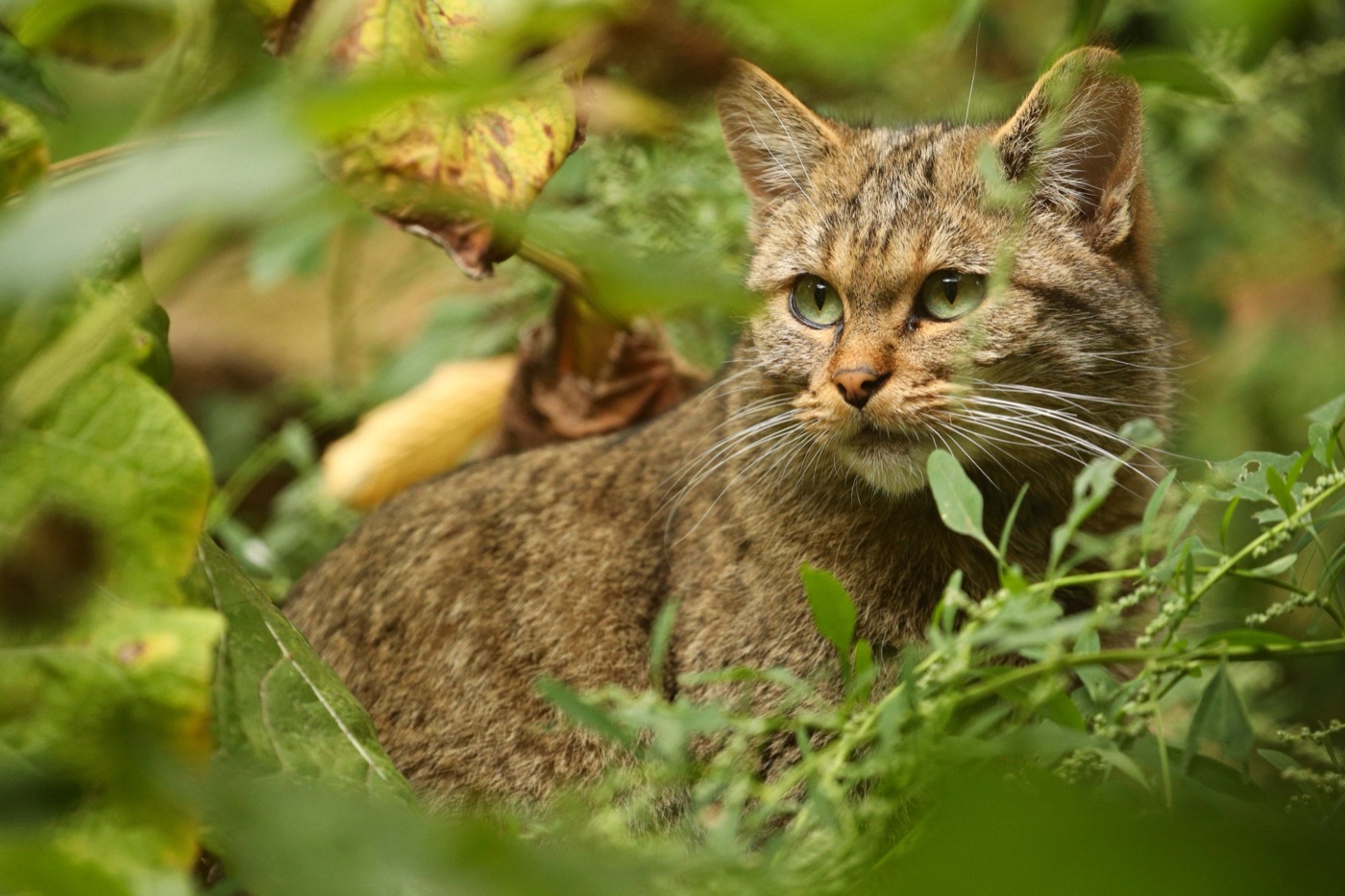
European wildcat
Around the Wintersteinturm in the Hochtaunus, the BUND conservation group runs a wildcat forest trail, since the large, unbroken woods of the Wispertaunus and the Hinterlandswald are among its best habitats. A bushy tail with a blunt black tip and broad dark rings sets it apart from a domestic tabby. It lives hidden and is active at dusk and at night, so quiet forest edges at twilight offer the best chance of an encounter.
Pictures: Freepik
Getting there
- 1 h 15 minFrankfurt am Main
- 1 h 15 minKoblenz
- 2 h 00 minKöln
- 4 h 45 minMünchen
- 5 h 45 minHamburg
- 6 h 30 minBerlin
Good to know
Dogs on a leash
Both nature park authorities ask that dogs be kept on a leash at all times in the forest, so wildlife is not startled. The Naturpark Taunus states this as a fixed rule for its trails, and the Naturpark RheinTaunus additionally points to the leash requirements that apply locally.
Fire only at approved barbecue spots
Campfires are prohibited in the forest without exception, and so is smoking. Fire is allowed only at officially approved barbecue spots; the Naturpark Taunus runs one of them in a former quarry near Cratzenbach, between Rod an der Weil and Weilrod, which is freely accessible and cannot be reserved. In the Naturpark RheinTaunus, barbecue huts can be rented.
Overnight stays in the forest are not allowed
Staying overnight, as well as setting up caravans and tents, is generally prohibited in the forests. Parking is only allowed in designated areas, because forest tracks blocked by vehicles keep forestry and rescue vehicles from getting through.
Getting there and around without a car
The U3 underground line runs directly from downtown Frankfurt to the Taunus Information Center at the Hohemark in Oberursel, a trip the nature park puts at 20 minutes. There are also the S-Bahn lines S1 to S5 and the regional trains RE20, RB21, RB22, RB12 and RB15 from Frankfurt and Wiesbaden. On weekends, bus line 57 runs to the Großer Feldberg 22 times a day, and at the Feldberg a dynamic parking guidance system shows which spaces are free.
Stay on the marked trails
In both nature parks, the rule is to stay on the official, marked trails. In the Wispertaunus, the Frankfurt Zoological Society is currently expanding visitor guidance measures so that retreat areas are preserved for disturbance-sensitive species such as the wildcat and the black stork. The planning area covers 7,677 hectares, of which 2,800 hectares are meant to become connected natural forest.
Swimming at the Hattsteinweiher
In the Taunus, swimming takes place at the designated bathing spot of the Hattsteinweiher pond, northwest of Usingen at the forest edge, at around 340 meters elevation. The pond is about four meters deep and has a marked-off area for non-swimmers; the municipality publishes a site map for every season and refers to the HLNUG, Hesse's state environmental agency, for the official water readings.
Protected landscapes
- Nature park
- Nassau
Names and boundaries: © OpenStreetMap contributors.
About this region
The Taunus is a forested ridge between the Rhein, Lahn, and Main rivers, rising to 881 meters at the Großer Feldberg and dropping south into the vineyards of the Rheingau. You will find pitches at the forest edge, campsites in the Rheingau, and spots right among the vineyards.
The busiest times are the summer school holidays and the riesling harvest in October, quieter in spring during the blossom and in late autumn. When a site is open is shown in each listing's calendar.
