Camping in the Swabian Jura
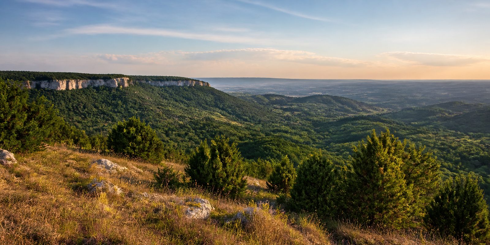
The Schwäbische Alb is a karst range of Jurassic limestone, roughly 200 to 220 kilometers long and 20 to 40 kilometers wide. Rain sinks straight into the limestone. The plateau stays dry at the surface, yet more than 2,800 caves have been documented below it, along with sinkholes and karst springs, and over 350 volcanic vents run through the rock. At its edge the range drops away along the Albtrauf, an escarpment more than 200 kilometers long and up to 400 meters high. It separates the Alb from the rest of Baden-Württemberg. Up top, juniper heaths keep the land open, a result of migratory sheep herding. Together with the ravine forests along the Trauf, they occur nowhere else on this scale.
The year in this region
September: Silver thistles open on the heaths
The silver thistle, an emblem of the juniper heaths, flowers from August to October, according to the Stuttgart Regional Council. Its bracts open only in dry weather and curl upward at night and in damp conditions. The biosphere reserve names Münsingen-Auingen as a place to see them.
In the middle of the month the sun rises at 6:58 AM and sets at 7:37 PM. That leaves 12 hours and 38 minutes of daylight.
Water and air: Open-Meteo, measured averages. How busy: share of school holidays 2027 across all sixteen federal states. Nature dates: German Weather Service, phenological observations 2014 to 2026 at 263 stations in the region, typical day.
Tours in this region
Marked tours that fit into a day from a site, and one multi day tour per kind.
- Hiking
HW 1 - Schwäbische-Alb-Nordrand-Weg
The Albtrauf sets the direction. From Donauwörth to Tuttlingen the trail returns again and again to the escarpment edge, over limestone rock and through beech forest, with the flat foreland below. Schloss Lichtenstein, Burg Teck, the Raichbergturm and the Lemberg at 1015 metres all lie on the way.
360 kmMulti day tour
- Hiking
Donauberglandweg
The Lemberg comes right at the start, at 1015 metres the highest hill of the Swabian Jura, and on a clear day its tower gives a view as far as the Alps. From there the trail crosses the Dreifaltigkeitsberg with its monastery and church and carries on south until it ends in the Upper Danube valley at Beuron. The area is quiet.
59.4 km
- Hiking
Traufgang Zollernburg-Panorama
From the Stich car park near Onstmettingen the path climbs through dense beech forest onto the plateau. At the Zeller Horn you step out of the trees onto the rock head, and opposite stands Burg Hohenzollern on its cone. That is the view everyone knows from postcards.
15.4 km
- Hiking
Traufgang "Wacholderhöhe"
Juniper heath shapes this round near Tailfingen, open grazing ground over limestone with dark single bushes standing in it. Silver thistles and orchids grow between them. The soil is thin, and centuries of sheep grazing made the picture what it is.
8.8 km296 m ascentLoop tour
- Cycling
Albtäler-Radtour
The loop from Amstetten links eight valleys of the central and eastern Jura. It is waymarked with an ammonite. Up on the plateaus it is dry and open. Down below the route follows streams, past karst caves and past rock that was once reef in the Jurassic sea.
186 kmMulti day tour
- Mountain biking
Alb-Crossing
The route crosses the Jura from northeast to southwest, along the rock edges and over the plateaus in between. About seven thousand metres of climbing spread across six suggested stages. Technically it stays straightforward, and stamina carries the rest.
370.2 kmMulti day tour
Tours: © OpenStreetMap contributors, ODbL. Lengths computed from the mapped course, as of September 12, 2026.
Animals you can meet here
 all year
Chamois
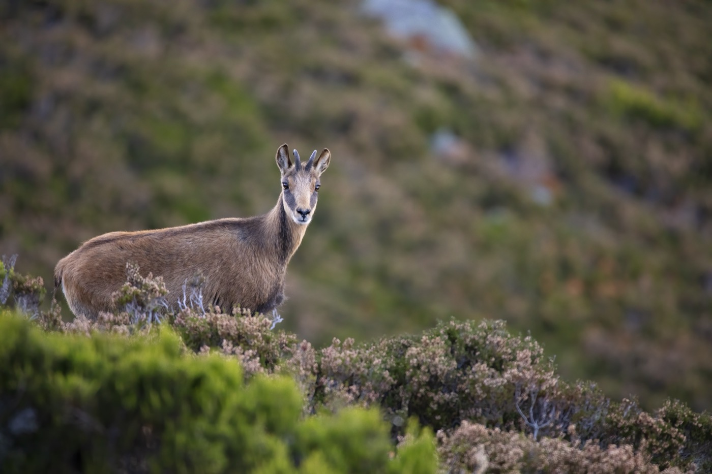
In the Upper Danube Valley the chamois lives on the limestone cliffs and their bases between Fridingen, Beuron and Sigmaringen, where it has been established since the 1970s. From the valley paths it can be seen year round on the open rock faces. Look for the short, hooked horns and its sure footed climbing across narrow rock ledges and shelves.
 all year
Peregrine falcon
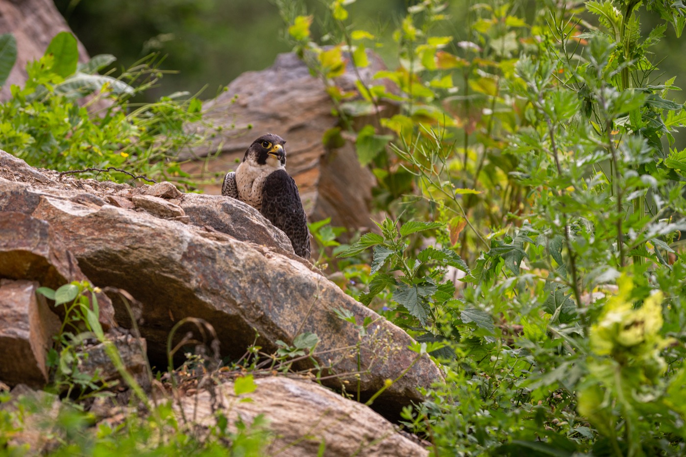
The peregrine falcon breeds on the limestone cliffs of the Upper Danube Valley and on rock outcrops along the Albtrauf escarpment. Look for the slate grey back and the dark moustache stripe below the eye. Its breeding season runs from January to July, which is why climbing crags such as the Rabenfels stay closed during this time.
 all year
Eagle owl
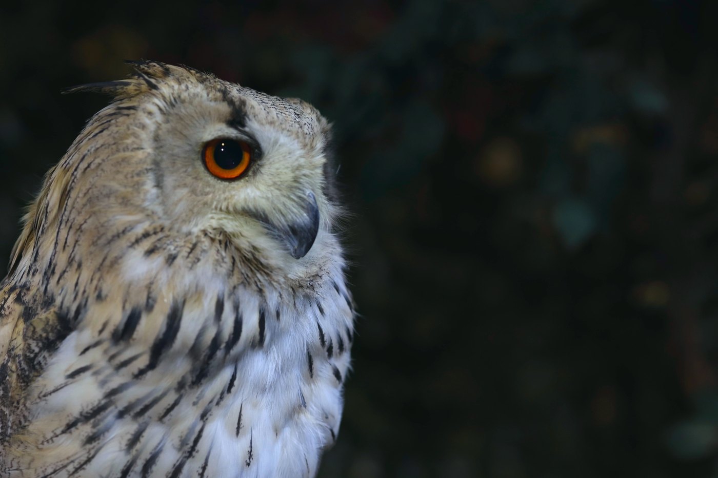
The eagle-owl uses the rock walls of the Upper Danube Valley and cliffs along the Albtrauf as nesting site and hunting ground. With its orange eyes and upright ear tufts, Europe's largest owl is hard to mistake, though by day it usually sits motionless, hidden in a rock crevice. At dusk it gives itself away with its deep, far carrying call.
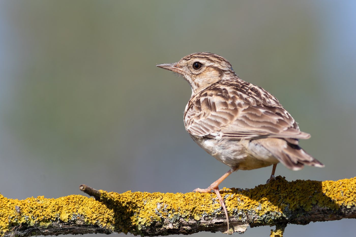 February to October
Woodlark
The woodlark lives on the juniper heathlands, calcareous grasslands and open expanses of the former Münsingen military training ground. Look for the pale eyebrow stripes that meet at the back of the head and its melodious song, often delivered in a circling display flight. It returns from mid February, starts breeding from late March and stays until it leaves between mid September and early November.
Pictures: Freepik
Getting there
- 1 h 00 minStuttgart
- 2 h 15 minMünchen
- 3 h 00 minFrankfurt am Main
- 4 h 30 minKöln
- 6 h 45 minBerlin
- 7 h 15 minHamburg
Good to know
Fire only in the fire pit
At the trekking camps in the Naturpark Obere Donau, fire belongs in the lockable fire pit and may burn only under supervision. Firewood is stacked no higher than 30 centimetres. In dry summers the pit stays shut for a while. In Baden-Württemberg's forests, smoking is also banned from 1 March to 31 October.
Keep dogs leashed, stay on the trail
In the core zones of the biosphere reserve and in nature reserves, hikers must stay on marked trails, and dogs must be kept on a leash. This matters especially where migratory sheep flocks graze: on the former Münsingen military training ground alone, shepherds move their flocks with herding dogs across about 4,000 hectares of pasture.
Climb only on approved crags
The rock faces in the Danube valley are closed to climbing by default, to protect eagle owls, peregrine falcons, ravens, and jackdaws. County climbing regulations open individual crags, often only seasonally: the Rabenfels in the Bäratal and the Lochenstein are open from August 1 to December 31. Current openings are listed by DAV Felsinfo and the IG Klettern Donautal climbing association.
Canoeing on the Danube requires a permit
The season on the upper Danube runs from May 1 to October 3. A boating permit costing 5 euros is required, along with a minimum water level of 53 centimeters in the Beuron section, or 56 centimeters when starting from Scheer, measured at 8 a.m. on the day of the trip or at 6 p.m. the evening before. Entry and exit are permitted only at official points; the first one in the Sigmaringen district is Hausen im Tal.
Münsingen training ground: marked trails only
The roughly 6,700-hectare former restricted military area has been open to the public since 2006, but only on the yellow-marked trails, which may not be left. It is one of the largest road-free open landscapes in Germany. Anyone wanting to explore further can book a guided tour with the Münsinger TrÜP-Guides on foot, by bike, or by bus.
Camp outdoors only at designated sites
Anyone wanting to sleep outdoors in the Naturpark Obere Donau uses the trekking camps. The season runs from May 1 to October 31, booking is online only, opening from mid-January. One overnight stay per camp is allowed, and use is limited to the hours between 5 p.m. and 10 a.m.; camping in the open countryside outside these sites is not permitted.
Protected landscapes
- Biosphere reserve
- Biosphärengebiet Schwäbische Alb
Names and boundaries: © OpenStreetMap contributors.
About this region
The Swabian Jura lies in southwestern Germany between the Danube and the Albtrauf escarpment, a karst range full of caves, juniper heathland and gorge forests. Campsites and pitches range from simple meadow spots to places with a sanitary building.
The busiest months run from May to September, when hikers and climbers are out; spring and autumn are quieter. When a site is open is shown in each listing's calendar.
