Camping in the Spreewald
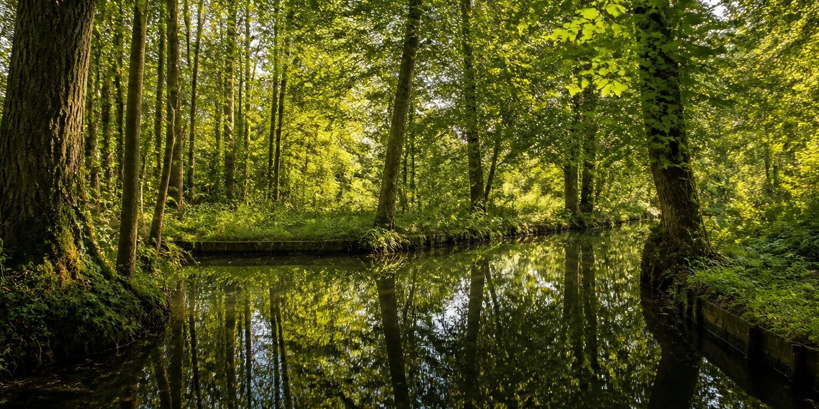
Southeast of Berlin, in the Landkreis Dahme-Spreewald, the Spreewald spreads across 475 square kilometres. A regulation has protected it since 1 October 1990, and UNESCO has recognised it as a biosphere reserve since 11 April 1991. Hundreds of channels, the Fließe, form a labyrinth. At Lübben the Oberspreewald and the Unterspreewald come together again as the Spree. Some 56,500 people live in 37 villages and two towns, and three percent of the area is core zone under especially strict protection. The village of Lehde and its 130 inhabitants are best reached on foot or by punt, and at the open-air museum three historic farmsteads show how people in the Spreewald lived in the 19th century. Since 19 March 1999 the Spreewaldgurke has carried a protected geographical indication, and it grows on around 500 hectares. Lower Sorbian culture is still alive here. In the weeks before Easter, several workshops decorate eggs with wax.
The year in this region
September: First Cranes Begin Gathering
Starting in September, the autumn crane migration through the Niederlausitz picks up, with the first flocks gathering on harvested fields and in wetlands before the main wave passes through in October. The autumn observation season also begins again at this time at the bird observation tower at Wussegk near Schlepzig.
In the middle of the month the sun rises at 6:38 AM and sets at 7:21 PM. That leaves 12 hours and 43 minutes of daylight.
Water and air: Open-Meteo, measured averages. How busy: share of school holidays 2027 across all sixteen federal states. Nature dates: German Weather Service, phenological observations 2014 to 2026 at 13 stations in the region, typical day.
Tours in this region
Marked tours that fit into a day from a site, and one multi day tour per kind.
- Hiking
Moorlehrpfad Raddusch
From the Naturhafen in Raddusch the loop runs flat over farm and gravel tracks, with sandy stretches in between. It touches the Radduscher Kaupen, an old peat cutting, the Carna Gora spring area and the Buschmühle. Kaupen are old sand islands in the bog. QR codes on small signs explain how the lowland turned into bog over thousands of years.
13.5 kmLoop tour
- Hiking
Wanderweg Lübben - Lübbenau
The link between the two Spreewald towns runs along the edge of the lowland, through Treppendorf, Neuendorf and Ragow. The ground stays firm: village streets, cobbles and compacted farm tracks, with short sandy stretches and a few planks across the ditches. A green bar on a white rectangle shows the way as far as the Krimnitz pumping station. There you can see how the water of the lowland is steered. The last stretch into Lübbenau carries no marking.
18 km
- Hiking
Rundwanderweg Lübbenau - Waldschlößchen - Lübbenau
From the Kirchplatz in Lübbenau the route heads out into the tangle of channels, over dozens of wooden bridges and up and down short flights of steps. It touches the Wotschofska, an island with a log built inn from 1894, and then Pohlenzschänke, Waldschlößchen and Leipe. Leipe sits on a sand island in the middle of the water, and the houses turn their front to the channels. Anyone arriving by land enters the plots from behind.
20.6 kmLoop tour
- Hiking
Paul-Gerhardt-Weg
Section 9
The last stage of the route from Berlin into the Spreewald starts at the church in Schlepzig and ends at the Paul-Gerhardt-Kirche in Lübben. In between the Spree keeps you company, along with a string of old fish ponds in the lower Spreewald. The marking is a golden path turning left inside a square. It stays flat the whole way.
15.1 km
- Cycling
Gurkenradweg
Section Nord- und Ostring
The big ring through the biosphere reserve links Lübben, Lübbenau and Cottbus, almost without a climb, on asphalt and firm gravel, sandy here and there in the pine woods. Place name signs are German and Lower Sorbian. On the edges lie the palaces of Lübben and Lübbenau, the rebuilt Slavic fort at Raddusch, the open air museum in Lehde and the Branitzer Park at Cottbus.
224.3 kmMulti day tour
- Cycling
Gurkenradweg
Section Westring
From Golßen the western arc of the cucumber circuit swings through the villages of the Niederlausitz to Lübben, on asphalt almost the whole way. Near Zützen stands the Kanow-Mühle on the Dahme, an oil mill first recorded in 1527 and still working with its historic machinery. Between Schiebsdorf and Prierow, village greens and pine woods take turns. There are no climbs here.
43.6 km
- Cycling
Spreeradweg
Between Cottbus and Lübben the route follows the Spree to the place where it splits into hundreds of channels. Beyond Cottbus lies the Peitz pond country, then come Burg with its Bismarck tower and the scattered farmsteads of the upper Spreewald. At Lübben the water gathers back into one bed. Alder woods and meadow line the way.
70.7 km
Tours: © OpenStreetMap contributors, ODbL. Lengths computed from the mapped course, as of September 12, 2026.
Animals you can meet here
 March to October
Common crane
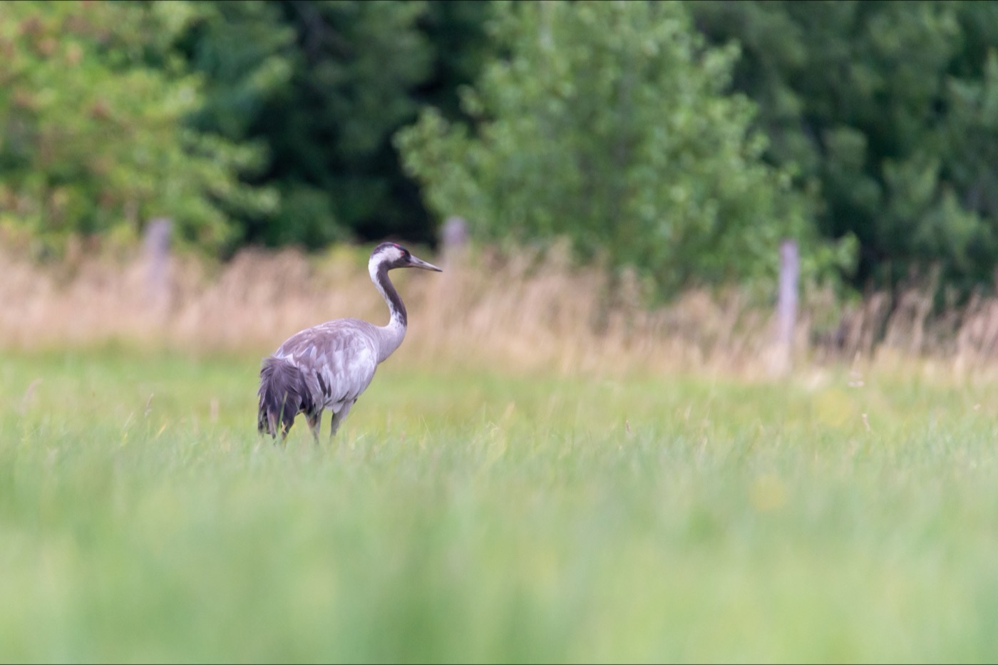
At the bird observation tower at Wussegk near Schlepzig, the common crane is easiest to spot in the early morning and evening hours, its loud trumpeting call often gives it away before you see it. It is recognized by its grey plumage and the red patch on the back of its head, and in flight it holds its neck stretched straight out. In March large flocks pass through on their way to their breeding grounds further north, from September the first birds gather in the fields of the Niederlausitz, and the main passage crosses over the tower in October.
 May to October
Eurasian beaver
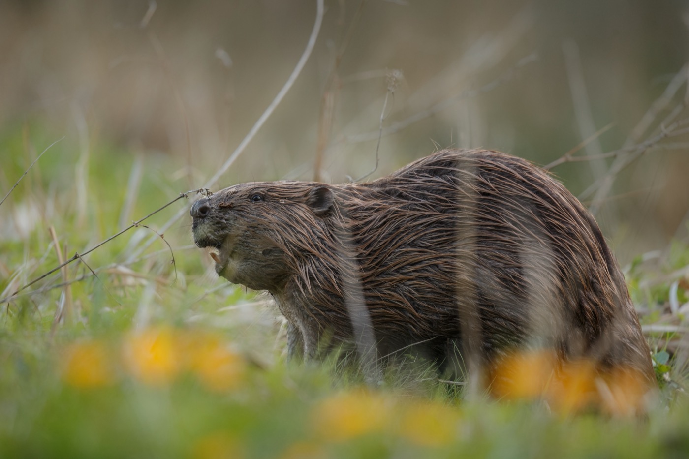
In the waterways around Lehde and Leipe, the Elbe beaver leaves clear gnaw marks on the poplars along the banks. Unlike elsewhere, it builds hardly any visible dams here, since the biosphere reserve regulates water levels anyway. It is most active at dusk, when it swims silently between the channels.
 April to September
Common kingfisher
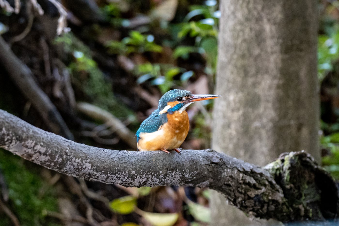
Along the waterways around Lehde, the kingfisher often perches motionless on overhanging branches before plunging headfirst into the water. Its bright blue back and orange breast are hard to miss even when passing by on a punt. Between April and September it nests in burrows dug into the banks, repeatedly flying the same route to the nest with small fish in its beak.
 September to November
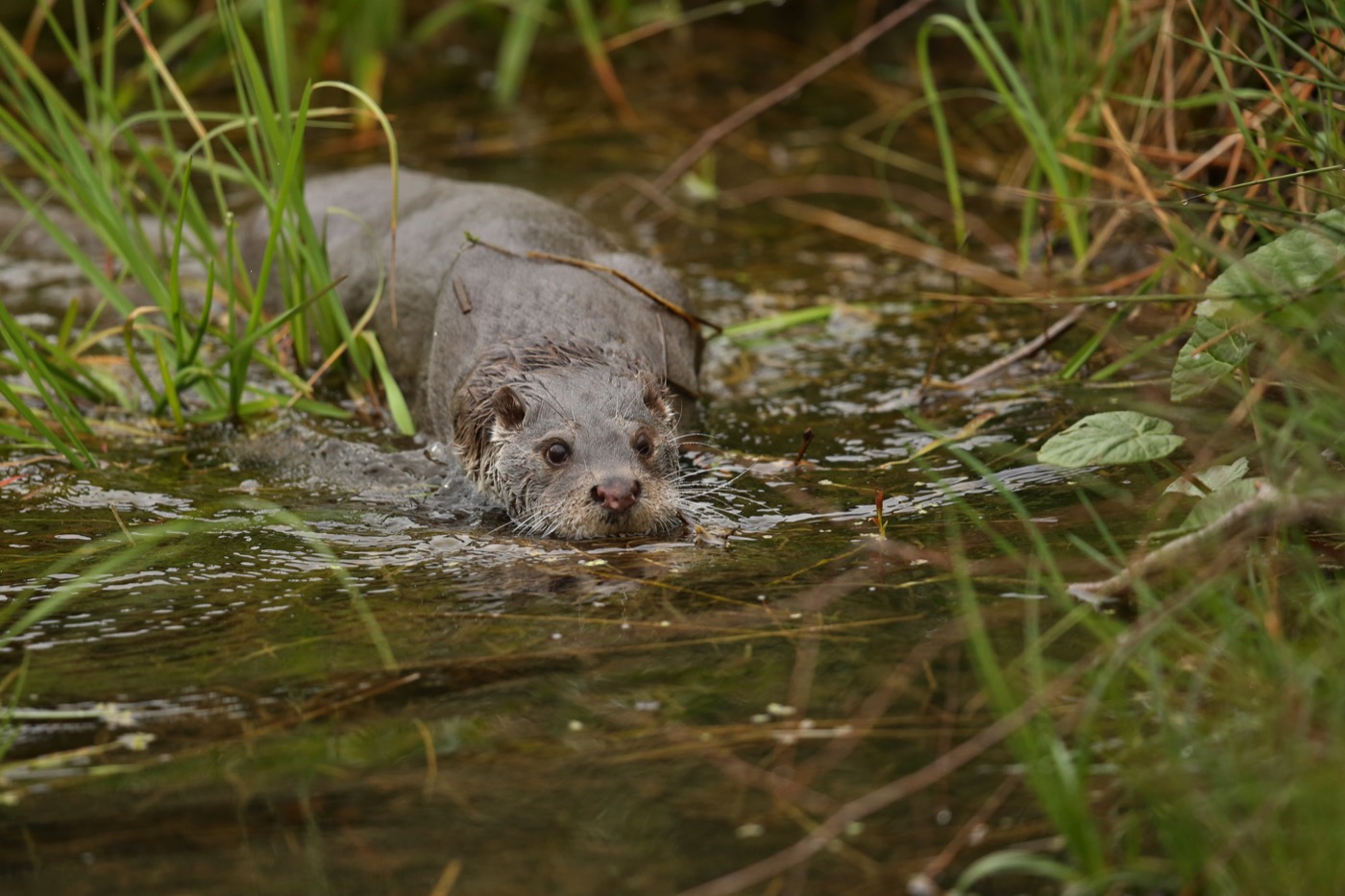
Otter
In the Innerer Spreewald nature reserve near Lehde, the otter leaves signs along sandbanks and jetties, small five-toed prints and dark droppings containing fish remains. It usually becomes visible at dusk, gliding silently through the water and steering with its long tail. In late autumn, as water levels drop, its tracks along the banks stand out more clearly.
Pictures: Freepik
Getting there
- 1 h 00 minBerlin
- 1 h 30 minDresden
- 3 h 45 minHamburg
- 5 h 45 minMünchen
- 5 h 45 minFrankfurt am Main
- 6 h 00 minKöln
Good to know
Fires only at designated spots
Lighting a fire is prohibited in protection zones I and II of the Spreewald biosphere reserve. Barbecues and campfires are allowed only at the places set aside for them, such as campsites and water hiking rest areas. The rule applies all year.
Dogs on the leash in the forest
In the forests of Brandenburg dogs may only be taken along on a leash, as the state forest act requires. In the Spreewald biosphere reserve they may not run free in protection zones I and II either. So pack the leash.
Operating the locks yourself
Around 53 locks sit in the Spreewald channels. Paddlers usually work them themselves, and a sign at each lock shows the order of the steps. When children help out during the holidays, you give them a Schleusengroschen, a small coin per boat.
Mooring Only at Designated Spots
In the biosphere reserve, punts, canoes, and rowboats may only moor at locks, designated water-trail rest areas, or restaurants with their own jetty; landing freely on the banks is not allowed. Stretches marked with a red-white-red sign are closed to all watercraft, including canoes and paddleboats.
Fishing Only at Set Times
Fishing is allowed from one hour before sunrise to one hour after sunset, on the stretches marked for it. Night fishing is permitted only on a few approved waters, and organized fishing events in nature reserves also need approval from the nature conservation authority.
Camping Only at Designated Sites
Wild camping is banned in the biosphere reserve for nature conservation reasons; it is allowed only at official campsites and water-trail rest areas in places such as Burg, Lübbenau, Lübben, or Schlepzig. Paddlers also have 15 legally designated rest stops available for short stays.
Bird Observation Tower at Wussegk
The freestanding tower stands at the edge of Schlepzig, about 300 meters from the parking lot along the Buchenhain nature trail, not far from the weir on the Zerniasfließ. Depending on the season, it is a good spot to watch cranes or wading and water birds, best in the early morning and evening hours.
Protected landscapes
- Biosphere reserve
- Spreewald
- Nature park
- Niederlausitzer Landrücken
Names and boundaries: © OpenStreetMap contributors.
About this region
The Spreewald lies southeast of Berlin, a UNESCO biosphere reserve since 1991 with hundreds of narrow waterways linking its villages by punt boat. Campsites and water-trail rest stops sit in Lübbenau, Burg, Lübben, and Schlepzig.
High season runs through July and August, when Lübbenau holds its Schützenfest and the Spreewald pickles ripen. Things quiet down from November, with fewer boat trips right up to the Spreewald Christmas market in December.
