Camping in the Sauerland
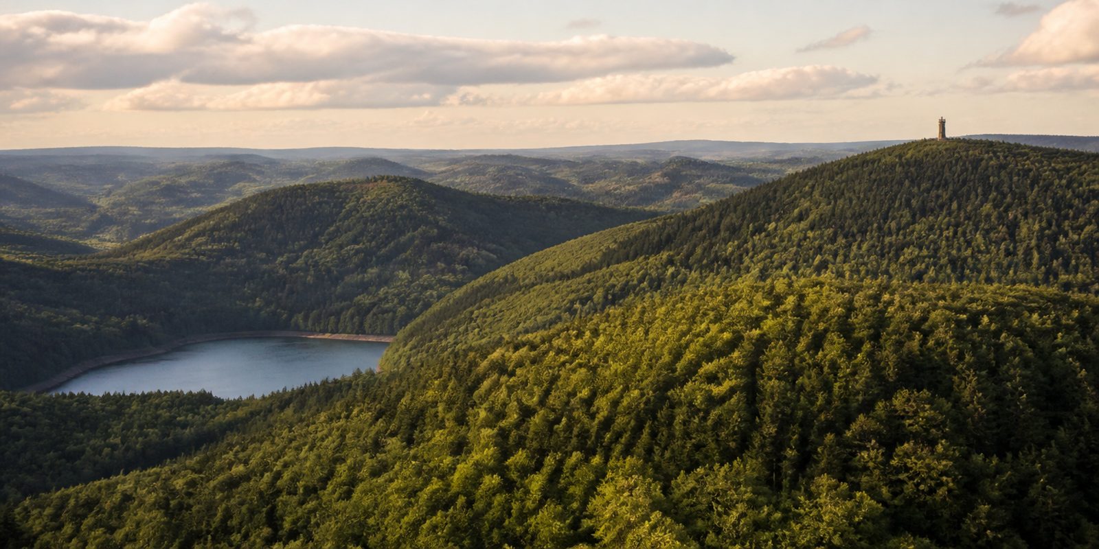
The Sauerland is the highest and wettest part of Nordrhein-Westfalen. Across some 5,000 square kilometres the ridges of the Rothaargebirge climb to 843.5 metres at the Langenberg and 841.9 metres at the Kahler Asten, and between them eight Ruhrverband reservoirs hold back 463 million cubic metres of water. Measured against a single river basin, that is the largest connected reservoir system in Germany. The rest of the state is lowland, Börde plain and conurbation. Up here you find the largest nature park in Germany, 4,215 square kilometres of it, and in the Neuer Hagen the largest upland heath in the state. The Bruchhauser Steine became its first national natural monument.
The year in this region
September: Red deer rut in the forests
With the first cool nights, the red deer rut begins in early September, and the stags' bellowing can be heard early in the morning and at dusk. The nature park and local guides offer evening walks, for instance starting from the Quellental trailhead car park in Meinerzhagen-Hösinghausen in the Ebbegebirge, around 6.5 kilometers (4.0 mi) from 6 pm. At the Wildwald Vosswinkel wildlife park near Arnsberg, the rutting season in the deer enclosure begins around September 19.
In the middle of the month the sun rises at 7:02 AM and sets at 7:44 PM. That leaves 12 hours and 42 minutes of daylight.
Water and air: Open-Meteo, measured averages. How busy: share of school holidays 2027 across all sixteen federal states. Nature dates: German Weather Service, phenological observations 2014 to 2026 at 169 stations in the region, typical day.
Tours in this region
Marked tours that fit into a day from a site, and one multi day tour per kind.
- Hiking
Rothaarsteig
From Brilon to Dillenburg along the Rothaargebirge ridge. Right at the start stand the Bruchhauser Steine, four rocks of hard porphyry weathered out of the softer Devonian slate around them. Further south come the Langenberg at 843 metres, the Ruhr source and the Kahler Asten. In the far south the springs of the Eder, Sieg and Lahn lie within a few kilometres of each other.
152.8 kmMulti day tour
- Hiking
Sauerland-Höhenflug
Between Altena and Korbach the route stays high. It follows ridges between four hundred and eight hundred metres, and several lookout towers stand along the way, among them the Robert-Kolb-Turm on the Nordhelle in the Ebbegebirge and the Schombergturm near Wildewiese. From there the view carries past the Sauerland and out into the Münsterland.
258.7 kmMulti day tour
- Hiking
Sauerland-Waldroute
Forest almost all the way, from Iserlohn to Marsberg. At Hemer the route crosses the Felsenmeer, where Middle Devonian reef limestone has been dissolved into a broken, fissured floor among the beeches. The highest point is the Lörmecketurm in the Arnsberger Wald at just under 581 metres.
244.8 kmMulti day tour
- Hiking
WaldSkulpturenWeg - Wittgenstein-Sauerland
Eleven works of art are spread along the Rothaar ridge between Bad Berleburg and Schmallenberg. A good twenty kilometres lie between them. Magdalena Jetelová's golden egg stands a good six metres tall at the forest edge on the Windbrachekopf, looking down into the Odeborn valley towards Bad Berleburg.
23.2 km
- Hiking
Rothaarsteig-Spur Kahler Asten-Steig, R
From Westfeld the way leads through the valley of the Schwarzes Siepen and over the Hinterster Hoher Knochen up to the Kahler Asten. At 842 metres the top carries heather and mat grass instead of forest, and the Astenturm looks out over half the Sauerland. About five hundred metres of climbing add up.
15.8 km500 m ascentLoop tour
- Hiking
Medebacher Bergweg
Nine half-timbered villages sit on this loop around Medebach. Between them the ground changes from wooded stream valleys to open slopes, and near Titmaringhausen and Düdinghausen the path crosses upland heath. The climb out of the Orke valley onto the Rösberg, just under eight hundred metres, is the long part of the day, with a view across to the Winterberg uplands.
66.6 kmMulti day tour
- Cycling
Ruhrtalradweg
The route starts at the Ruhr source near Winterberg. It stays close to the young river at first, opens into a wider valley past Olsberg, Meschede and Arnsberg, and is largely free of cars. The surface is mostly asphalt with stretches of gravel, and the gradient works in your favour.
235.6 kmMulti day tour
- Mountain biking
Hochsauerland Zweitausender
The name refers to the metres of climbing, not to any summit. About seventeen hundred add up over a good seventy kilometres. From Winterberg it runs over the Kahler Asten, down the Lenne valley to Westfeld and Oberkirchen and then up onto the Hunau and the Rimberg. Most of the riding is on forest tracks.
73.5 km1714 m ascentLoop tour
Tours: © OpenStreetMap contributors, ODbL. Lengths computed from the mapped course, as of September 12, 2026.
Animals you can meet here
 September to October
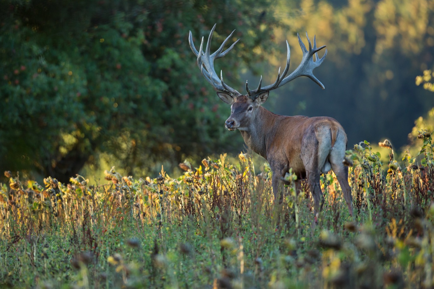
Red deer
In the Rothaargebirge and the Ebbegebirge, red deer live free in the mountain forests, and in the Wildwald Vosswinkel near Arnsberg also in an enclosure. A mature stag carries a widely branched antler and is noticeably larger than a roe deer. From early September the rut begins, and at dusk the roaring of the stags can be heard, for instance on the evening walks that start from the Wanderparkplatz Quellental near Meinerzhagen-Hösinghausen.
 March to September
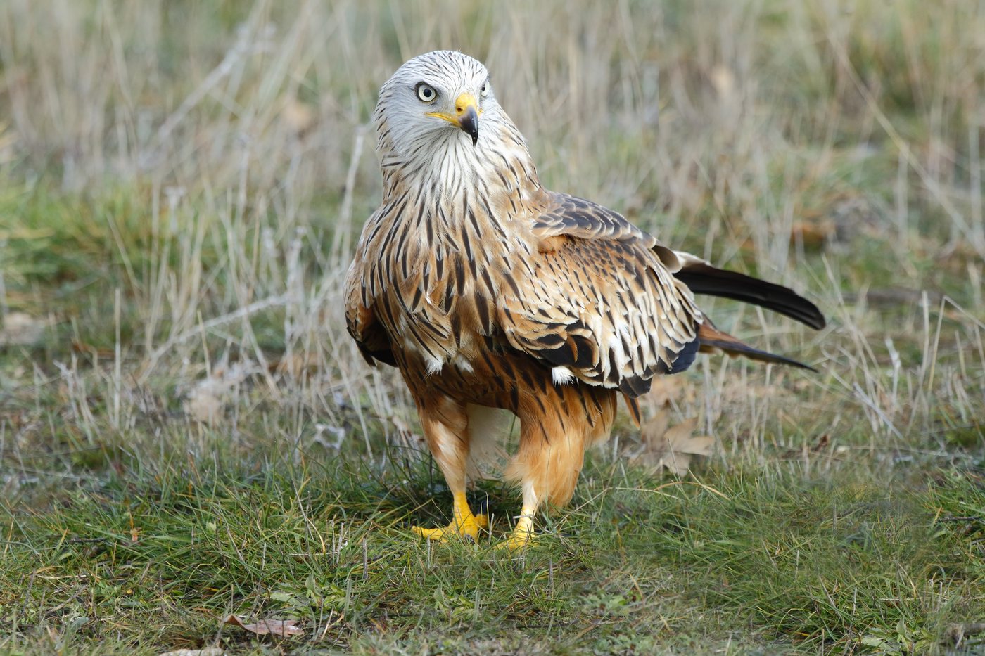
Red kite
Over the Medebacher Bucht and in the Diemel and Hoppecke valleys near Marsberg and Brilon, the red kite circles, recognizable by its deeply forked, rust-red tail. From March it nests at forest edges and in open stands of old trees, then hunts for mice over the open fields and freshly mown meadows.
 May to August
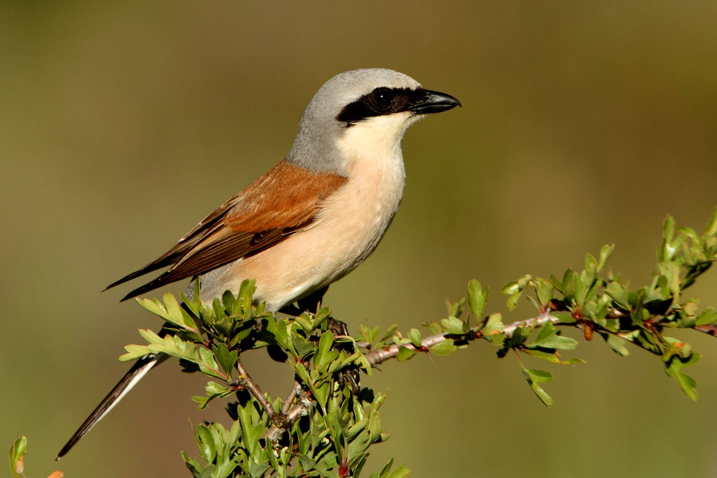
Red-backed shrike
In the Medebacher Bucht bird sanctuary near Medebach, Hallenberg and Winterberg, the red-backed shrike lives in the semi-open hedge and pasture landscape, the largest population of this species in Nordrhein-Westfalen. It perches on fence posts and bush tips and impales its prey on thorns and barbed wire, a habit that makes it unmistakable. From mid-May the female lays her eggs.
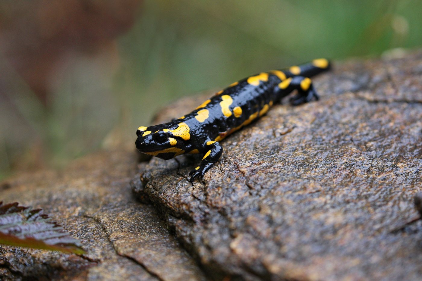 March to May
Fire salamander
In the damp deciduous forests along the cool headwater streams of the Wennetal, the Schwarzbachtal and the Hunau lives the fire salamander, unmistakable for its black skin with bright yellow spots. Active at night, it appears above all on mild, rainy evenings between March and May.
Pictures: Freepik
Getting there
- 1 h 30 minDortmund
- 2 h 00 minKöln
- 2 h 45 minFrankfurt am Main
- 4 h 15 minHamburg
- 5 h 45 minBerlin
- 6 h 15 minMünchen
Good to know
Dogs on the trails or on a leash
In the forests of North Rhine-Westphalia, dogs may run free on the trails as long as they respond to commands and stay in sight. As soon as the trail is left, the dog must go on a leash. In nature reserves, dogs must be kept on a leash at all times, and people and dogs stay on the trails. The Rothaarsteig long-distance trail applies the same rule among its eleven rules of conduct.
Fires only at designated spots
Open fires and barbecues are not allowed in the forest or within 100 meters of it, and a smoking ban also applies in the forest from March 1 to October 31. For breaks, the nature park has a dense network of shelters and rest areas, such as Auf'm Stück at the Sorpesee, Beerenberg and Franzosenkreuz in the Hochsauerlandkreis district, or the Ziegenhelle at 815 meters.
Bringing your own boat onto the reservoirs
A shared set of leisure rules applies to all eight Ruhrverband reservoirs. At the Sorpesee, swimming, sailing, windsurfing, canoeing, rowing and diving are allowed, while at the Hennetalsperre only permanently moored or locally rented boats are permitted, and boats brought from elsewhere, including SUPs, kayaks and inflatables, must stay out. Anyone moving a boat from one body of water to another cleans it first and lets it dry out for at least five days.
Overnight stays only at designated sites
Sauerland-Tourismus distinguishes three forms of staying overnight outdoors: campsites, motorhome pitches and trekking sites. Camping in the open forest is not allowed, and parking on forest tracks is prohibited. For the trekking sites, the nearby hiking car parks are intended for parking. The nature park runs six trekking sites around Hallenberg, bookable online for 20 euros per platform and night, each with a tent platform for up to two tents and a composting toilet.
The cycling tunnel is closed in winter
The 689-meter Kückelheimer Tunnel on the SauerlandRadring cycling route, also known as the bat tunnel, is closed every year on November 1 and reopens by April 9 at the latest, so that bats can hibernate there undisturbed. Anyone cycling the route between November and April should plan for the signposted detour. The current status is posted in the route information for the SauerlandRadring.
Stay on the paths in the protected areas
The open highland heaths and mountain meadows are breeding grounds for the meadow pipit, tree pipit, cuckoo and great grey shrike, so visitors stay on the marked paths. The heath in the Neuer Hagen nature reserve is kept open by a flock of Heidschnucke heath sheep and goats. At the Bruchhauser Steine, only one of the four rock towers, the Feldstein, can be climbed, and the site has fixed opening hours, from April to October, Tuesday to Sunday, 10 am to 6 pm.
Protected landscapes
Names and boundaries: © OpenStreetMap contributors.
About this region
The Sauerland lies in the south of Nordrhein-Westfalen and rises to 843 meters, the highest part of the state. Eight reservoirs form Germany's largest reservoir system on a single river. Campsites, RV pitches and trekking sites line the lakes, the forest and the Rothaarsteig trail.
Summer is the busiest season, quieter in spring and autumn. In winter, cross country skiers head for the Kahler Asten, which averages around 120 days of snow a year.
