Camping in the Rhön Mountains
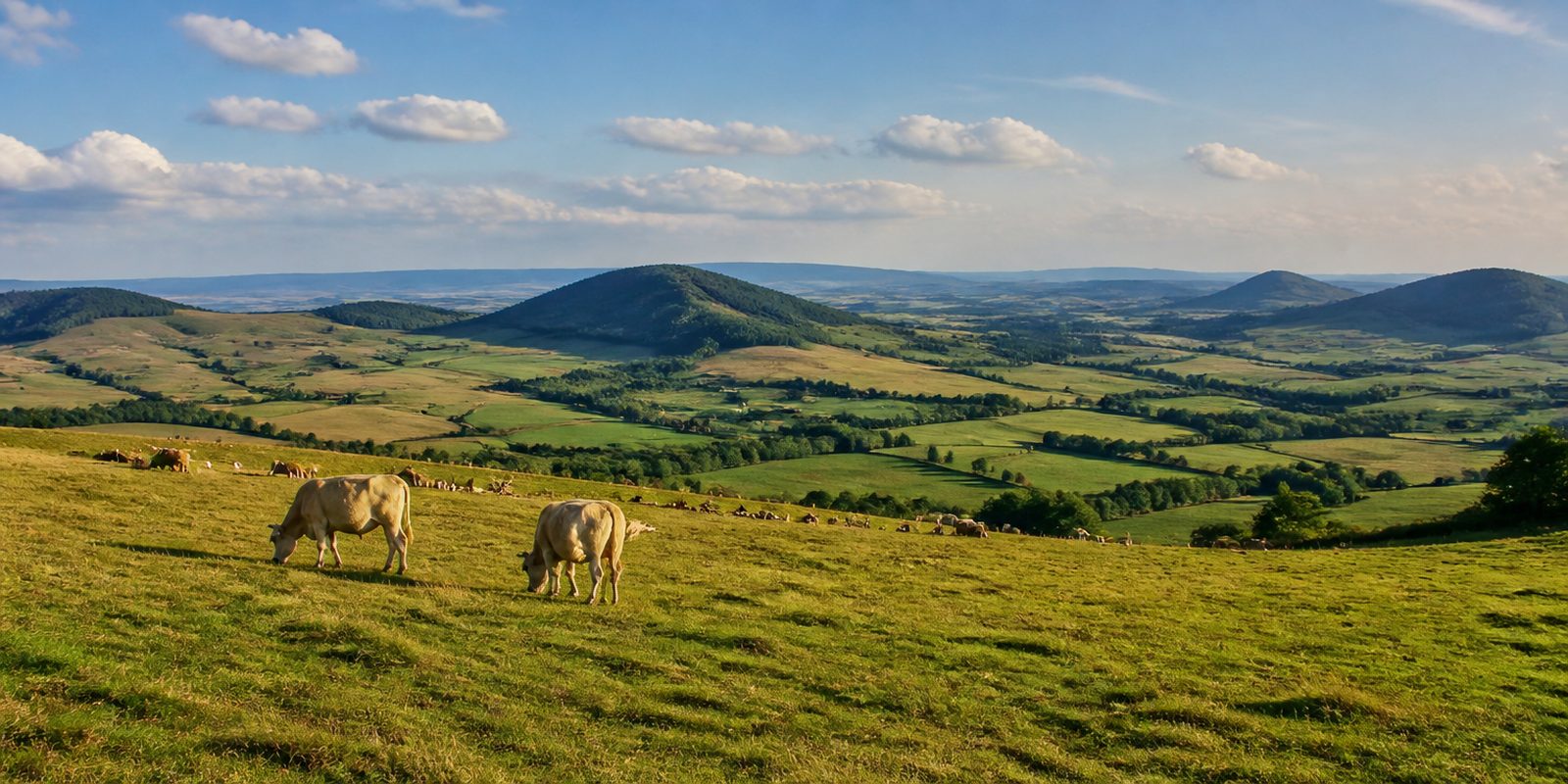
The Rhön is volcanic in origin. Where Bayern, Hessen and Thüringen meet, basalt domes and wide plateaus form an upland range that grazing livestock has kept open for centuries, which is why it is called the Land der offenen Fernen, the land of open distances. No forest grows on the ridges. Up there lie the largest mat-grass swards outside the Alps. Raised bogs that have stayed close to their natural state sit alongside them. Settlement is thin, and the night sky benefits: since August 2014 it has been recognised as an International Dark Sky Reserve.
The year in this region
September: Red Deer Rutting Season Begins
The red deer rut begins in mid-September. It can be reliably heard at the Gersfeld wildlife park, opened by the town in 1972, where red deer, fallow deer, and roe deer live in enclosures. September also brings a clear drop in rainfall, often with the mild, hazy weather known there as Altweibersommer, an autumn spell much like an Indian summer.
In the middle of the month the sun rises at 6:55 AM and sets at 7:36 PM. That leaves 12 hours and 41 minutes of daylight.
Water and air: Open-Meteo, measured averages. How busy: share of school holidays 2027 across all sixteen federal states. Nature dates: German Weather Service, phenological observations 2014 to 2026 at 117 stations in the region, typical day.
Tours in this region
Marked tours that fit into a day from a site, and one multi day tour per kind.
- Hiking
Der Hochrhöner
From Bad Kissingen to Bad Salzungen across the highest ridges of the Rhön, through Bavaria, Hesse and Thuringia. The trail takes in the Kreuzberg with its Franciscan monastery on the way to the Rotes Moor, with mountain meadows and basalt domes in between. There it splits into a western route over the Wasserkuppe and an eastern route over Heidelstein and Ellenbogen, and the two meet again at Andenhausen. Up there hardly a tree stands.
172 kmMulti day tour
- Hiking
Extratour Hochrhöntour
From the Schornhecke car park narrow paths lead across the Lange Rhön, Bavaria's largest nature reserve outside the Alps. The route goes over the Heidelstein and the Schwabenhimmel, where the view runs far across the plateau, and past the basalt lake in the old Steinernes Haus quarry. Grass, wind and distance, trees hardly at all. Black grouse breed in the mountain meadows.
14.7 kmLoop tour
- Hiking
Extratour Kreuzbergtour
The loop climbs through wide deciduous woods and over soft meadow tracks to the Kreuzberg, 928 metres high, with its three crosses on the summit. Only the crown is basalt. Below it come shell limestone and red sandstone. At the top stands the Franciscan monastery, the only one of the order in Germany to run its own brewery, and the villages of Kilianshof and Sandberg lie along the way.
13.2 kmLoop tour
- Hiking
Extratour Rotes Moor
A boardwalk leads into the Rotes Moor, one of the last raised bogs in Hesse, between birches and dark peat water. Later the route drops into the Kaskadenschlucht, where the Feldbach jumps over mossy blocks. Then it climbs back to the Heidelstein, and from the Schwabenhimmel the view reaches across the Ulster valley to the Thüringer Wald. The Kesselrain nature reserve lies on the way.
18.1 kmLoop tour
- Hiking
Extratour Milseburg
The Milseburg is an 835 metre cone of phonolite whose crown carries no forest, and the path from the Danzwiesen heads straight up it. At the top stand the Gangolfskapelle and a crucifixion group from the eighteenth century, while below the summit the remains of a Celtic ring wall run through the block scree. The route continues over the Stellberg and around the Maulkuppe, part of it through old beech forest. The view reaches far into the Fulda country.
10.8 kmLoop tour
- Cycling
Milseburgradweg
The path lies on the bed of the old Rhönbahn, from Götzenhof near Fulda to Hilders in the Ulster valley, asphalt all the way and with the even, gentle gradient of a railway line. Halfway along comes the Milseburgtunnel of 1889, close to 1200 metres long and cool even at midsummer. Beyond it everything rolls downhill.
30.9 km
- Cycling
Ulstertal-Radweg
The Ulster rises at the Heidelstein at a good 800 metres and joins the Werra at Philippsthal, and the cycle path keeps it company the whole way. From Hilders on it lies on the bed of the old Ulstertalbahn, mostly asphalt, with gravel sections in the former border strip. By way of Tann and Geisa it passes Point Alpha, where the inner German border once ran. It is downhill nearly all of it.
57.6 km
- Cross country skiing
Rundloipe NSG Lange Rhön
The track runs across the open plateau of the Lange Rhön, where Bavaria, Hesse and Thuringia meet. It alternates between forest edges and open fields, brushes the Stirnberg and the Frauenhöhle, and stays between 630 and 880 metres. The Thüringer Hütte and the inn on the Rother Kuppe sit on the loop. Trees only stand at the edges.
26.6 km485 m ascent
- Canoeing
Fränkische Saale
The paddle runs down from the Rhön towards the Main, past Bad Kissingen and Hammelburg to the mouth at Gemünden. The water moves calmly, trees line the banks for long stretches, and meadows and fields open up in between. At the weirs by Aura, Elfershausen, Westheim and Hammelburg the boat has to be carried. A day on the river passes slowly.
58.3 km
Tours: © OpenStreetMap contributors, ODbL. Lengths computed from the mapped course, as of September 12, 2026.
Animals you can meet here
 February to October
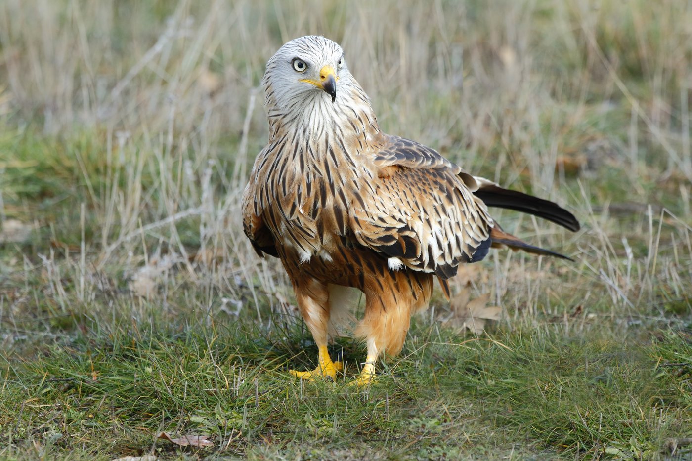
Red kite
Red kites circle over the ridge paths of the Lange Rhön and the meadow valleys of the Kuppenrhön, a bird the biosphere reserve administration calls the signature species of the Rhön. Its deeply forked reddish-brown tail and the pale patches on its long wings make it recognizable from far away. From February into October it soars over the high plateaus before leaving for its winter quarters.
 April to August
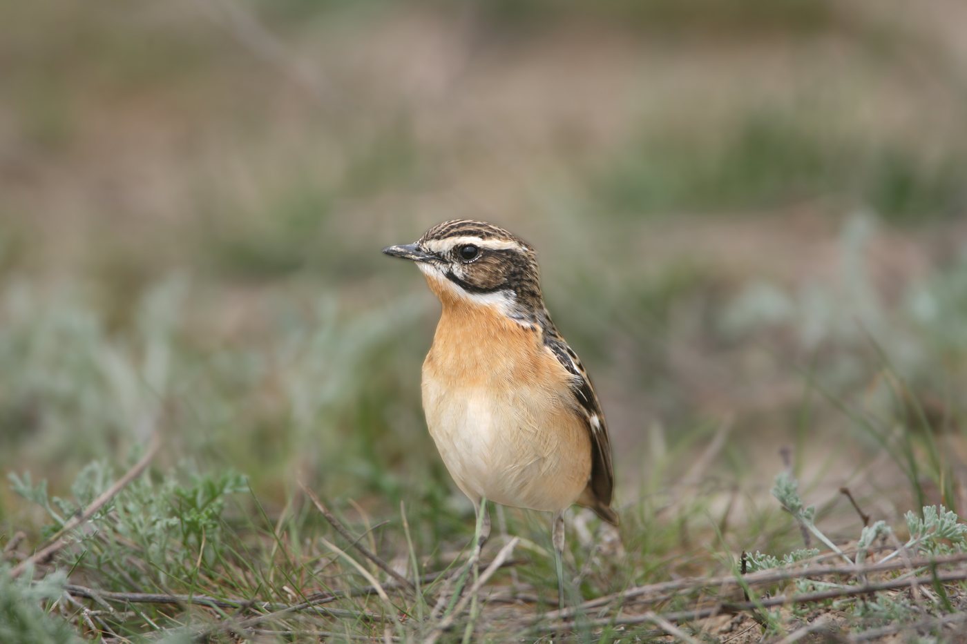
Whinchat
On the mountain meadows of the Lange Rhön, the whinchat perches upright on fence posts and tall stalks, with the Schornhecke hiking car park toward Heidelstein a good starting point. Its creamy white eyebrow stripe and orange-brown breast stand out clearly against the green of the meadows. From April to August it defends its territory from these lookout perches.
- all year
Rhön sheep
Rhön sheep graze in shepherded flocks on the mountain meadows and common pastures across the Rhön, recognizable by their black, wool-free heads and white legs. This old sheep breed was first recorded in 1844 in the Dreiländereck and today numbers around 5,000 animals spread across several flocks. Their grazing keeps the open summits and slopes free of scrub, the openness that earned the Rhön its byname, the land of open distances.
 all year
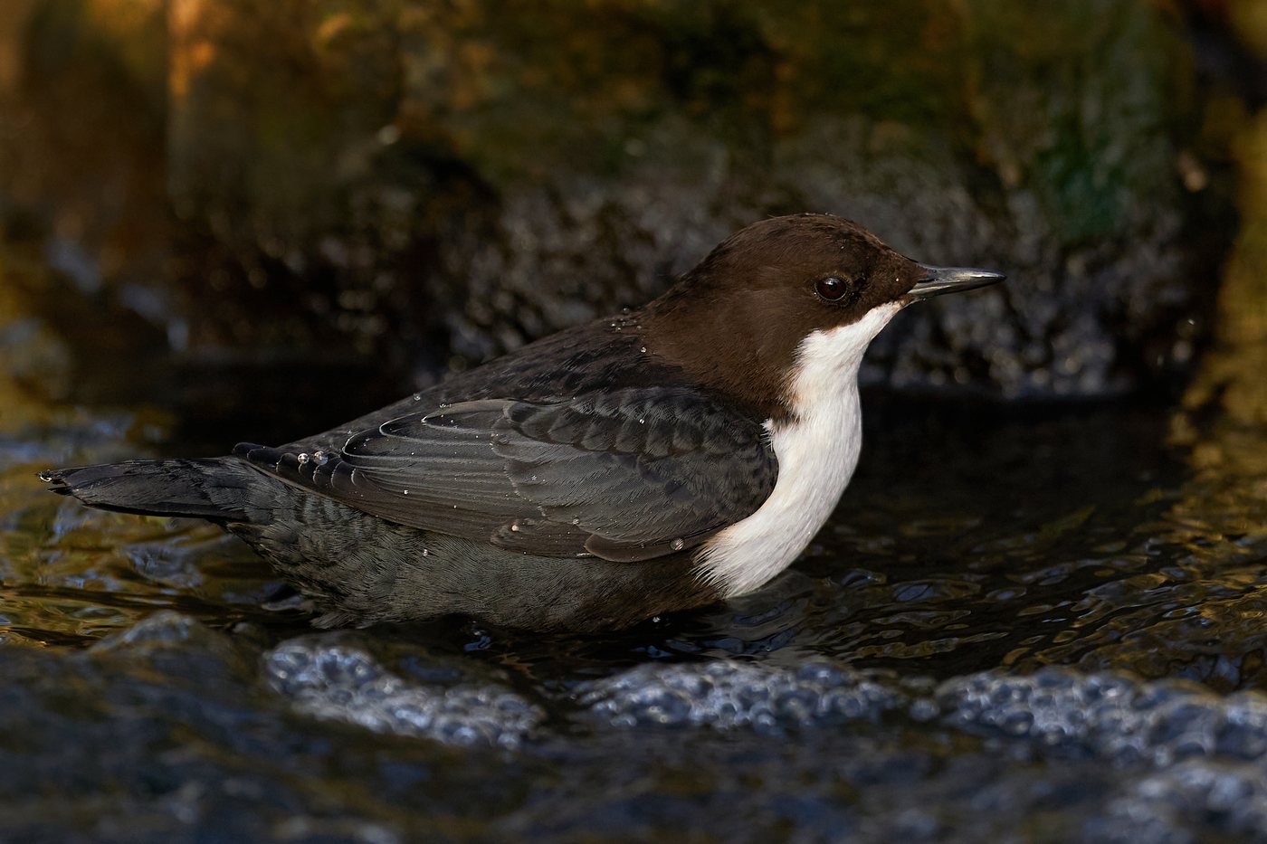
White-throated dipper
At clear streams such as the Ulster, Brend and Streu, the white-throated dipper perches on stones in the water, bobbing its whole body up and down. Its white throat patch stands out clearly against the otherwise dark brown plumage before it dives under to search for food. It builds its round nest under overhanging roots and bridges, and because it stays close to its territory, it remains on ice-free stretches even in winter.
Pictures: Freepik
Dark skies
Places certified by DarkSky International.
Sternenpark Rhön
The biosphere reserve where three states meet is among the darkest country in central Germany. The Hohe Geba has observing platforms for telescopes, and a dozen open air sky sites come with loungers and star charts.
Fulda
The first dark sky community in Germany, certified in 2019. The town on the western edge of the Rhön dark sky place has converted its street lamps so the sky above the biosphere reserve stays dark.
Getting there
- 1 h 15 minWürzburg
- 1 h 30 minFrankfurt am Main
- 3 h 15 minKöln
- 3 h 45 minMünchen
- 4 h 30 minHamburg
- 4 h 45 minBerlin
Good to know
Leash Requirement in the Nature Reserves
Dogs must be kept on a leash at all times in the nature reserves and core zones of the Rhön UNESCO Biosphere Reserve. This includes the Lange Rhön, the largest nature reserve in Bavaria outside the Alps, as well as the Rotes Moor and Schwarzes Moor bogs. Outside the protected areas, the reserve administrations also ask that dogs be kept on a leash, because dogs notice wildlife well before their owners do.
Stay-on-the-Path Rule in the Lange Rhön
In the Lange Rhön nature reserve, leaving the designated paths is not allowed, in summer or winter. The area holds Germany's last population of black grouse outside the Alps and is a breeding ground for ground-nesting birds such as the whinchat and meadow pipit. In winter, groomed cross-country trails and marked winter hiking paths are provided instead.
Boardwalks Through the Raised Bogs
Schwarzes Moor and Rotes Moor may only be crossed on wooden boardwalks; the rest of the bog surface stays untouched. The 66-hectare Schwarzes Moor is a core zone of the biosphere reserve, has a viewing tower, and draws around 100,000 visitors a year. Channeling visitors onto the boardwalk is exactly what lets the bog handle that many.
Overnight Stays and Parking Only at Designated Sites
Wild camping is not permitted in the Rhön's nature reserves, whether in a camper van, a tent, or a bivouac. Parking is allowed only in officially designated lots, since vehicles left elsewhere can block emergency access routes. Motorhome sites are available in the towns around the Hochrhön.
Open Fire and Smoking in Protected Areas
Smoking and open fire are banned in the Rhön's protected areas. Grilling and campfires are limited to designated sites outside the protected areas, and many towns and inns maintain such fire pits. Being part of the Dark Sky Reserve also means using sparing, downward-facing lighting at night.
Boating Rules on the Fränkische Saale
The Fränkische Saale may be paddled from the bridge at Herschfeld above Bad Neustadt down to the weir above Gemünden, around river kilometer 96 to 97. Night paddling is banned from 6 p.m. to 7 a.m., weirs must be portaged, and groups should number no more than ten boats. A minimum water level also applies: for the stretch from Bad Neustadt to Bad Kissingen, the Salz gauge must read at least 160 centimeters.
Protected landscapes
- Biosphere reserve
- Rhön
- Nature park
- Bayerische RhönHessische Rhön
Names and boundaries: © OpenStreetMap contributors.
About this region
The Rhön Mountains sit at the tripoint of Bavaria, Hesse and Thuringia. Their treeless plateaus carry the largest mat-grass grasslands outside the Alps and a night sky recognized as a dark sky reserve since 2014. Campsites and pitches sit in the villages around the Wasserkuppe and the Lange Rhön.
Summer is busiest, with the mountain meadows in bloom and the dark sky weeks in August. It quiets down in autumn, while snowy January and February mainly draw cross-country skiers.
