Camping in the Palatinate Forest
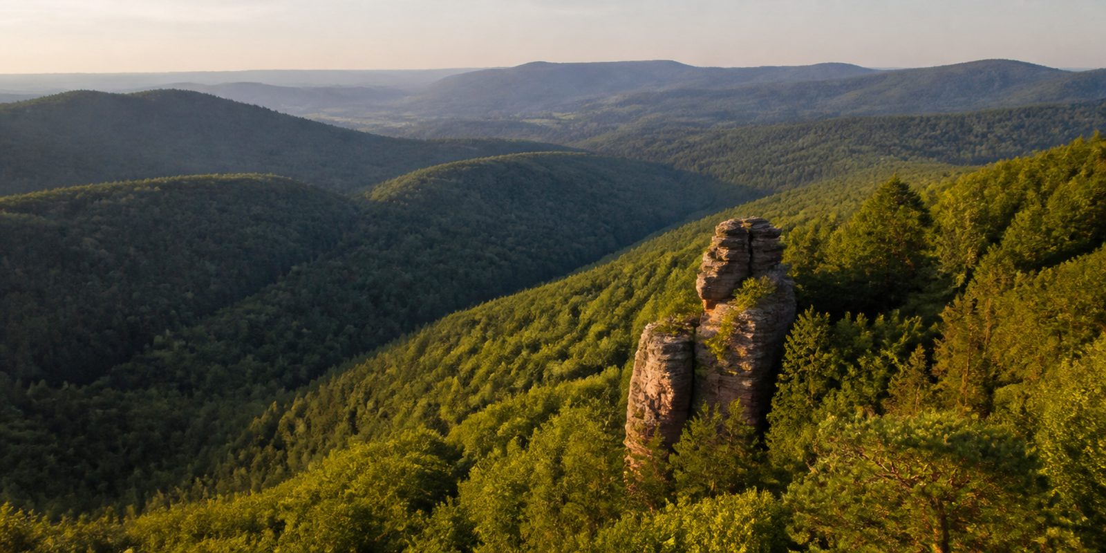
The Pfälzerwald covers about 1,800 square kilometers, making it the largest contiguous forest in Germany, and together with the French Northern Vosges it forms the country's only cross-border UNESCO biosphere reserve. It only got its name in 1843, when Palatinate forestry officials met in Johanniskreuz and gave the northern part of the Vosges this new designation. Massive red sandstone crags define especially the south around Dahn, where the Burgruine Altdahn, a ruined castle, sits on one such outcrop. Gräfenstein and the Trifels crown other rock formations of this kind. The range reaches its highest point at the Kalmit, 673 meters, while the Wieslauter headwaters area near Hinterweidenthal, the largest core zone, is largely left to develop on its own. The Pfälzerwald-Verein, the regional hiking association, maintains about 12,000 kilometers of marked trails, and at harvest time anyone may pick fruit from the streuobst trees, the traditional orchard trees marked with a yellow ribbon.
14 places and units in this region
Places in this region

The year in this region
September: Dürkheimer Wurstmarkt Taps Its Barrels
On the second and third weekends of September, the Wurstmarktplatz in Bad Dürkheim turns into what organizers call the largest wine festival in the world, often drawing more than 600,000 visitors. Thirty-six historic wine stands, known as Schubkärchler, each pour several wines at about 120 seats, always including a Riesling. At the center stands the Dürkheimer Riesenfass, a giant wine barrel built in 1934 with a capacity of 1.7 million liters, which today houses a restaurant.
In the middle of the month the sun rises at 7:04 AM and sets at 7:43 PM. That leaves 12 hours and 40 minutes of daylight.
What nature does this month
- Apple picking starts around September 29 (usually between September 19 and October 4)
Water and air: Open-Meteo, measured averages. How busy: share of school holidays 2027 across all sixteen federal states. Nature dates: German Weather Service, phenological observations 2014 to 2026 at 53 stations in the region, typical day.
Tours in this region
Marked tours that fit into a day from a site, and one multi day tour per kind.
- Hiking
Dahner Felsenpfad
Around Dahn the red sandstone rocks stand in the forest like sculptures: Braut und Bräutigam, the Ungeheuerfelsen, the Schlangenfelsen, the Elwetritschefels. The path leads past them and comes out at the Jungfernsprung, a pulpit high above the valley of the Wieslauter. The ground underfoot is red sand.
13.1 km
- Hiking
Felsenland Sagenweg
A multi-day loop through the Dahner Felsenland that also crosses a stretch of French ground. On the way stand the Altdahn castle group with Grafendahn and Tanstein, the ruin of Neudahn above the Moosbachtal and the Drachenfels near Busenberg, all of them built into the sandstone. Almost every place carries a legend, and a good two dozen of them line the route. Forest ponds and quiet valleys lie in between.
88 kmMulti day tour
- Hiking
Hauensteiner Schusterpfad
Hauenstein is home to the German shoe museum, and the trail carries the cobbler in its name. It climbs to the Felsentor below the Nedingfelsen, where the view opens over the village, then runs on narrow paths through pine forest to the Kreuzfelsen. A summit cross stands on top. From the Hühnerstein the view reaches Burg Trifels.
15.5 km
- Hiking
Pälzer Keschdeweg
Keschde is the Palatinate word for the sweet chestnut, and it grows along the Haardt edge in a broad band above the wine road. The trail runs from Hauenstein by way of Annweiler and Albersweiler to that edge and then along it, past the Villa Ludwigshöhe, the Kropsburg above St. Martin and Hambacher Schloss to Neustadt. The forest ends here, the vineyards begin. In autumn the spiny husks lie on the ground by the hundred.
59.1 km
- Hiking
Pfälzer Waldpfad
Straight through the Palatinate Forest, nine stages from Kaiserslautern to Schweigen-Rechtenbach on the French border. Near the start comes the Karlstal by Trippstadt, after two stages the forest crossroads of Johanniskreuz, later the Weißenberg, at 610 metres the highest point of the trail, and in the south the Dahner Felsenland with the still inhabited Burg Berwartstein. Quiet is the real point here.
142.9 kmMulti day tour
- Cycling
Pfälzerwald Tour
The route leads south away from Kaiserslautern, always following the stream valleys: Moosalb, Queidersbach, Schwarzbach, Rodalb. Almost all of it is asphalt, on cycle tracks and farm roads under tall forest. A few longer climbs sit between the valleys. At the end, near Hinterweidenthal, stands the Teufelstisch, a sandstone mushroom with a massive cap.
61.7 km
- Mountain biking
MTB-Park Pfälzerwald, Tour 18
The start is the Rudolf-Keller-Haus near Lemberg-Langmühle. On the threshold of the Wasgau the loop runs over soft forest floor, short gravel sections and a number of narrow trails, with asphalt only where it passes through villages. It passes the Drei Buchen and Hohe List hiking huts and works through the Rodalbtal, adding up to nearly a thousand metres of climbing.
45.1 km961 m ascent
- Mountain biking
MTB-Park Pfälzerwald, Tour 2
From the station in Waldfischbach-Burgalben the ride crosses the town briefly and then climbs, past the Galgenfelsen, which a flight of steps opens up. The area is called the Holzland. Higher up, climbs and descents alternate through open woodland, by way of Heltersberg, Johanniskreuz and Schmalenberg, and the way back runs on lonely trails.
45.6 km
Tours: © OpenStreetMap contributors, ODbL. Lengths computed from the mapped course, as of September 12, 2026.
Animals you can meet here
 February to June
Peregrine falcon
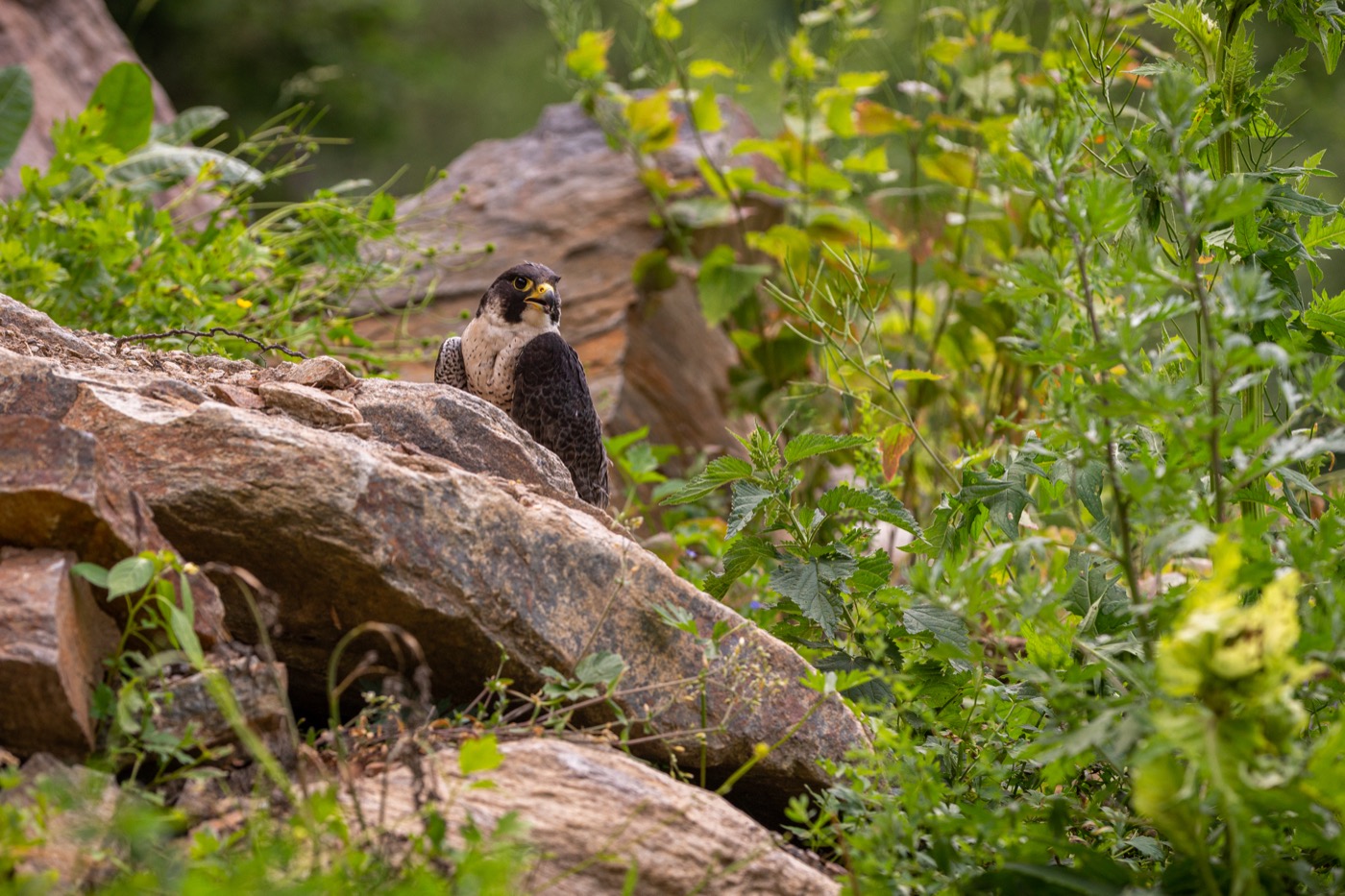
At the Eußerthaler Krappenfels in the Dahner Felsenland, the peregrine falcon nests in inaccessible niches of the sandstone wall, which is why the rock faces are closed to climbers from February onward. In its hunting stoop it reaches speeds over 300 kilometers per hour, recognizable by its pointed, sickle-shaped wings and the dark moustache-like marking on its face. By late June the young falcons leave the nesting niche and practice their first flight maneuvers in the air above the rock towers.
 February to June
Eagle owl
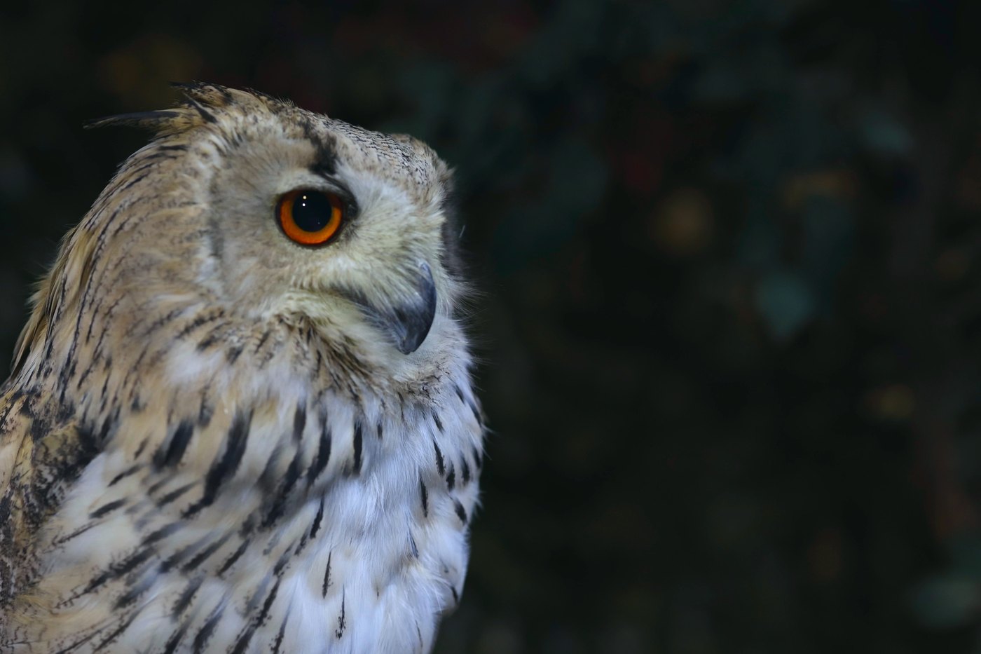
At the Buhlsteinpfeiler between Busenberg and Vorderweidenthal, the Eurasian eagle-owl nests in a hard-to-reach rock niche, which is why access stays closed from February to June. With a wingspan of up to 1.70 meters and its conspicuous ear tufts, it is Europe's largest owl, spending the day motionless and well camouflaged in a crevice. At dusk the pair gives its deep, name-giving call before setting off to hunt over the rock towers.
 February to June
Common raven
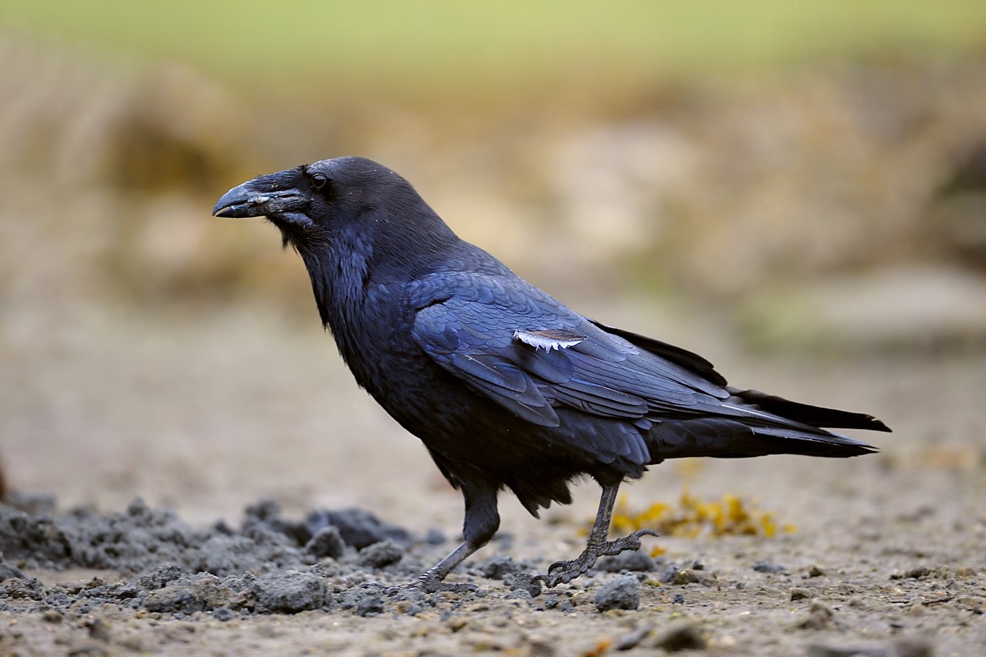
Above the rock towers of the Dahner Felsenland, the common raven circles, distinguishable from a crow by its wedge-shaped tail and its deep, croaking call. With a wingspan of almost one and a half meters, it is the largest songbird in the world. From spring into early summer the pair performs acrobatic dives and rolls over the rocks, often as a courtship or territorial display.
 April to September
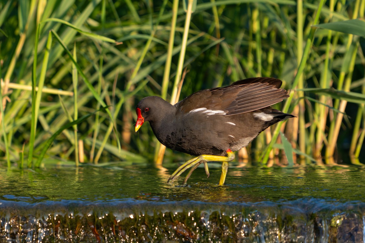
Common moorhen
At the Ungeheuersee near Leistadt, one of the quiet Wooge ponds of the Pfälzerwald, the common moorhen hides its floating nest in the reeds along the shore. Its red bill with a yellow tip and the white stripe along its flank set it apart from the similar coot. From April into autumn it swims among the reed stems with its characteristic head-jerking motion, and its call is usually heard before the bird itself is spotted in the reeds.
Pictures: Freepik
Getting there
- 1 h 45 minMannheim
- 2 h 30 minFrankfurt am Main
- 3 h 45 minKöln
- 4 h 45 minMünchen
- 7 h 00 minHamburg
- 7 h 45 minBerlin
Good to know
Fire only at an approved fire pit
Under the Rhineland-Palatinate forest act, any fire in the woods or within 100 metres of them needs a permit from the forestry office. Fire pits the office has built or approved are exempt. The trekking sites in the Pfälzerwald have one, and the camping stove belongs in it too. In dry summers the pit stays cold for a while.
No dogs in Wildpark Silz
The Wild- und Wanderpark der Südlichen Weinstraße near Silz takes no dogs at all, not even on a lead. Its trails run through the large enclosures where the game roams free. Kennels stand ready at the entrance. On the Pfälzerwald trekking sites dogs are welcome, on a lead.
Cliff Closures for Bird Protection
From February 1 through June 30, more than fifty red sandstone crags in the Pfälzerwald are closed to climbers, and in some cases to hikers as well, including the Buhlsteinpfeiler, the Eußerthaler Krappenfels, and the Dürrensteine. The closure protects the breeding peregrine falcons, Eurasian eagle-owls, and common ravens that nest in the rock crevices. Depending on the cliff, the approach trails may be affected too; the districts of Südwestpfalz and Südliche Weinstraße keep an up-to-date list.
Swimming Only at the Designated Shore
At the Seehof near Erlenbach, the southern shore with its sandy beach is set up as the official swimming area; the rest of the 15-hectare pond's shoreline, partly wooded, serves other purposes. The lake is registered as an EU bathing water and is checked regularly during the season. A kiosk on the shore serves visitors between May and October.
Stay-on-the-Trail Rule in the Core Zones
In the strictly protected core zones of the biosphere reserve, which make up about three percent of its total area, only a few trails stay open to hikers and cyclists. In the Wieslauter headwaters area near Hinterweidenthal, the largest of these zones, leaving the marked trails is not permitted, so the forest can develop without human influence. Anyone wanting to experience the core zone beyond the open trails can book a guided tour through the Hinterweidenthal forestry office.
Parking at the Trailhead Lots
The major routes through the Pfälzerwald start at signposted trailhead parking lots, such as the one in the Zieglertal near Hinterweidenthal or the one by the Sportpark in Dahn. From there, marked trails lead directly into the surrounding forests and core zones; parking outside these lots is barely possible in the dense woodland. For multi-day tours, it is worth checking the relevant tourist information website beforehand.
Protected landscapes
- Biosphere reserve
- Pfälzerwald-Vosges du Nord
Names and boundaries: © OpenStreetMap contributors.
About this region
The Palatinate Forest in southwestern Rhineland-Palatinate is Germany's largest contiguous forest at roughly 1,800 square kilometers, shaped by red sandstone rocks and the Trifels castle ruin. Campsites and pitches sit by Wooge ponds, in the rocky landscape around Dahn, or near the vineyards of the Haardt.
It gets busy in August and in September for the Bad Dürkheim wine festival, while winter between November and February stays quiet. When a site is open is shown in each listing's calendar.
