Camping in Ostfriesland
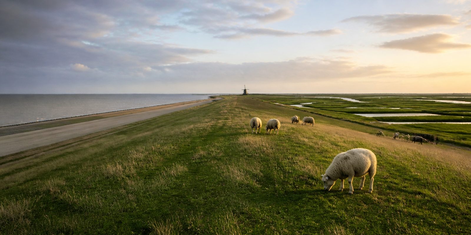
Ostfriesland is flat. The highest point on the mainland barely reaches 19 metres, sheep keep the dikes cropped short, and the canals run dead straight through the wide Fehn districts. The region sits in the far northwest of Niedersachsen between the Ems and the Jade and takes in the districts of Aurich, Leer and Wittmund along with the independent city of Emden, 3,144 square kilometres in all, home to some 462,000 people. Six of the East Frisian islands lie offshore: Borkum, Juist, Norderney, Baltrum, Langeoog and Spiekeroog. Behind them stretches the Nationalpark Niedersächsisches Wattenmeer, a UNESCO World Heritage Site since 2009. About half the population still speaks Low German. And when it comes to tea, served with Kluntje rock sugar and a cloud of cream, the Rekord-Institut für Deutschland puts the Ostfriesen first in the world for consumption per head. Northwest of Aurich lies the Ewiges Meer, the largest raised bog lake in Germany, and southwest of it the fishing harbour of Greetsiel with the biggest fleet of shrimp cutters in the region.
29 places and units in this region
Places in this region

The year in this region
September: Spoonbills Leave Memmert
On the bird island of Memmert south of Juist, Eurasian spoonbills are among roughly 40 bird species that breed there, a practice going back to their first successful breeding in the Lower Saxony Wadden Sea in 1995. On some days, up to 100,000 birds rest at the island's high-tide roosts before the spoonbills set off in September for their winter quarters in southwestern Europe and West Africa.
In the middle of the month the sun rises at 7:03 AM and sets at 7:48 PM. That leaves 12 hours and 45 minutes of daylight.
Water and air: Open-Meteo, measured averages. How busy: share of school holidays 2027 across all sixteen federal states. Nature dates: German Weather Service, phenological observations 2014 to 2026 at 90 stations in the region, typical day.
Tours in this region
Marked tours that fit into a day from a site, and one multi day tour per kind.
- Cycling
Friesenroute Rad up Pad
Rad up Pad is Low German for bike on the path, and the loop rides exactly like that: over dykes, past brick churches and chieftains' castles, through moorland and along the fen canals of Großefehn. Between Emden, Greetsiel, Norddeich and Aurich there is not a single climb. The wind decides how the day goes.
272.9 kmMulti day tour
- Cycling
Friesische Mühlentour
More than forty windmills stand along the full loop, gallery Dutch mills above all, with post mills and hollow post mills among them. It measures around 250 kilometres, in six stages by way of Norden, Esens, Aurich, Großefehn, Emden and Greetsiel. The section held here runs from Bagband through the fen villages of Großefehn to Aurich, on the East Frisian cycle network and along the fen canals. The land stays perfectly flat.
23.5 km
- Cycling
Internationale Dollard Route
From Leer the route runs down the Ems through the Rheiderland, past Ditzum and Jemgum, where the river opens into the Dollart. The loop returns through the province of Groningen. The landscape is polder: drainage ditches, pumping stations, sluice villages and mound villages that are the only rises in the flat.
124 km
- Cycling
Nordseeküstenroute
Section Niedersachsen-Niederlande-Bremerhaven
The East Frisian section of the North Sea Cycle Route begins at the Dutch border near Bunde and runs through Weener, Emden and the Krummhörn to the open coast. From there the Wadden Sea stays alongside and the sluice villages line up: Greetsiel, Neßmersiel, Bensersiel, Neuharlingersiel. You ride along the crest of the dyke or down at its foot. Sheep graze in between.
391.3 kmMulti day tour
- Cycling
EmsRadweg
The Ems starts as a trickle in the Senne near Hövelhof and ends as a river wide enough for the cruise ships built at Papenburg to be taken down to the North Sea. Between the two lie the Münsterland and the Emsland, meadows to the horizon and long stretches close to the water. There is next to no climbing.
380.3 kmMulti day tour
- Hiking
Europäischer Fernwanderweg E9 / International coastal route, Deutschland, Niedersachsen
In Lower Saxony the international coastal path between the Atlantic and the Baltic takes the line from the Dollart to the Weser. It is stitched together from older trails, the Ems-Dollart-Pad, the Emsweg, the Ostfriesland-Wanderweg and the Ems-Jade-Weg, and it runs along dyke crests, past sluices and through marshland. You walk without a single climb.
290.6 kmMulti day tour
- Hiking
Störtebekerweg
The trail is named after Klaus Störtebeker. It starts at the station in Leer, follows the Leda out to the Ems and the Ems down to its mouth, then runs along the coast to the Großer Hafen in Wilhelmshaven. The waymark is a white S on black. River paths, dyke crests and the beach at Schillig take turns along the way.
187.8 kmMulti day tour
Tours: © OpenStreetMap contributors, ODbL. Lengths computed from the mapped course, as of September 12, 2026.
Animals you can meet here
 October to March
Barnacle goose
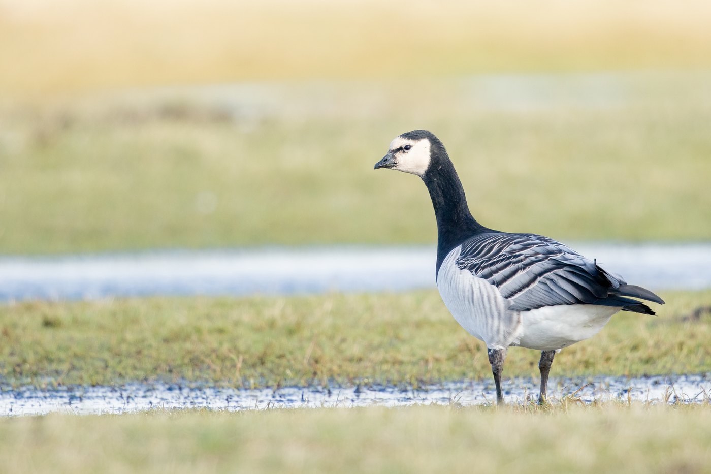
At the observation hides on the Dollart near Bunde in the Rheiderland, tens of thousands of barnacle geese winter in dense flocks from October to March. The black head with its white face mask and the grey-barred back are visible from a distance. During the day the geese graze on the meadows of the Rheiderland, and in January and February NABU invites visitors to breakfast with the wild geese from the hides.
 April to September
Eurasian spoonbill
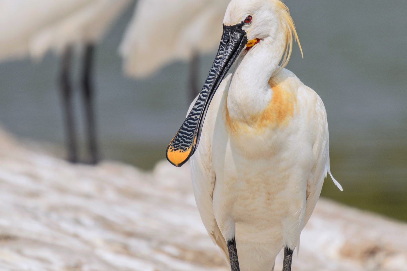
On the bird island of Memmert south of Juist, the Eurasian spoonbill has bred since its first successful nesting in 1995, and the island can be circled from a distance by excursion boat. The long, spoon-shaped bill and the pure white plumage with a yellow breast patch in breeding season stand out even from afar. With sweeping head movements it sifts the shallow water for small prey, before the birds set off in September for southwestern Europe and West Africa.
 June to October
Harbour seal
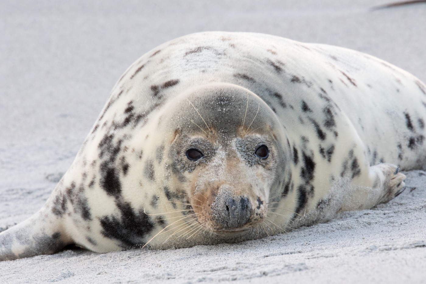
In the Wattenmeer off Norddeich, harbor seals give birth in June and July, and orphaned pups, known as Heuler, are then raised at the Seehundstation Nationalpark-Haus. The grey-brown mottled fur and the long whiskers around the muzzle are good identifying features. At low tide the animals haul out by the dozen on the sandbanks off the coast and slip back into the water only shortly before the tide returns.
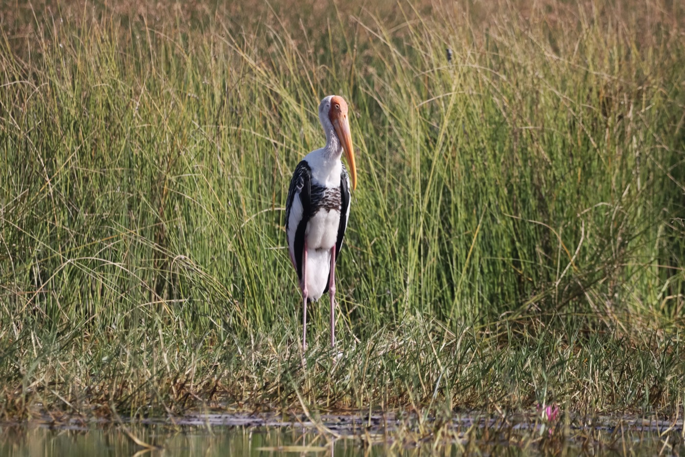 March to August
White stork
In the Jümmegebiet between Leda and Jümme in the Landkreis Leer, more white storks nest than anywhere else in Ostfriesland, and volunteer stork wardens have tended the nests for decades. The pure white plumage with black flight feathers and the long red bill are recognizable from a distance. From March the returning pairs occupy their old nests on barns and utility poles and begin building for the new brood.
Pictures: Freepik
Dark skies
Places certified by DarkSky International.
Spiekeroog
On the car free island there are no headlights and little street lighting. Walk over the dyke into the dunes in the evening and you have the sea on one side and the stars on the other.
Getting there
- 1 h 30 minBremen
- 2 h 45 minHamburg
- 3 h 15 minKöln
- 5 h 00 minFrankfurt am Main
- 5 h 15 minBerlin
- 8 h 15 minMünchen
Good to know
Motorhome stays on the mainland
Juist, Baltrum, Langeoog and Spiekeroog are car-free, and Langeoog and Spiekeroog both fall under a general ban on motor traffic. The motorhome therefore stays at the ferry harbor on the mainland, in Neßmersiel for Baltrum or Bensersiel for Langeoog. Long-stay parking is waiting there.
Leash Requirements on Dikes and Tidal Flats
Dogs are generally not allowed on the dikes, whether on a leash or off, in order to protect the turf and the pregnant ewes. In the Nationalpark Wattenmeer (the Wadden Sea National Park), leashes are required in the resting and buffer zones, while dogs may run free on specially designated dog beaches.
Rest Zones for Beach-Nesting Birds
On Borkum and Norderney, temporary movable fences protect the nesting sites of the common ringed plover, Kentish plover, and little tern during the breeding and rearing season. The fences are not real barriers. Instead, they guide beach visitors around the nesting areas without closing the beach entirely.
Jann-Berghaus-Brücke in Leer
As part of Bundesstraße 436, a German federal highway, this bascule bridge over the Ems in Leer connects the districts of Leerort and Bingum. With a passage width of about 56 meters, it ranks among the largest bascule bridges in Central Europe, second only to Rotterdam's Erasmus Bridge. Ships must radio ahead on channel 15 before passing through, while the bridge remains open to road traffic at all times.
Mudflat Hikes and the Tides
Guided mudflat hikes with certified national park mudflat guides are offered at several points along the coast. Sturdy neoprene socks are recommended over rubber boots, along with weatherproof clothing. The mudflats are shaped by low and high tide, which alternate roughly every six hours, so hikes taken outside guided tours should be planned carefully around the tide tables.
Organizing the Easter Bonfires
The Easter bonfires in East Frisian villages are prepared by volunteer fire departments, sports clubs, and village communities, and lit on the night before Easter Sunday. Collecting brush and hedge trimmings for the piles begins as early as winter.
Protected landscapes
- National park
- Niedersächsisches WattenmeerRuhezone I/12
Names and boundaries: © OpenStreetMap contributors.
About this region
Ostfriesland lies in northwest Lower Saxony, between the Ems and Jade, with six islands and Wattenmeer National Park offshore. Straight canals cross the flat Fehn region and sheep graze the dikes, with campgrounds on the islands and pitches inland.
The season starts at Easter and peaks in July and August, with mudflat hikes and beach life. Spring and autumn are quieter, shaped by wild geese and migrating waders.
