Camping in the Odenwald
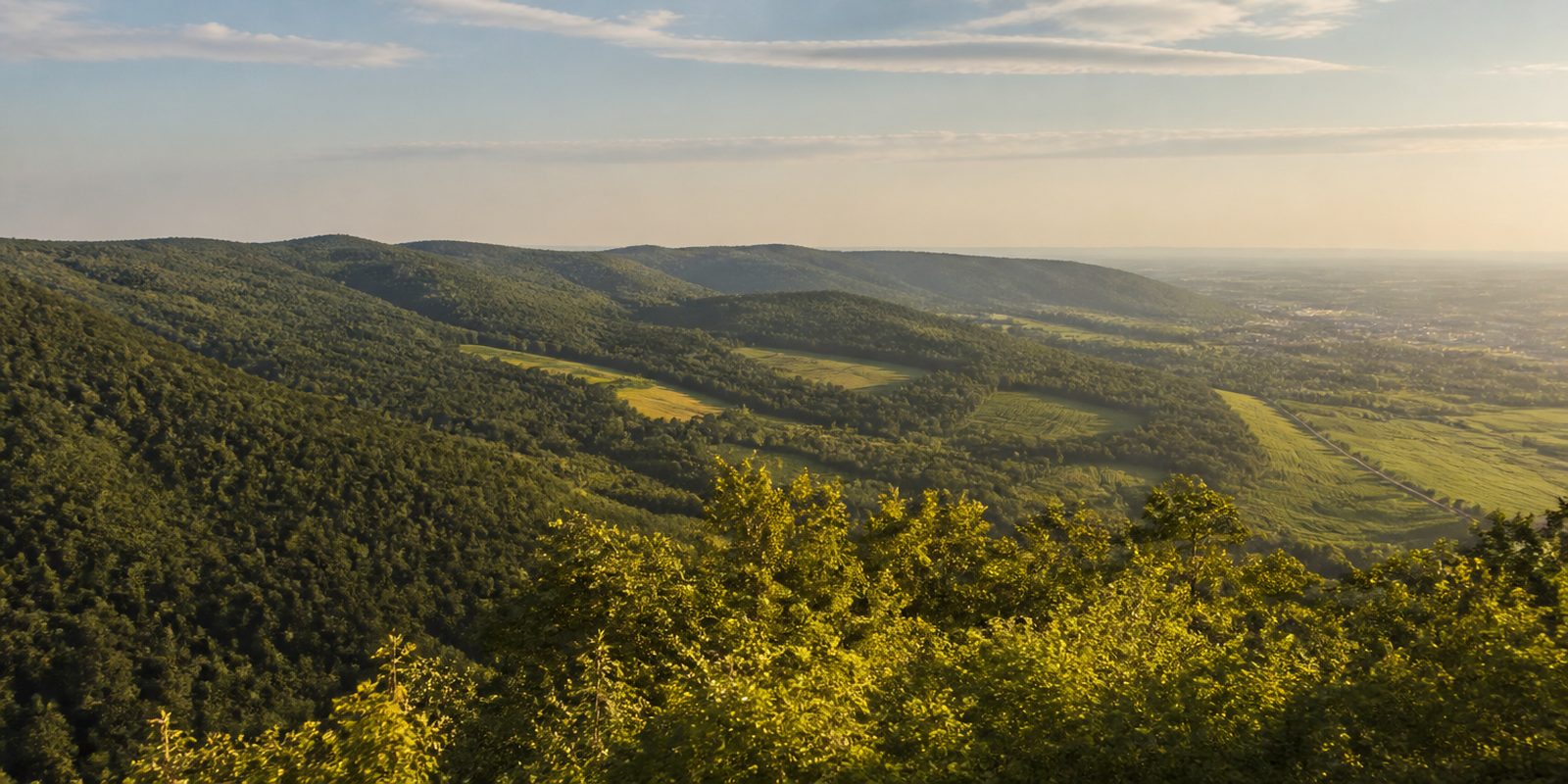
The Odenwald is an upland range of about 2,500 square kilometers spread across Hesse, Baden-Württemberg and Bavaria. Two landscapes sit side by side here. Along the Bergstraße the range drops to the Rhine plain over 65 kilometers between Darmstadt and Wiesloch, and the almond blossom starts there as early as the beginning of March. Behind it begins the wooded sandstone Odenwald, which reaches 626.8 meters at the Katzenbuckel. Earth history is packed close together. A UNESCO Global Geopark and the Naturpark Neckartal-Odenwald lie next to each other, the Felsenmeer near Lautertal has been a National Geotope since 2006, and the Katzenbuckel itself is the eroded vent of an extinct volcano. Then there is the Rotwildgebiet Odenwald, one of only five red deer districts defined by law in Baden-Württemberg and the only one reaching across all three states.
The year in this region
September: Red Deer Rut in the Odenwald
The red deer rut begins in early September and lasts five to six weeks; the stags bellow and can be heard far off at dusk. The Odenwald red deer range covers about 46,600 hectares, spread across all three states with 24,000 hectares in Hesse, 17,000 in Baden-Württemberg, and 5,600 in Bavaria. Its core consists of large, connected stretches of forest.
In the middle of the month the sun rises at 6:59 AM and sets at 7:39 PM. That leaves 12 hours and 40 minutes of daylight.
Water and air: Open-Meteo, measured averages. How busy: share of school holidays 2027 across all sixteen federal states. Nature dates: German Weather Service, phenological observations 2014 to 2026 at 105 stations in the region, typical day.
Tours in this region
Marked tours that fit into a day from a site, and one multi day tour per kind.
- Hiking
Nibelungensteig
From Zwingenberg on the Bergstraße to Freudenberg am Main. The Felsenmeer near Lautertal-Reichenbach comes early, a two kilometre field of dark grey quartz diorite boulders, and the sandstone Ebersberger Felsenmeer follows later. The route keeps mostly to narrow paths through deep forest and over ridges with long views. Over the Krehberg, the highest point at 576 metres, and past the Marbach reservoir the trail reaches the timber framed towns of Amorbach and Miltenberg.
126.3 kmMulti day tour
- Hiking
Alemannenweg
A wide loop through the Odenwald that starts in Erbach and ends in Michelstadt, both towns with a medieval core. Burg Frankenstein, the Veste Otzberg and the Auerbacher Schloss above the Bergstraße stand along the way. At the Felsenmeer in the Lautertal the traces of Roman quarrymen are still visible in the slope, and orchard meadows and broadleaf woods fill the space between. The trail never climbs above 599 metres.
148 kmMulti day tour
- Hiking
Neckarsteig
It starts at Heidelberg castle, climbs the Königstuhl and then keeps mostly to the slopes high above the Neckar. Below lie the river bends, and a castle appears again and again: the Bergfeste Dilsberg, Burg Hirschhorn or Burg Guttenberg. At Neckargerach the route enters the Margarethenschlucht. A blue N marks it.
126.3 kmMulti day tour
- Hiking
Burgensteig Bergstraße
Always on the edge between the Odenwald and the Rhine plain, from Darmstadt-Eberstadt south to Heidelberg castle. In the north the trail goes through forest, past Burg Frankenstein and the Alsbacher Schloss and around the Melibokus at mid height. Further south lie the vineyards of the Bergstraße, with Weinheim and Schriesheim. To the west the view runs far out over the plain. A blue castle marks the route.
115.7 kmMulti day tour
- Hiking
Blütenweg
Halfway up the slope along the Bergstraße, from Darmstadt-Eberstadt to the pedestrian zone of Wiesloch, mostly through vineyards and meadows. Twenty five settlements lie on the route, among them Bensheim, Heppenheim, Weinheim and Schriesheim, so village streets are part of the walk. There is far less climbing than on the Burgensteig above. A yellow B shows the way.
97.1 kmMulti day tour
- Cycling
3-Länder-Radweg
Three rivers and three federal states: the loop follows the Mümling south, the Neckar between Hirschhorn and Mosbach and the Main from Miltenberg to Wörth. Most of it is asphalt, with water bound surfaces and forest tracks in between. Between the valleys the route climbs over the Odenwald ridges, a good 1900 metres of ascent in total. Timber framing turns up in almost every village.
214.8 km1830 m ascentMulti day tour
- Cycling
Odenwald-Madonnen-Weg
The name comes from the Madonna figures, wayside shrines and field crosses that stand at almost every crossroads in the Bauland and the Madonnenländchen. Between Tauberbischofsheim, Walldürn and Buchen the route works its way over the Odenwald ridges, up and down all the time, and from Mudau it drops gently to Mosbach on the trackbed of the old narrow gauge railway. From the Neckar at Eberbach and Hirschhorn it flattens out, first in the valley, then across the Rhine plain to Speyer. The surface is mostly asphalt.
180.2 km580 m ascentMulti day tour
- Mountain biking
Naturpark Neckartal-Odenwald
Section Gravel Crossing
Straight across the nature park, from Weinheim via Wilhelmsfeld, the Königstuhl and Eberbach to Walldürn. The ground is mostly gravel and hardened forest road, with short narrow paths and little asphalt. Between the woods the route crests open tops with views over the Neckar valley, and orchard meadows cover the slopes. It follows signposted cycling and hiking routes. The nature park offers the GPX track.
144.5 kmMulti day tour
Tours: © OpenStreetMap contributors, ODbL. Lengths computed from the mapped course, as of September 12, 2026.
Animals you can meet here
 April to October
Fire salamander
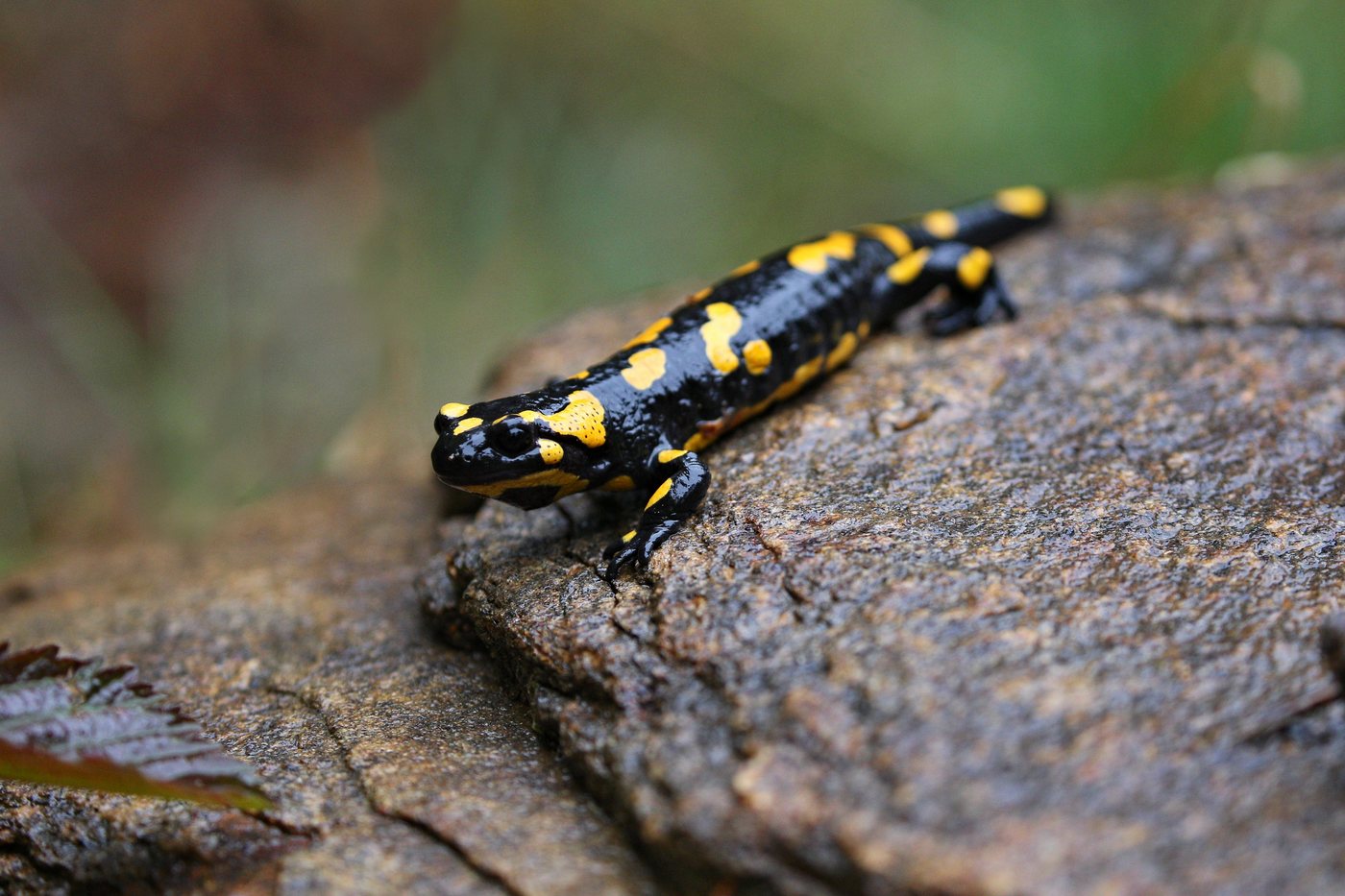
In the spring-fed streams and narrow valleys of the Buntsandstein-Odenwald, the fire salamander stays in damp, cool spots. Its glossy black skin with bright yellow spots or stripes makes it easy to recognize. After rain it leaves its hiding place under deadwood and stones and moves along the stream banks in search of food.
 May to July
Stag beetle
The stag beetle lives in old oak stands and traditional orchard meadows of the Neckartal-Odenwald Nature Park, mostly in the warmer, lower elevations. The males carry an antler-like pair of reddish-brown mandibles that make them instantly recognizable. At dusk in June they fly to oaks with flowing sap, where they mate.
 May to September
Aesculapian snake
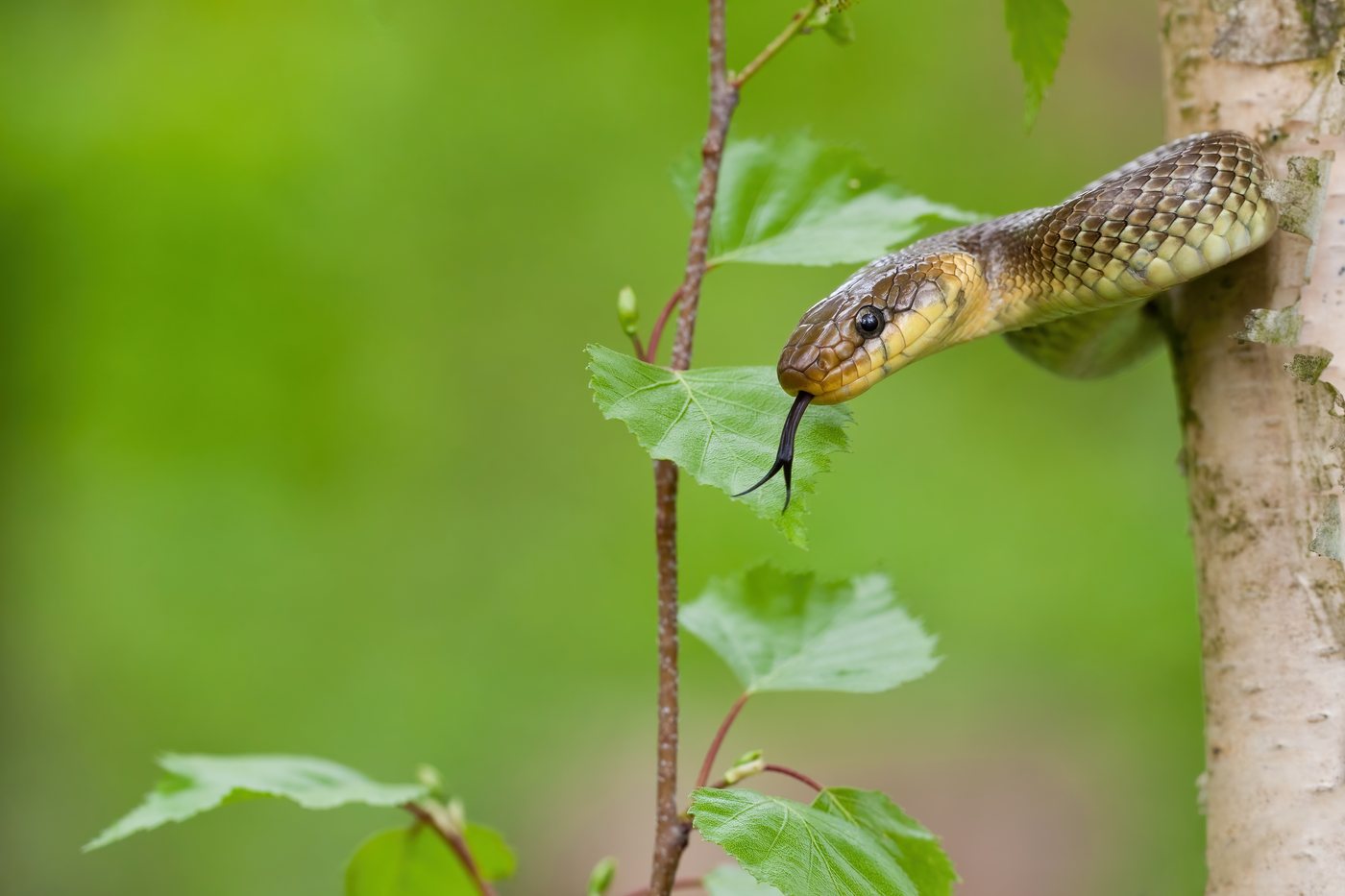
On the sunny slopes of the Neckartal in the southern Odenwald lives the Aesculapian snake, one of only a few relict populations left in Germany. The slender, olive-brown to gray-brown snake without noticeable markings is active by day and likes to bask on warm rocks. In high summer it shifts its activity to the cooler morning and evening hours.
 September to October
Red deer
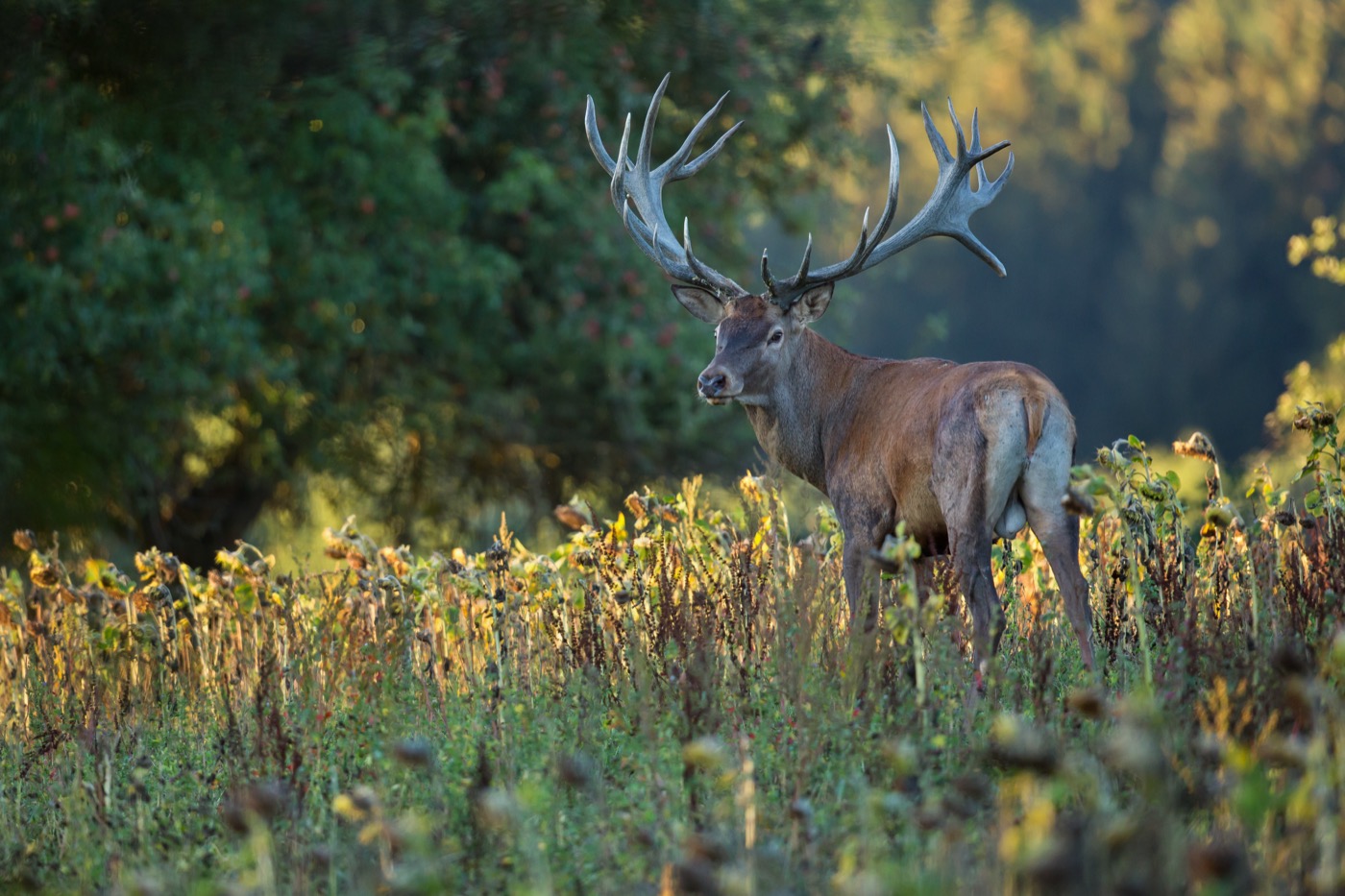
The red deer lives in the large, continuous forests of the Odenwald red deer reserve, which stretches over about 46,600 hectares through Hessen, Baden-Württemberg and Bayern. The stags now carry their full antlers, often with twelve points, and a reddish-brown summer coat. From early September they bellow for five to six weeks at dusk as the rut begins.
Pictures: Freepik
Getting there
- 1 h 15 minFrankfurt am Main
- 1 h 30 minMannheim
- 3 h 15 minKöln
- 4 h 15 minMünchen
- 6 h 00 minHamburg
- 6 h 30 minBerlin
Good to know
Overnight Stays Only in Trekking Camps
Camping and overnighting in the forest are not permitted in the Nature Park, with one exception: four trekking camps, Waldschlössel near Wagenschwend, Bachgeflüster near Walldürn, Sonnenberg in Elztal, and Zapfenglück near Buchen. Each camp has three tent sites for up to three people, costs 15 euros per tent per night, and is booked exclusively online, with booking opening every year on March 1. The season runs from May through the end of October, and arriving by car or parking at the camp is not allowed.
Grilling Only at Designated Spots
Open fires do not belong in the forest; grilling is done at spots set up for it. The Geo-Naturpark Bergstraße-Odenwald lists more than 40 grill huts and grill sites in its directory, from the grill hut at the Weschnitz spring in Grasellenbach to the Liederbachquelle grill hut in Beerfelden to the grill site in the old quarry in Lindenfels. Some of the trekking camps have fixed fire pits.
Dogs Must Stay Leashed
The Neckartal-Odenwald Nature Park's visitor rules explicitly ask that dogs be kept on a leash to protect wildlife. This also means staying on marked trails and respecting any barriers. Because the animals feed at dusk, visitors are asked to keep especially quiet during those hours; the Bewusst Wild initiative addresses hikers and mountain bikers on this point.
Bird Sanctuary Island in the Reservoir
The Marbach-Stausee, a reservoir near Mossautal, is divided into three zones: a swimming area with a sunbathing lawn on the south shore, a sailing and surfing area to the east behind the dam, and a bird sanctuary island that may not be entered. Sailboats and windsurfers are limited to 3.5 square meters of sail area. The reservoir is freely accessible at all times and lies about seven kilometers (4.3 miles) south of Erbach on the B460.
Trails Marked by the Odenwaldklub
The region's long distance trails are marked and maintained by the Odenwaldklub, the regional hiking club, each with its own symbol: a wine red N for the Nibelungensteig, a red A for the Alemannenweg, a blue castle tower on white for the Burgensteig Bergstraße, and a blue wavy N for the Neckarsteig. Anyone who knows the symbols can find their way without a map. The same markings are recorded in the OpenStreetMap data for the trails.
Bring Your Own Water
Most of the trekking camps have no drinking water; bring your own supply or refill it in nearby villages. All four camps have toilets or composting toilets, and some also have a weather shelter. All trash, including hygiene waste, must be carried back out, as there are no bins on site.
Protected landscapes
- Nature park
- Bayerischer OdenwaldNeckartal-Odenwald
Names and boundaries: © OpenStreetMap contributors.
About this region
The Odenwald is a low mountain range of around 2,500 square kilometers between Hesse, Baden-Württemberg and Bavaria. In the west it drops toward the Rhine plain as the mild Bergstraße with its vineyards, while in the east it rises as the forested Sandstein-Odenwald up to the Katzenbuckel. You will find campsites and pitches between vineyards and forest edges.
It is busiest in spring during the almond blossom on the Bergstraße and in autumn during the red deer rut in the higher Odenwald. When a site is open is shown in each listing's calendar.
