Camping in North Frisia
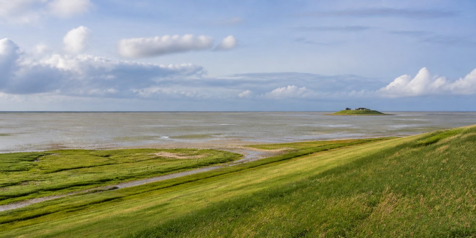
Nordfriesland covers 2,083 square kilometers, making it the northwesternmost district in Germany, stretching from the Danish border near Rodenäs to the mouth of the Eider river near Tönning. Ten Halligen, small tidal islets with no protective dike of their own, sit in the middle of Nationalpark Schleswig-Holsteinisches Wattenmeer, which at roughly 4,410 square kilometers is the largest national park between the North Cape and Sicily and has been a UNESCO World Heritage Site since June 26, 2009. Offshore lie the islands of Sylt, Föhr, Amrum, and Pellworm, reachable only by boat or, in the case of Sylt, via the Hindenburgdamm causeway, which carries only trains and the car-shuttle train. Five languages are traditionally spoken here: High German, Low German, Danish, South Jutlandic, and North Frisian, making the district the most linguistically diverse in Germany. The district seat is Husum, which Theodor Storm celebrated as the gray town by the sea; the highest point, at 53.5 meters, is the Sandesberg near Ostenfeld on the Geest, the sandy ridge inland from the marsh. Toward the coast, flat marshland and diked polders called Köge dominate, where sheep keep the dikes trimmed short.
29 places and units in this region
Places in this region

The year in this region
September: Return of the Barnacle Geese
Starting in September, the first barnacle geese return to the Nordfriesland coast from their Arctic breeding grounds. In fall, several thousand birds rest in the Rickelsbüller Koog near Rodenäs together with the flocks from the neighboring polders, before many move on or winter along the coast.
In the middle of the month the sun rises at 6:56 AM and sets at 7:43 PM. That leaves 12 hours and 47 minutes of daylight.
Water and air: Open-Meteo, measured averages. How busy: share of school holidays 2027 across all sixteen federal states. Nature dates: German Weather Service, phenological observations 2014 to 2026 at 51 stations in the region, typical day.
Tours in this region
Marked tours that fit into a day from a site, and one multi day tour per kind.
- Hiking
Wanderweg Schlei-Eider-Elbe / Fernwanderweg E1, Schleswig-Holstein, Westvariante
Right across Schleswig-Holstein, from the Schlei at Schleswig over the Geest ridges to the Elbe at Blankenese. The ground alternates between sandy tracks on the Geest, bog paths in the Dörpstedter Moor and one stretch of the old Ochsenweg trading road. The Eider is crossed at Pahlen in Dithmarschen. A white saltire marks the whole route.
262.7 kmMulti day tour
- Hiking
Nord Süd Trail
Section Sylt - Flensburg
This is where Germany's longest long distance trail begins, at the country's northernmost point on Sylt, and it only ends more than three thousand kilometres later in the Allgäu. The first part still belongs to the island: beach, the edge of the Watt, paths on top of dikes. After that it carries on across the mainland towards Flensburg on the Baltic. Walking only this section still counts as a start.
109.6 kmMulti day tour
- Cycling
Nordseeküstenroute
Section Hamburg und Schleswig-Holstein
Along the North Sea on dike crests and quiet country roads, from the Elbe to the Danish border. The surface alternates between asphalt, compacted gravel and looser tracks. Sheep keep the dikes short. Along the way lie the Eidersperrwerk, the harbour of Husum and the stilt houses of St. Peter-Ording, and side trips lead to Föhr, Amrum, Pellworm and Sylt.
393.5 kmMulti day tour
- Cycling
Wikinger-Friesen-Weg
From the North Sea to the Baltic, from St. Peter-Ording on Eiderstedt via Tönning and Friedrichstadt to Maasholm on the Schlei. First marsh and the river lowlands of Eider, Treene and Sorge, then the Geest near Hollingstedt, finally the ice age hills of the Schlei region around Kappeln. The roads are well surfaced and quiet. It stays flat until shortly before the Schlei.
172.3 kmMulti day tour
- Cycling
Eider-Treene-Sorge-Radweg
A loop through the lowlands of the Eider, the Treene and the Sorge, mostly on farm tracks between pastures and watercourses. Locks and pumping stations stand at many points. In Bergenhusen storks clatter on the rooftops, the Wilde Moor lies near Schwabstedt, and the Eider is crossed by the Lexfähre. Friedrichstadt and Lunden make good places to start.
164.7 kmLoop tourMulti day tour
- Cycling
Fahrradtour 2 – Westerhever Leuchtturm
Across the flat peninsula of Eiderstedt to the red and white lighthouse of Westerhever, which stands out in the foreland among salt marshes. The route goes through Tating, Garding and Osterhever and past the Tümlauer Koog, where bird watching points have been set up. Thatched houses stand along the roadside. There are no climbs.
48.8 km
- Cycling
Route durch die Köge
A short round through the Köge north of Husum, starting at the Amsinck-Haus, where coastal protection and dike building are explained. It runs through the Sönke-Nissen-Koog with its listed white farmsteads under green roofs. A branch heads out along the four kilometre causeway to the Hamburger Hallig. The sky takes up most of the space.
19.1 km
- Canoeing
Wasserwanderweg Untereider
Broad, slow and free of tides between Rendsburg and the Nordfeld weir, the Untereider can be paddled upstream as easily as down. The banks are low, with reed beds, dikes and a lot of sky above them. Below the weir the tidal Eider begins, and seals lie on the sandbanks there. Nobody is in a hurry.
76.9 kmMulti day tour
Tours: © OpenStreetMap contributors, ODbL. Lengths computed from the mapped course, as of September 12, 2026.
Animals you can meet here
 April to October
Harbour seal
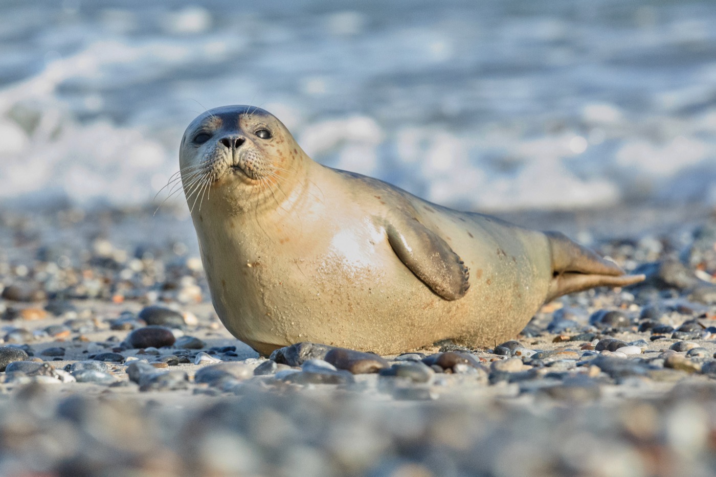
On the Jungnamensand sandbank off Amrum, harbor seals haul out on the exposed flats at low tide from April to October. The round head without ear flaps and the V-shaped nostrils set it apart from the larger grey seal. From early June, females give birth here, and the pups swim out with their mothers on the very next tide.
 April to October
Grey seal
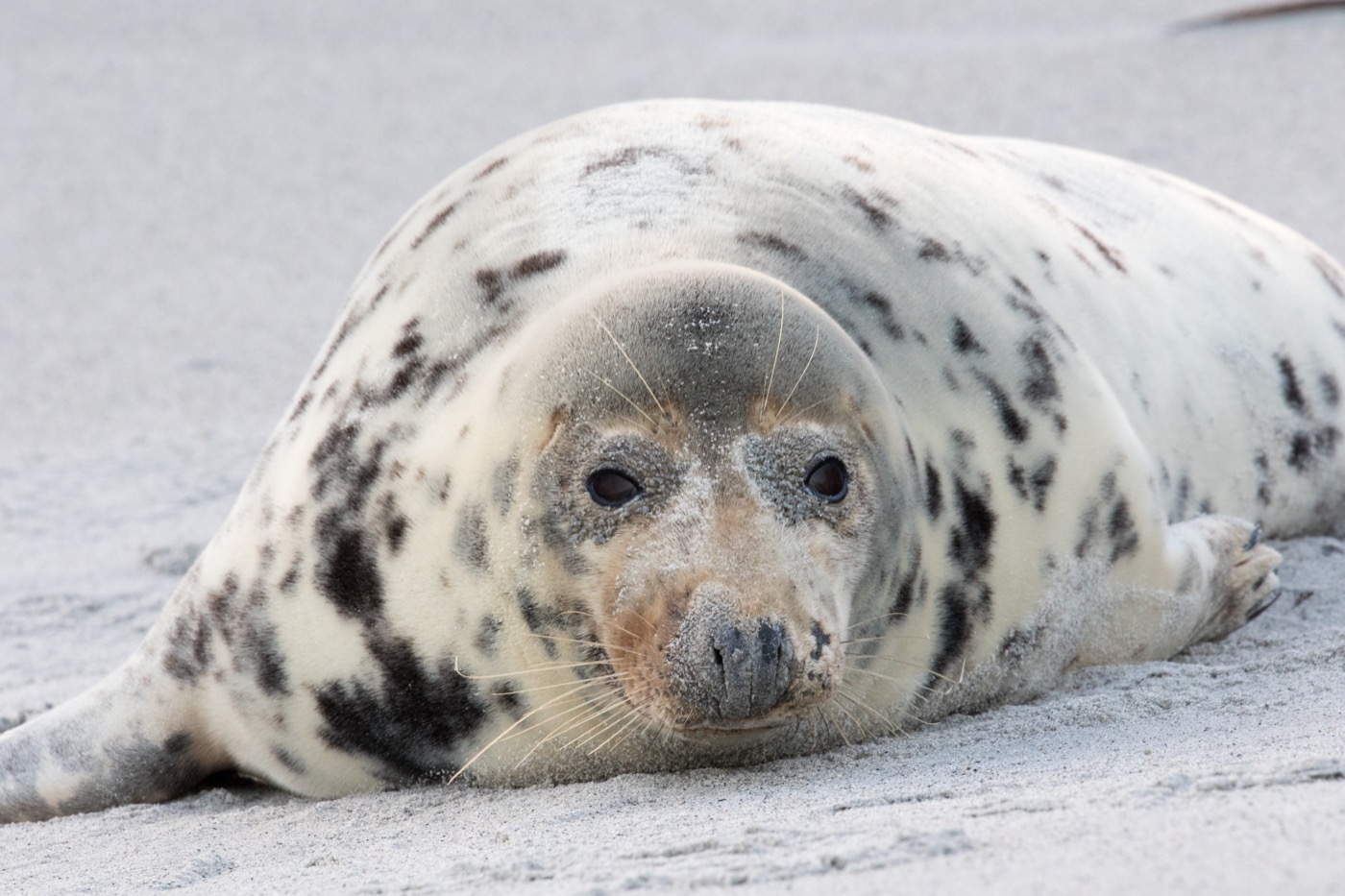
Among the harbor seals on the Jungnamensand sandbank off Amrum, the noticeably larger grey seals haul out at low tide too. The straight head profile with the long snout, often called a horse face, sets it apart at a glance from the round-headed harbor seal. From April to October both species can be watched here together, basking on the sandbanks as the water recedes.
 October to February
Barnacle goose
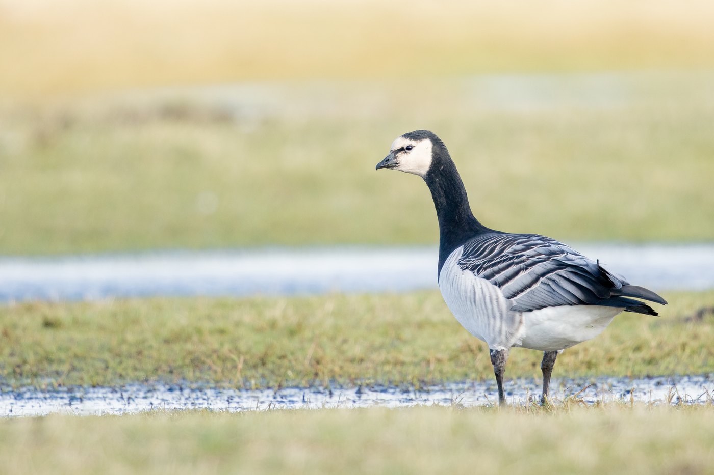
In the Rickelsbüller Koog near Rodenäs, several thousand barnacle geese rest from October to February after returning from their Arctic breeding grounds. The black head with the white face mask and the grey, black-barred back set it apart from other geese along the dike. Together with the flocks from the neighboring polders, they graze here on the salt marshes before some move on and the rest winter along the coast.
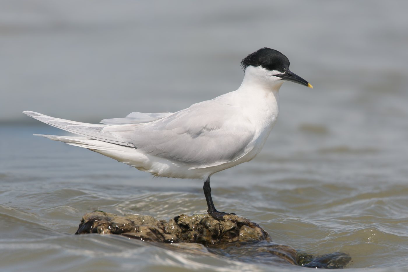 April to August
Sandwich tern
Hallig Norderoog is home to Germany's largest colony of Sandwich terns from April to August, with two to five thousand breeding pairs. The black cap with its shaggy crest and the black bill with a yellow tip set it apart from the smaller common terns nesting nearby. Because the hallig lies in the national park's strictest protection zone, the colony can only be watched from a distance on guided mudflat walks starting July 15.
Pictures: Freepik
Dark skies
Places certified by DarkSky International.
Pellworm
The marsh island is flat as a table, so the view reaches the horizon in every direction. Constellations that stay behind hills or houses elsewhere stand clear here.
Getting there
- 1 h 30 minKiel
- 2 h 00 minHamburg
- 4 h 45 minBerlin
- 6 h 00 minKöln
- 6 h 45 minFrankfurt am Main
- 9 h 30 minMünchen
Good to know
Biike fires on 21 February
On the evening of 21 February more than 60 Biike fires burn in Nordfriesland, on the islands Sylt, Amrum and Föhr, on the Halligen and on the mainland. The German UNESCO Commission has listed the custom as intangible cultural heritage since 2014. Kale is eaten together afterwards.
Leash Requirement in the National Park
Throughout Nationalpark Wattenmeer and on the sea dikes, dogs must be kept on a leash year-round. A minimum distance of 300 meters must also be kept from harbor seal haul-out sites.
Access Rules for Hallig Norderoog
Hallig Norderoog lies in the national park's strictest protection zone and is a nesting site for more than ten thousand seabirds and shorebirds. It may only be entered as part of officially guided mudflat hikes, and not before July 15.
Mudflat Hiking Only With a Guide
The only way into the open mudflats is together with certified national park mudflat guides or the Schutzstation Wattenmeer ranger stations, since the tidal channels and tides shift from day to day.
Sylt Reachable Only by Train
The roughly eleven-kilometer Hindenburgdamm causeway between Niebüll and Westerland is open only to rail traffic; there is no road. Travelers arriving by car use the car-shuttle train from Niebüll.
RV Harbors Instead of Wild Camping
Overnight parking in an RV outside designated sites is not permitted on beaches or dikes. Towns such as St. Peter-Ording offer dedicated RV harbors with electricity, fresh water, and wastewater hookups.
Protected landscapes
- National park
- Schleswig-Holsteinisches Wattenmeer
Names and boundaries: © OpenStreetMap contributors.
About this region
North Frisia is Germany's northwesternmost district, with the islands of Sylt, Föhr, Amrum and Pellworm and ten Halligen inside the Nationalpark Wattenmeer. Campsites and pitches sit behind the dikes, on the islands, or inland on the Geest.
Summer is busiest, when the Halligflieder blooms purple and Ringreiten is held. Spring and autumn are quieter, with migratory birds and barnacle geese. The season runs into the Husumer Krabbentage in October, then winter brings Landunter.
