Camping at Lake Constance
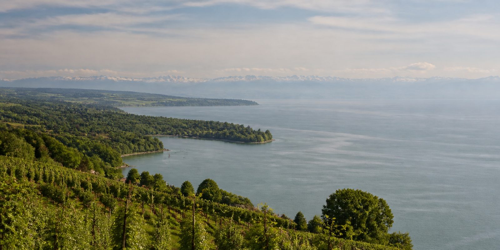
The Bodensee is one of Central Europe's largest lakes. 536 square kilometers, 251 meters at its deepest. Its water level follows the snowmelt in the Alps: lowest in late winter, highest in June. That rhythm builds gravel shores carrying plant communities found nowhere else in Germany. The body of water moderates the climate so strongly that some 9,000 hectares around the lake make up the largest continuous fruit-growing area in Germany, and more than 200,000 waterbirds stay through the winter half of the year. According to NABU, that is around three quarters of all the waterbirds wintering in Baden-Württemberg.
The year in this region
September: Apple harvest and Bodensee Apple Weeks
The apple harvest runs through September and October in two to three picking rounds, mainly Elstar, Gala, Jonagold, and Golden Delicious. About 25 towns between Lindau and Mainau Island hold the Bodensee Apple Weeks from mid-September to early November, with orchard tours, fruit markets, and tastings. In the fen meadows, marsh gentian, German gentian, and devil's-bit scabious bloom at the same time.
In the middle of the month the sun rises at 6:59 AM and sets at 7:37 PM. That leaves 12 hours and 38 minutes of daylight.
Water and air: Open-Meteo, measured averages. How busy: share of school holidays 2027 across all sixteen federal states. Nature dates: German Weather Service, phenological observations 2014 to 2026 at 28 stations in the region, typical day.
Tours in this region
Marked tours that fit into a day from a site, and one multi day tour per kind.
- Cycling
Bodensee-Radweg
Around the lake and through three countries, mostly on asphalt and almost always flat. The route alternates between lakeside promenades, the orchards on the northern shore and the nature reserve in the Rhine delta near Bregenz. The Reichenau with its vegetable fields lies alongside as a detour. Ferries cut corners, for instance between Konstanz and Meersburg.
293.2 kmMulti day tour
- Hiking
Bodensee-Rundwanderweg
Section Stein a. R. - Lindau
On foot along the shore, from Stein am Rhein, where the Rhine leaves the lake again, to Lindau. Sometimes right at the water, sometimes higher up on the slopes where buildings or nature reserves block the edge. Konstanz and Überlingen lie along the way, along with the pilgrimage church of Birnau high above the water. The waymark is a blue dot with an arrow.
164 kmMulti day tour
- Hiking
SeeGang
From Konstanz over the wooded Bodanrück to Bodman and on along the steep shore through Sipplingen to Überlingen. The middle part is the wildest, with deeply cut ravines, streams and the Marienschlucht, where a walkway with viewing platforms runs through the gorge. Between Bodman and Sipplingen it flattens into orchards.
52.9 km1400 m ascent
- Hiking
Jubiläumsweg Bodenseekreis
This route deliberately keeps away from the shore and crosses the hinterland from Kressbronn to Überlingen, over drumlins left behind by the ice age glacier. In between lie bogs, ponds, the Rotach valley and the Aachtobel, a narrow gorge that feels like primeval forest. From the Gehrenbergturm you see lake and Alps.
115.5 kmMulti day tour
- Cycling
Donau-Bodensee-Radweg
In Ulm the route leaves the Danube in the shadow of the minster and crosses Upper Swabia to the shore of the Bodensee at Kressbronn. The surface is mostly asphalt, sometimes packed gravel. Upper Swabia is hilly, the route rises and falls constantly, and in between it follows the quiet valley of the Wolfegger Ach.
155.8 kmMulti day tour
- Cycling
Bodensee-Königssee-Radweg
Straight across the Bavarian alpine foreland from Lindau on the Bodensee to the Königssee, the Alpine chain always on the right. The route takes in the Allgäu, the Pfaffenwinkel, the Tölzer Land, the Tegernsee and the Chiemgau, and collects several thousand metres of climbing on the way. Almost nothing here is flat.
455.8 km3530 m ascentMulti day tour
Tours: © OpenStreetMap contributors, ODbL. Lengths computed from the mapped course, as of September 12, 2026.
Animals you can meet here
 January to December
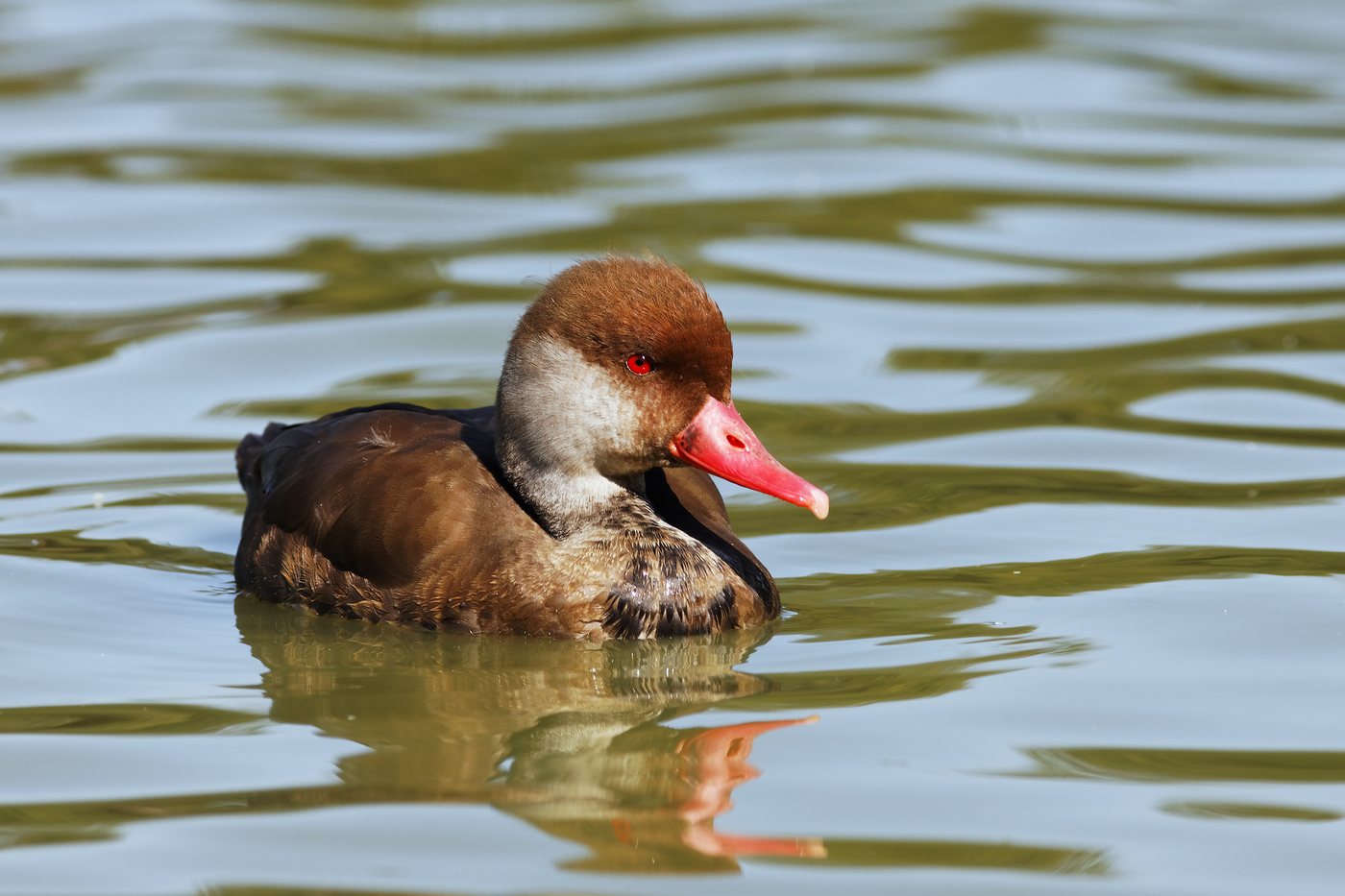
Red-crested pochard
On the Untersee, especially in the protected water zone off the Wollmatinger Ried, in the Ermatinger Becken and at the mouth of the Radolfzeller Aach, swim the most striking ducks on the Bodensee. The drake has a bright orange-red head, a red bill and black plumage with broad white flanks, while the female stays a plain brown with a pale cheek. In July and August around 4,000 birds moult together here, and in winter more arrive from Spain and southern France, drawn by the abundant stonewort.
 January to December
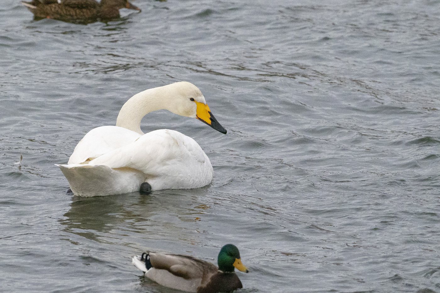
Whooper swan
In the Ermatinger Becken on the Untersee and in the Eriskircher Ried between the mouths of the Schussen and the Rotach, most of the Bodensee's whooper swans gather, with peak numbers between late December and early February. Unlike the silent mute swan, it holds its neck straight and carries a yellow-and-black bill, and its trumpeting call often carries far across the water. Flocks arriving from late October are easy to watch from the Reichenauer Damm and the information trail at the Stockacher Aachmündung near Bodman-Ludwigshafen.
 all year
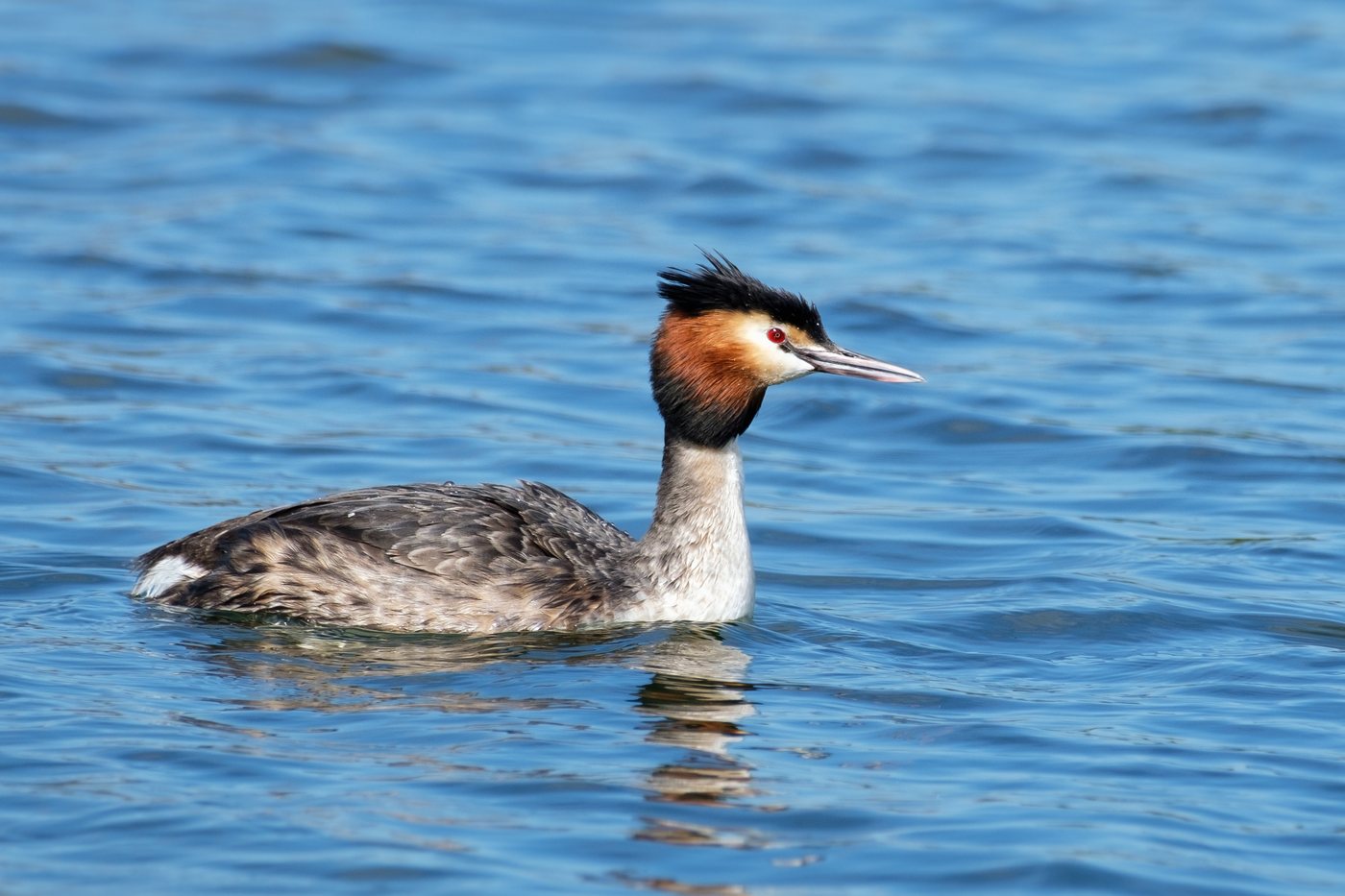
Great crested grebe
The great crested grebe can be seen on the Bodensee all year round, and during the breeding season especially in the flooded reed beds of the Wollmatinger Ried and the Mettnau peninsula. It is recognized by its double black crest and rust-red neck ruff, which it raises for courtship in spring. The courtship dances with synchronized head-shaking begin in early spring and can be watched from the lakeside promenades in Konstanz, Überlingen and Friedrichshafen.
 all year
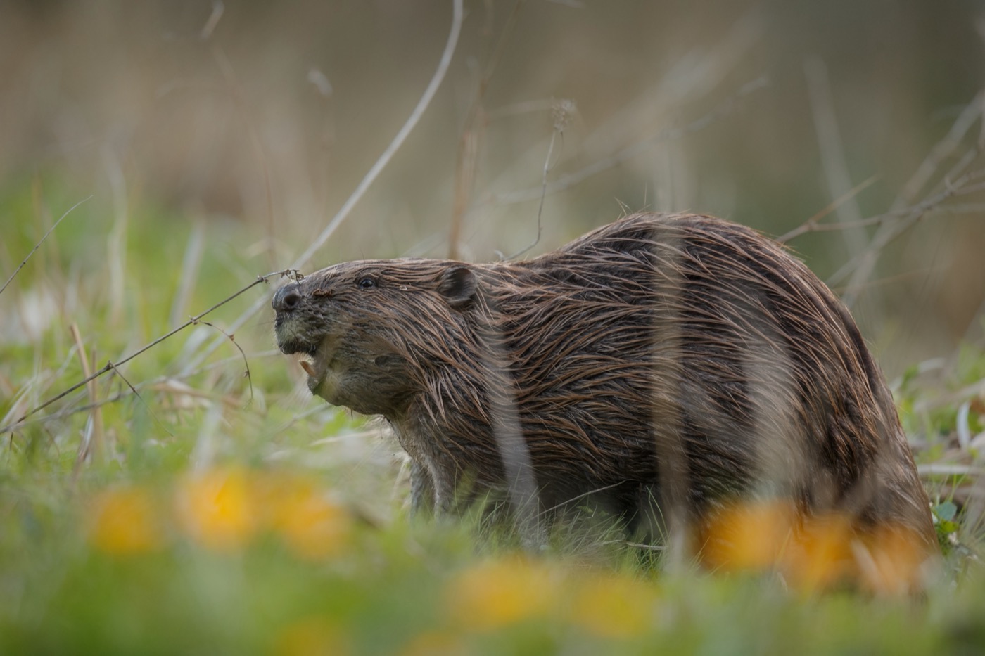
Eurasian beaver
Along the tributaries and in the wetlands around the Bodensee lives the beaver, Europe's largest rodent, recognizable by its broad, flat tail and dense brown fur. It has been settling the Bodenseekreis since around 2010, and its cone-shaped gnawed tree trunks now turn up along smaller streams too. These gnaw marks are easiest to spot in the winter half of the year, when the beaver feeds on the bark of willows and poplars and the bare branches leave the view unobstructed.
Pictures: Freepik
Getting there
- 2 h 00 minFreiburg im Breisgau
- 2 h 15 minMünchen
- 4 h 00 minFrankfurt am Main
- 5 h 30 minKöln
- 7 h 30 minBerlin
- 8 h 00 minHamburg
Good to know
Red-white-red signs mark the rest zones
Water areas closed for nature conservation are marked with red-white-red navigation signs and nature reserve signs. This applies especially in July and August, when the waterbirds are flightless during molt, to the areas off the Wollmatinger Ried, off the Hornspitze, and at the mouth of the Aach River near Radolfzell. Boats, surfboards, and swimmers stay outside these boundaries.
Motorboats keep 300 meters from shore
Under Article 6.11 of the Bodensee Shipping Regulations, motor-powered craft may not come closer than 300 meters to the shore or to a reed belt in front of it, except when docking or casting off, and must keep to 10 km/h or less there. This limit does not apply to canoes, kayaks, and stand-up paddleboards, but beyond 300 meters from shore they are required to carry a buoyancy aid meeting EN ISO 12402-5. The regulation applies identically in Germany, Austria, and Switzerland.
In the reserve, stay on the paths and keep dogs leashed
The regulation for the Eriskircher Ried prohibits, under Section 4 No. 12, leaving the marked paths within the reserve, and this applies explicitly to photographers as well. The Eriskirch Nature Center also asks that dogs be kept on a leash at all times, since even a calm dog will startle the animals into flight. The same path rules apply in the other fen reserves along the north and west shores.
No fires in the shoreline reserves
Fires are not allowed in the shoreline nature reserves; the regulation for the Eriskircher Ried lists this explicitly under Section 4 No. 11. The NABU Bodensee Center also advises against campfires on the gravel shores, since the shoreline turf there is home to the Bodensee forget-me-not. Grilling is allowed only at the designated sites.
Overnight stays only at designated sites
Camping, setting up camp, and parking caravans or other vehicles are prohibited in the shoreline reserves, per Section 4 No. 10 of the regulation for the Eriskircher Ried. Around the German side of the Bodensee there are campgrounds and RV sites for this instead, listed by Deutsche Bodensee Tourismus, among them in Lindau, Kressbronn, and Hagnau.
The car ferry connects the north and south shores
The car ferry from Konstanz to Meersburg crosses 4.8 kilometers of water in about 15 minutes and runs around the clock, 365 days a year, every 10 to 15 minutes during the day. Six ships are in service, and bicycles and pedestrians are also carried. According to the Konstanz municipal utility company, the crossing saves about 60 kilometers of driving around by land.
About this region
Lake Constance lies between Baden-Württemberg and Bavaria and, at 536 square kilometers, is one of the largest lakes in Central Europe, between gravel shores and orchards. Campsites and RV pitches line the waterfront, in towns such as Lindau, Kressbronn, and Hagnau.
The lake is busiest during the orchard blossom in April and through summer, quieter from October as birds migrate through. When a site is open is shown in each listing's calendar.
