Camping in the Harz Mountains
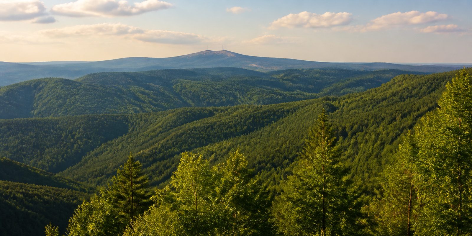
The Harz is Germany's northernmost upland range. It spans Lower Saxony, Saxony-Anhalt and Thuringia. Out of the North German Plain it rises as one closed block, with a difference in elevation of more than 900 meters packed into the few kilometers between the foreland and the ridge. At the top stands the Brocken at 1141 meters, and this is where the northernmost natural tree line in Central Europe runs. In the south there is Zechstein gypsum. Streams vanish into it underground, and caves form in the rock.
The year in this region
September: Red Deer Rut at the Bruchberg
From September 15 to October 5, the trail along the Clausthaler Flutgraben, a historic water channel at the Bruchberg, is closed because it crosses a key red deer mating area. The rut can be watched undisturbed from the Heidelbeerschneise, a forest clearing, and the national park administration also offers mindful guided rut-viewing tours. In Sankt Andreasberg, the Hirschbrunfterlebnistage, a red deer rut festival, take place in September.
In the middle of the month the sun rises at 6:51 AM and sets at 7:34 PM. That leaves 12 hours and 43 minutes of daylight.
Water and air: Open-Meteo, measured averages. How busy: share of school holidays 2027 across all sixteen federal states. Nature dates: German Weather Service, phenological observations 2014 to 2026 at 102 stations in the region, typical day.
Tours in this region
Marked tours that fit into a day from a site, and one multi day tour per kind.
- Hiking
Harzer-Hexen-Stieg
Straight across the Harz, from Osterode to Thale. The Brocken comes at the halfway mark, and for long stretches the path runs beside the ditches that mining used from the sixteenth century onward to steer its water across the slopes. It ends down in the Bodetal, between the Hexentanzplatz and the Rosstrappe.
97 kmMulti day tour
- Hiking
Karstwanderweg
Along the southern rim of the Harz there is gypsum in the ground. The rock decides everything here. It dissolves in water, the ground settles, and round sinkholes are left behind, a few of them water filled like the Juessee and the Wiedensee. Between them dry grassland with orchids grows on thin soil over gypsum and dolomite, and caves and karst springs lie right beside the path.
265.7 kmMulti day tour
- Hiking
Selketal - Stieg
The Selke has cut itself a narrow, warm valley into the eastern Harz, and the trail stays close to the water almost the whole way. It passes mills under old beeches and runs below Burg Falkenstein. The narrow-gauge railway comes along through the valley.
76.3 kmMulti day tour
- Hiking
Harzer BaudenSteig
The trail runs along the sunny south-western side of the Harz, through broadleaf and mixed forest and over ridges with a wide view into the foreland. Staffed Bauden and lookout towers stand right on the route, among them the Albertturm on the Iberg, the Knollenbaude with its tower on the Großer Knollen and the Hanskühnenburg at 811 metres. At the end waits Kloster Walkenried.
76.8 kmMulti day tour
- Hiking
Teufelsstieg
From Bad Harzburg the route passes the Molkenhaus and runs above the Eckertalsperre reservoir before the long climb on the slabbed Kolonnenweg begins. At the top you stand on the Brocken. The descent goes through the Eckerloch and follows the Kalte Bode into the Elendstal, where the stream squeezes narrowly between the rocks. A white devil on a green field shows the way.
24.3 km
- Cycling
Harzrundweg
The loop rides around the Harz along its rim rather than over it. It links half-timbered towns such as Goslar and Wernigerode with quiet villages in between, swinging into the hills and out again the whole way, which adds up in climbing. In the eastern Harz come Thale, Gernrode and Ballenstedt. Tarmac alternates with gravel farm tracks, and the old towns add cobbles. In the south the route crosses the gypsum karst.
321.3 kmMulti day tour
- Mountain biking
Die Harz-Wald-Tour
Between Drei Annen Hohne and Wernigerode the loop keeps to the edge of the national park, mostly on gravel, with tarmac through the villages. Not far off the route the Holtemme falls over granite blocks in the Steinerne Renne. The Ilsetal leads down to Ilsenburg with its old monastery. A second start sits at the Eichberg in Wernigerode.
33.2 km720 m ascentLoop tour
Tours: © OpenStreetMap contributors, ODbL. Lengths computed from the mapped course, as of September 12, 2026.
Animals you can meet here
 May to October
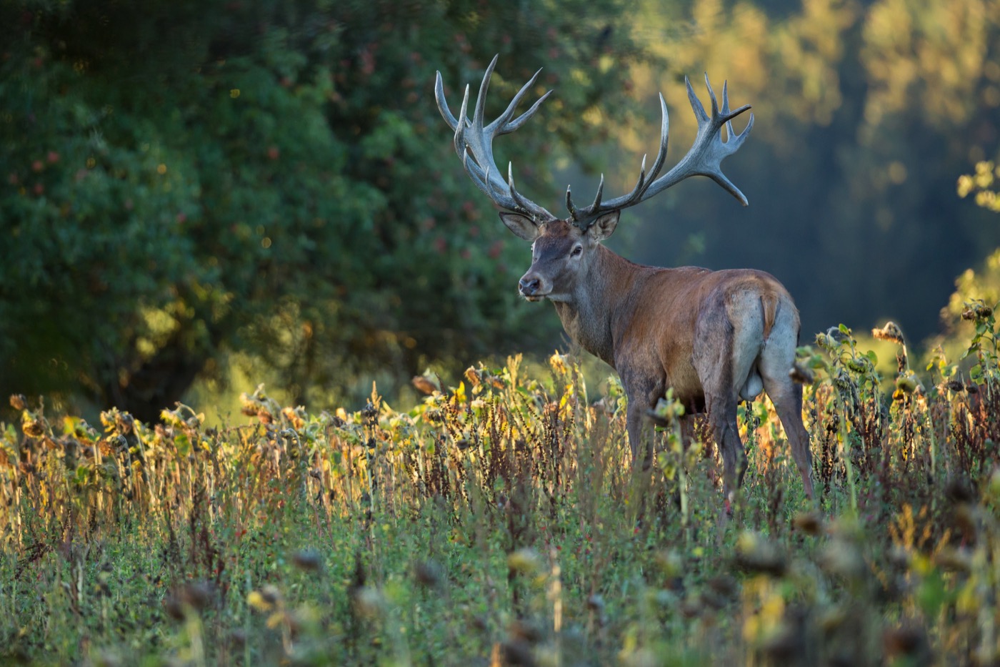
Red deer
The Molkenhaus wildlife observation station near Bad Harzburg is open from May to September, and the accessible station in the Odertal near Sankt Andreasberg is open as well. The reddish brown summer coat and the stags heavily branched antlers mark the red deer out from a distance. During the rut in September the animals move to the Bruchberg, and from the Heidelbeerschneise their roaring can be followed undisturbed.
 all year
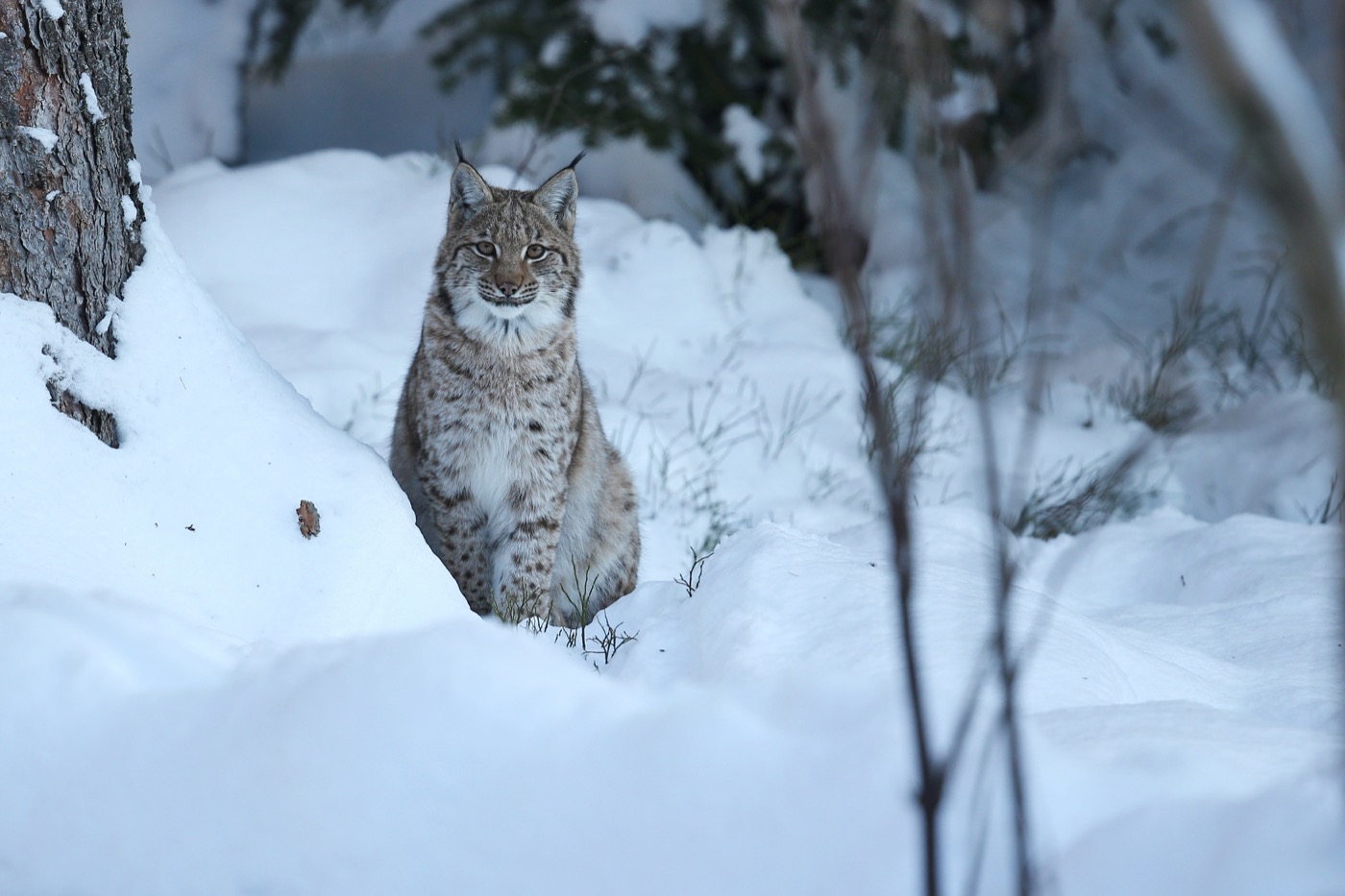
Eurasian lynx
The lynx can reliably be seen in the four hectare enclosure at the Rabenklippe above Bad Harzburg, with public feeding on Wednesdays and Saturdays at 2.30 pm. Its spotted coat and black ear tufts set it apart from other wild cats. Living freely, it has settled across the whole Harz since its reintroduction in 2000, and during the mating season between February and April the otherwise solitary animals are most often on the move.
 all year
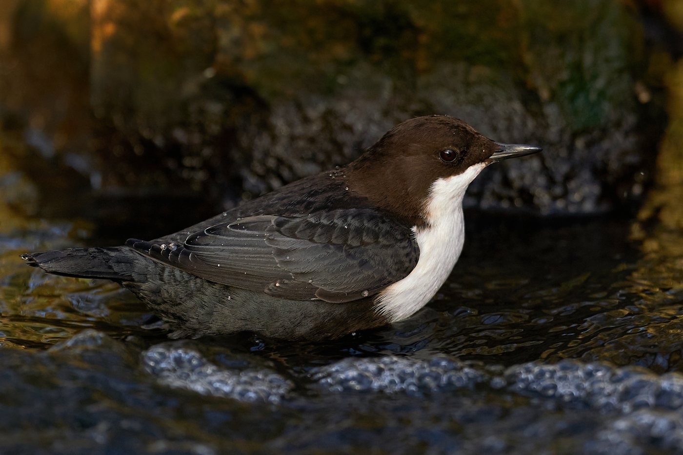
White-throated dipper
On the cold, oxygen rich mountain streams Oder, Sieber, Ilse, Ecker, and Oker, the white throated dipper sits on stones in the water, well seen from the accessible station in the Odertal between the Oderhaus car park and Rinderstall. Its white throat patch against dark plumage and its constant bobbing give it away from far off. As a resident bird it stays here all year, diving headfirst into the current and walking along the streambed after larvae and small crustaceans.
 October to November
Common crane
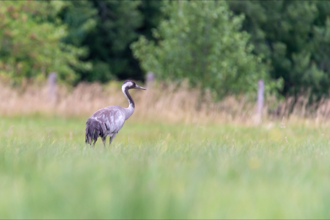
At the Helmestausee near Kelbra on the southern edge of the Harz, up to 40,000 common cranes rest here on a single day during the autumn migration, well seen from the tower on the shore. The red patch on the crown and the black and white head are visible from far off, and their trumpeting call carries far across the lake. Between 16 October and 11 November, guided walks by the Karstlandschaft Südharz biosphere reserve accompany the stopover.
Pictures: Freepik
Getting there
- 1 h 30 minMagdeburg
- 3 h 00 minHamburg
- 3 h 00 minBerlin
- 3 h 30 minFrankfurt am Main
- 4 h 15 minKöln
- 5 h 30 minMünchen
Good to know
Leash Requirement Throughout the National Park
In Harz National Park, dogs must be kept on a leash at all times, including on cross-country ski trails and winter hiking trails. At the Molkenhaus wildlife observation station near Bad Harzburg, dogs are not permitted at all. The rule protects roe deer, red deer, and the wild lynx population.
Stay-on-Trail Rule and Drone Ban
The national park requires visitors to stay on the roughly 600 kilometers of marked trails. Drones and other unmanned aircraft are banned, because rare bird species such as the peregrine falcon nest on the rock faces and cliffs. Plants, berries, and mushrooms are left untouched; nothing may be collected.
No Fires, No Grilling, No Fireworks
Open fires, grilling, and smoking are prohibited throughout the national park, with fines of up to 25,000 euros. Fireworks are banned there year-round. Open fires and camping are also not permitted at the Harz reservoirs.
Swimming Only at Three Reservoirs
Swimming and hand-powered water sports such as stand-up paddleboarding and kayaking are allowed at the Oker, Oder, and Innerste reservoirs. The Ecker, Grane, and Söse reservoirs supply drinking water and are not legally open for this. Motorized water sports are banned on all the reservoirs, and boats may not moor at dams or retaining walls.
Overnight Stays and Road Access
Tent camping, bivouacking, and camping are not allowed in Harz National Park, nor at the reservoirs. Two roads are closed to public car traffic, the Brockenstraße and the access road to the lynx enclosure at the Rabenklippe. Both destinations can be reached on foot, by the Brockenbahn railway, or by public bus.
Bogs Only via Boardwalks
The raised bogs may only be crossed on boardwalks, such as the 4.5-kilometer loop trail around the Große Torfhausmoor, a raised bog, starting at the TorfHaus visitor center. The boardwalks lead straight through the bog without putting weight on the peat body. In winter, walking on ice surfaces in the national park is not permitted.
Protected landscapes
- National park
- Harz
- Biosphere reserve
- Karstlandschaft Südharz
- Nature park
- Südharz
Names and boundaries: © OpenStreetMap contributors.
About this region
The Harz is Germany's northernmost low mountain range, a solid block rising to the Brocken at 1141 metres, on the border of Lower Saxony, Saxony-Anhalt and Thuringia. You will find pitches for motorhomes and tents as well as cabins.
The busiest weeks are July and August, when the Brocken summit is frost-free and the reservoirs open for water sports. In winter cross-country skiers take to the trails; spring and autumn are quieter. When a site is open is shown in each listing's calendar.
