Camping in Franconian Switzerland
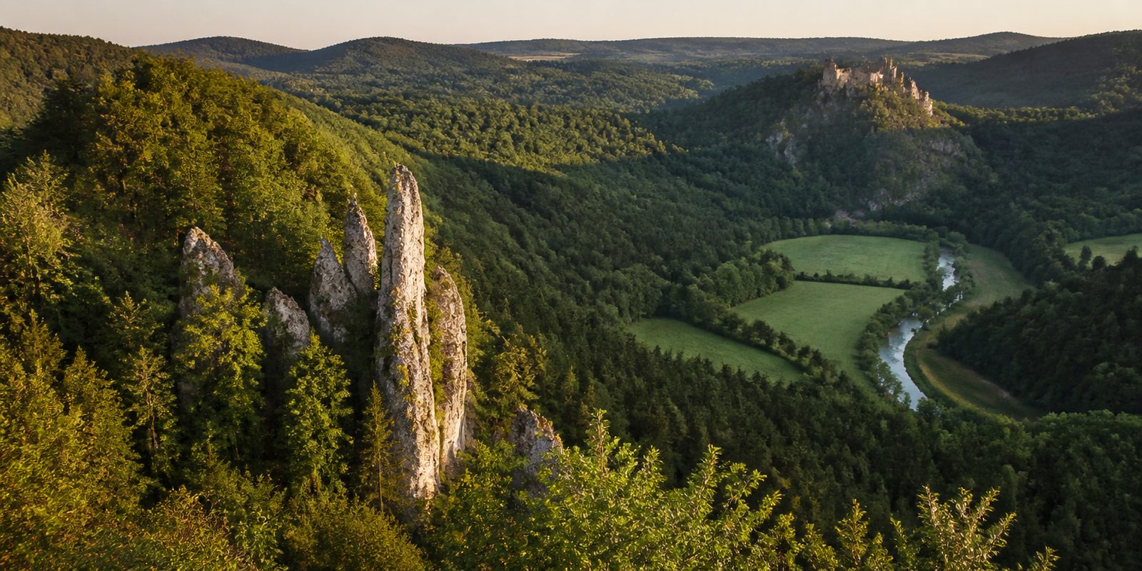
Free-standing rock towers rise above narrow river valleys. The Fränkische Schweiz is a karst landscape of White Jurassic dolomite, where the water seeps away and leaves whole valleys dry. Up on the plateaus lie calcareous grasslands with 46 recorded orchid species, more than half of all those found in Germany. Rock and orchard sit directly side by side. Around 1,000 climbing crags carry some 14,000 routes and more than 1,000 caves run through the ground below, while roughly 2,500 hectares hold more than 200,000 sweet cherry trees, the largest continuous growing area for this fruit in Germany. In the nature park almost 100 eagle owl territories are occupied.
15 places and units in this region
Places in this region

The year in this region
September: Red Deer Rut in Veldensteiner Forst
In the Veldensteiner Forst between Pegnitz, Plech, and Neuhaus an der Pegnitz, the rut begins in early September and lasts five to six weeks. The roughly 70-square-kilometer woodland is an officially designated red deer area, accounting for about a third of Bavaria's annual red deer harvest. The herds consist of family groups of up to 30 animals.
In the middle of the month the sun rises at 6:50 AM and sets at 7:30 PM. That leaves 12 hours and 40 minutes of daylight.
Water and air: Open-Meteo, measured averages. How busy: share of school holidays 2027 across all sixteen federal states. Nature dates: German Weather Service, phenological observations 2014 to 2026 at 99 stations in the region, typical day.
Tours in this region
Marked tours that fit into a day from a site, and one multi day tour per kind.
- Hiking
Fränkische Schweiz 5-Tage-Wanderung
A green five in a white triangle marks this wide loop through the southeastern Fränkische Schweiz, from Pegnitz by way of Pottenstein and Gößweinstein to Egloffstein and back. The line follows the Püttlachtal and the Trubachtal with its old mills, then climbs to the Hohe Reuth. Most of it runs on natural ground. About a quarter is asphalt and village streets.
104.9 kmMulti day tour
- Hiking
Fränkische Schweiz 7-Tage-Wanderung
From Ebermannstadt the blue seven follows the Wiesenttal to Streitberg and Behringersmühle. The Neideck ruin rises above Streitberg. The line then reaches Gößweinstein and Tüchersfeld, where half-timbered houses stand tight against the dolomite towers, before returning by Pottenstein, Betzenstein and Egloffstein.
96.9 kmLoop tourMulti day tour
- Hiking
Karstkundlicher Wanderpfad
The Fränkischer Albverein opened this path in 1936. From Krottensee near Neuhaus an der Pegnitz it passes sinkholes, dry valleys and caves, among them the Maximiliansgrotte and the Vogelherdgrotte, with boards explaining the Jurassic rock along the way. In the Steinerne Stadt the dolomite towers called Zwei Brüder flank the trail.
12.2 km
- Hiking
Frankenweg
North to south straight through Franken, from Untereichenstein in the Frankenwald over the Fränkische Schweiz and the Altmühltal to Harburg on the Wörnitz. The character comes from the rock and dolomite formations of the White Jurassic, with karst valleys and thin, open plateaus. The high point is the Döbraberg.
523 kmMulti day tour
- Hiking
Fränkischer Gebirgsweg
Section 1
The Rennsteig ends at Blankenstein. The Fränkischer Gebirgsweg starts there, and its northern section to Kirchenlamitz crosses the Frankenwald into the Fichtelgebirge, where the Schneeberg is the highest point of the whole trail. Further south the route reaches the Fränkische Schweiz and finishes near Hersbruck.
70.2 kmMulti day tour
- Cycling
Fränkische-Schweiz-Radweg
The first part belongs to the Wiesent, upstream from Forchheim to Muggendorf. After that it gets hillier, by way of Nankendorf and Plankenfels to Bayreuth, half on asphalt and otherwise on field and forest tracks. Castle ruins and dripstone caves sit along the edges.
65.6 km
- Cycling
Hochweg Fränkische Schweiz
Between Bamberg and Bayreuth the route keeps to the plateaus of the Fränkische Alb. Only at Plankenfels does it drop into the Wiesenttal. At Litzendorf stands a baroque church by Johann Dientzenhofer, and from Obernsees on you roll along the paved bed of the old railway into Bayreuth.
68.2 km
- Cycling
Reichswald Fränkische Schweiz Radweg
Leaving Nürnberg, the route first crosses the Sebalder Reichswald, where pine grows on sandy ground. It carries on north by Dormitz and Neunkirchen am Brand until the dolomite crags of the Ehrenbürg appear above Kirchehrenbach. The hill stands clear of the escarpment.
39.9 km
Tours: © OpenStreetMap contributors, ODbL. Lengths computed from the mapped course, as of September 12, 2026.
Animals you can meet here
 January to December
Eagle owl
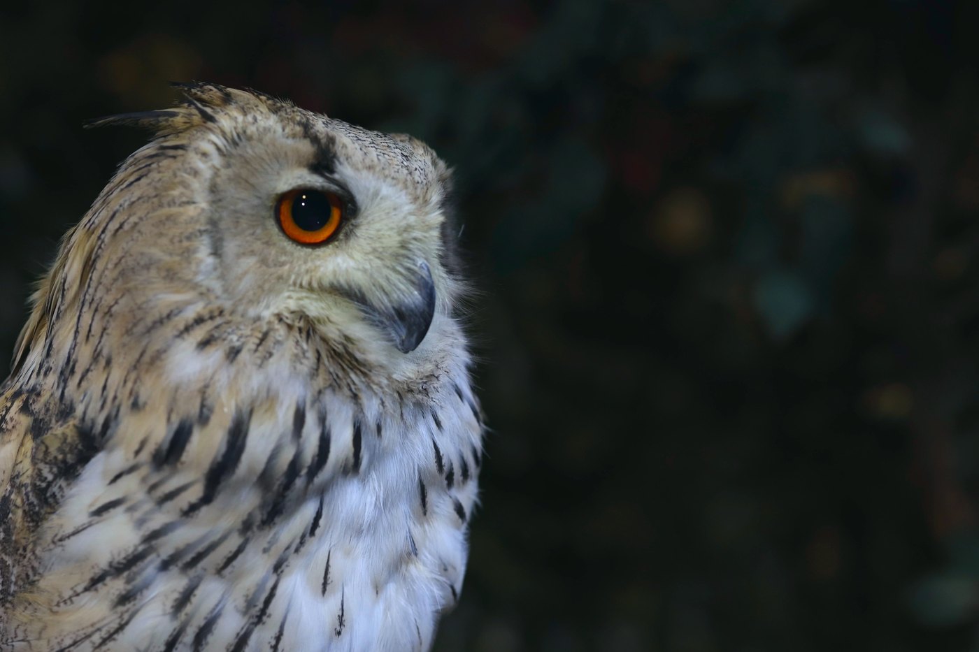
On the dolomite cliffs of the Wiesent, Püttlach and Trubach valleys, the Eurasian eagle-owl displays from November to March. Its prominent ear tufts and orange-red eyes are already visible at dusk, when its deep call carries far across the rock walls. The first pairs start nesting in late February, and in the nature park nearly 100 territories are occupied, with more than 60 pairs breeding on the cliffs.
 September to October
Red deer
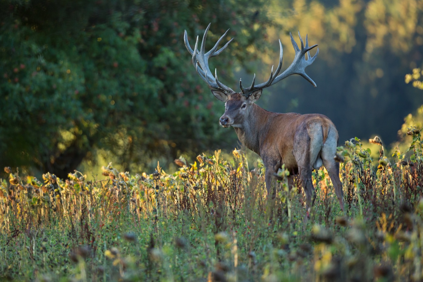
In the Veldensteiner Forst between Pegnitz, Plech and Neuhaus an der Pegnitz, the rutting season begins in early September, and the loud roaring of the red deer echoes through the forest for five to six weeks. It is recognizable by its heavy antlers and reddish-brown coat. The herds move as family groups of up to 30 animals through the roughly 70 square kilometer designated red deer reserve.
 all year
White-throated dipper
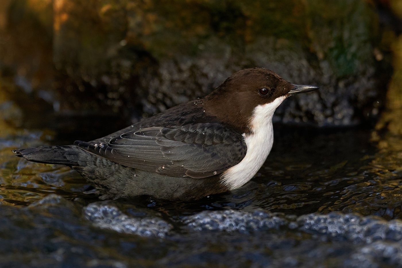
On the Wiesent and its tributaries Ailsbach, Aufseß, Püttlach, Trubach and Leinleiter, the white-throated dipper perches on stones in midstream and dives for insect larvae, recognizable by its white throat and breast against dark plumage. It is a year-round resident, staying by these clear, gravelly stretches of the trout streams throughout the year. Its song is most noticeable in February and March, just before the breeding season.
 May to August
Greater mouse-eared bat
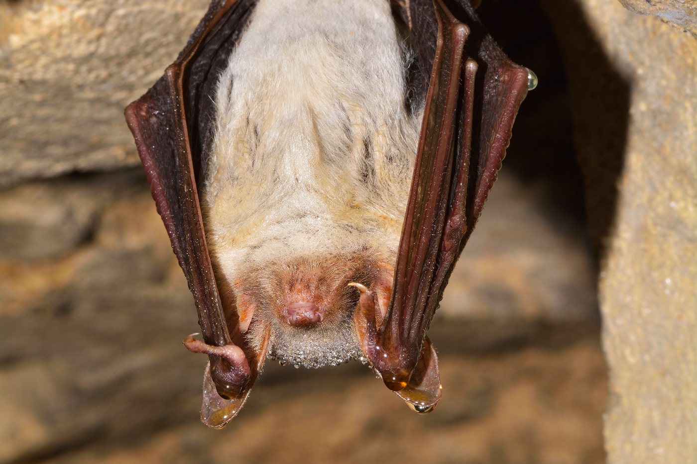
In the attics of village churches and castles hang the maternity roosts of the greater mouse-eared bat, often several hundred to over a thousand animals packed closely together. Its large, namesake ears and grayish-brown fur mark it out as the largest native bat species. At dusk the animals swarm out to hunt over meadows and forest edges, and the nature park is home to 20 of Bavaria's 25 bat species.
Pictures: Freepik
Getting there
- 1 h 00 minNürnberg
- 2 h 30 minMünchen
- 2 h 45 minFrankfurt am Main
- 4 h 15 minBerlin
- 4 h 30 minKöln
- 6 h 00 minHamburg
Good to know
Dogs in the show caves
Dogs on a lead are welcome in the Binghöhle near Streitberg and the Teufelshöhle near Pottenstein. At the Binghöhle only after a word with the staff. Both caves charge a small amount for the dog. At the Sophienhöhle by Burg Rabenstein dogs wait outside.
Seasonal Closures on the Climbing Crags
Some of the roughly 1,000 climbing crags carry temporary closures so eagle owls and peregrine falcons can breed undisturbed. The closure period runs from January through July for the eagle owl and from February through June for the peregrine falcon. The affected crags are listed on a closure list updated daily and are marked on site by volunteers.
Canoeing on the Wiesent
The Wiesent may be paddled from May 1 to September 30; the upper reach as far as Plankenfels stays closed year-round. Putting in and taking out is only allowed at the marked points at the Pulvermühle in Doos near Waischenfeld, in Behringersmühle, and in Muggendorf. Group trips of more than ten boats need separate approval.
Fires Only at Designated Spots
In the forest and within 100 meters of it, open fires require a permit under Article 17 of the Bavarian Forest Act, and from March 1 to October 31 smoking is also banned in the forest. In the nature park's protected zone, lighting open fires for recreational use likewise requires a permit. The nature park therefore points visitors to its official fire pits.
RV Overnight Stays
Camping outside officially approved sites requires a permit in the nature park's protected zone, as does driving off roads, paths, and designated areas. The regional tourist office lists 45 RV sites in the area. The best equipped are Pottenstein with six spots, and Waischenfeld and Strullendorf with four each.
Seasonal Bus Lines Into the Valleys
From early May to early November, the VGN transit network runs dedicated leisure bus lines into the valleys; outside this period they do not operate. These include the Wiesenttal-Express (line 389) between Ebermannstadt and Pegnitz, the Trubachtal-Express (line 229) from Gräfenberg to Gößweinstein, and the Brauereien-Wander-Express (line 230) from Ebermannstadt to Hollfeld. The lines are designed for hikers, cyclists, and families.
Protected landscapes
- Nature park
- Fränkische Schweiz - Frankenjura
Names and boundaries: © OpenStreetMap contributors.
About this region
Franconian Switzerland lies in northeastern Bayern between Bamberg, Bayreuth, and Nürnberg, shaped by rock towers and narrow river valleys in dolomite rock. Campgrounds and RV pitches are found mainly along the Wiesent, Püttlach, and Trubach, plus simple pitches at private hosts.
The season starts in April with the cherry blossom and is busiest from May to September, when you can paddle the Wiesent by canoe. When a site is open is shown in each listing's calendar.
