Alpine Huts in the Chiemgau
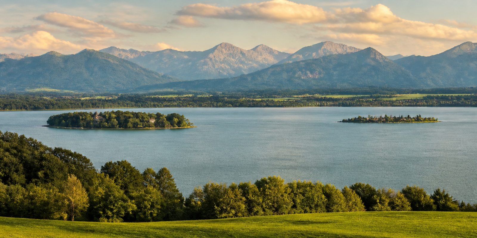
Alpine huts in the Chiemgau stand in the mountains south of the lake, on the flanks of the Kampenwand and the Geigelstein, the Hochgern and the Hochfelln. Most of them sit between a thousand and fifteen hundred meters, at the height where mountain forest and pasture still run into each other and rock has not yet taken over the ground. The walks up begin down in the valleys around Aschau and Marquartstein, around Bergen and Ruhpolding. Because the range drops away northward toward the lowland, a pasture that lies open in that direction gives you a view across the wooded foothills as far as the Chiemsee.
The year in this region
September: Red-crested pochards gather at Chiemsee
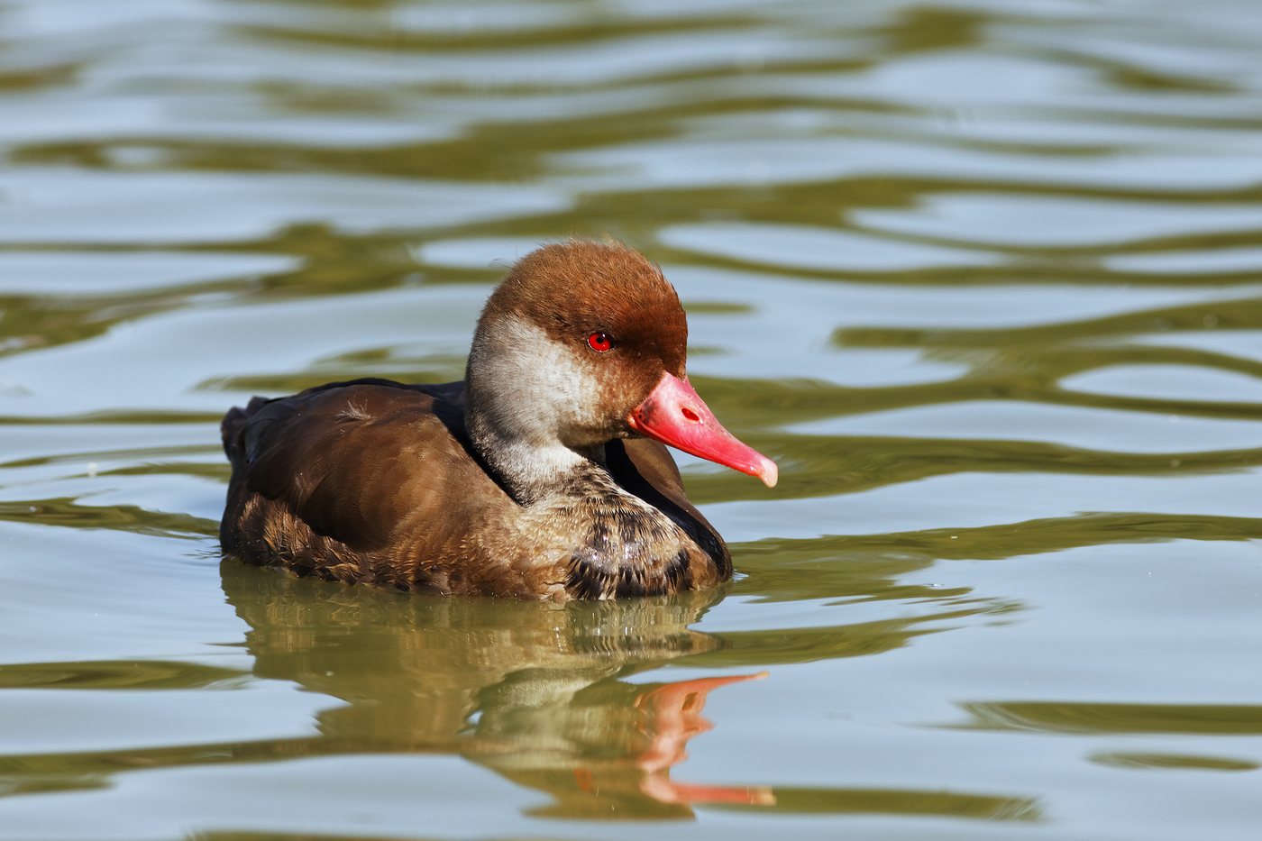
For the red-crested pochard, the Chiemsee is Bavaria's second most important resting and wintering wetland after the Ismaninger Teichgebiet. Molting and wintering run from September to March, and numbers rise markedly during this period, reaching autumn peaks of 3,000 to 8,000 birds statewide. The drakes can be recognized from a distance by their rust-red heads and red bills.
In the middle of the month the sun rises at 6:46 AM and sets at 7:24 PM. That leaves 12 hours and 38 minutes of daylight.
Water and air: Open-Meteo, measured averages. How busy: share of school holidays 2027 across all sixteen federal states. Nature dates: German Weather Service, phenological observations 2014 to 2026 at 39 stations in the region, typical day.
Tours in this region
Marked tours that fit into a day from a site, and one multi day tour per kind.
- Hiking
SalzAlpenSteig
From Prien am Chiemsee over the Chiemgau mountains to Bad Reichenhall, on to the Königssee and as far as the Hallstätter See in Austria. The route follows salt: old pack trails, saltworks and the line of the brine pipeline that once ran from Bad Reichenhall to Traunstein, with boggy ground, mountain streams and quiet forest in between. On the Hochfelln you stand at 1674 metres.
236.6 kmMulti day tour
- Hiking
Maximiliansweg
Section Bayern
King Maximilian II travelled from Lindau on Lake Constance to Berchtesgaden in 1858, and the route picks up his line again. It runs through the Bregenzerwald, past Neuschwanstein, over the Ammergau Alps and the Bavarian foothills into the Chiemgau and Berchtesgaden ranges, across alpine pasture, scree and rooty paths. The view often reaches far out over the lowland.
410.8 kmMulti day tour
- Hiking
Chiemsee Rundweg
Around the lake on field tracks, narrow natural paths and paved promenades, through Bernau, Prien, Gstadt, Seebruck and Chieming. Between Aiterbach and the Sassau peninsula the reeds stand tall, and observation towers rise in the Grabenstätter Moos and the Achen delta. The Alps stay in sight nearly all the way.
58.2 km
- Cycling
Chiemgau-Radweg
Between Inzell, Ruhpolding and Reit im Winkl, mostly on forest and farm tracks through meadows and woodland. Then come Lödensee, Mittersee and Weitsee. The Chiemgau mountains stand ahead or behind the whole way, and towards the end the Schwarzlofer stream accompanies the route into Reit im Winkl.
30.9 km
- Cycling
Bodensee-Königssee-Radweg
Section Chiemgau
In the Chiemgau the route runs through the Priental valley by way of Aschau, Bernau am Chiemsee and Grassau, along the northern edge of the Chiemgau Alps. Before that it crosses the Inn at Neubeuern and rolls over the soft hills of the alpine foreland. At Bernau the Chiemsee appears.
42.5 km350 m ascent
- Mountain biking
Chiemgau King MTB
Eight alpine pastures in one go: from the Chiemgau Arena in Ruhpolding over Maria Eck and the Stoißeralm to Inzell, on to the Bründlingalm, the Torfbahnhof at Rottau and up to the Steinlingalm below the Kampenwand. Then the Staffnalm in the Hochplatte area above Marquartstein, the Jochbergalm near Unterwössen and the Winklmoosalm above Reit im Winkl, before the way back to Ruhpolding. Some 4600 metres of climbing lie in between.
161.3 kmMulti day tour
- Cross country skiing
Aufstiegsloipe Hemmersuppenalm
The track climbs from Reit im Winkl in the valley at 800 metres up through the forest to the plateau of the Hemmersuppenalm above 1200 metres. At the top wide alpine meadows open out under snow, with the Hindenburghütte at their edge. Snow lasts longer up here than below.
6.4 km
Tours: © OpenStreetMap contributors, ODbL. Lengths computed from the mapped course, as of September 12, 2026.
Animals you can meet here
 January to December
Red-crested pochard
On the open water of the Chiemsee, especially off the Achendelta and in the Hirschauer Bucht, the red-crested pochard gathers in large numbers. The drakes stand out from a distance with their rust-red head and bright red bill. From September to March, the Chiemsee is Bavaria's second most important resting and wintering water for the species, after the Ismaninger Teichgebiet.
 all year
Chamois
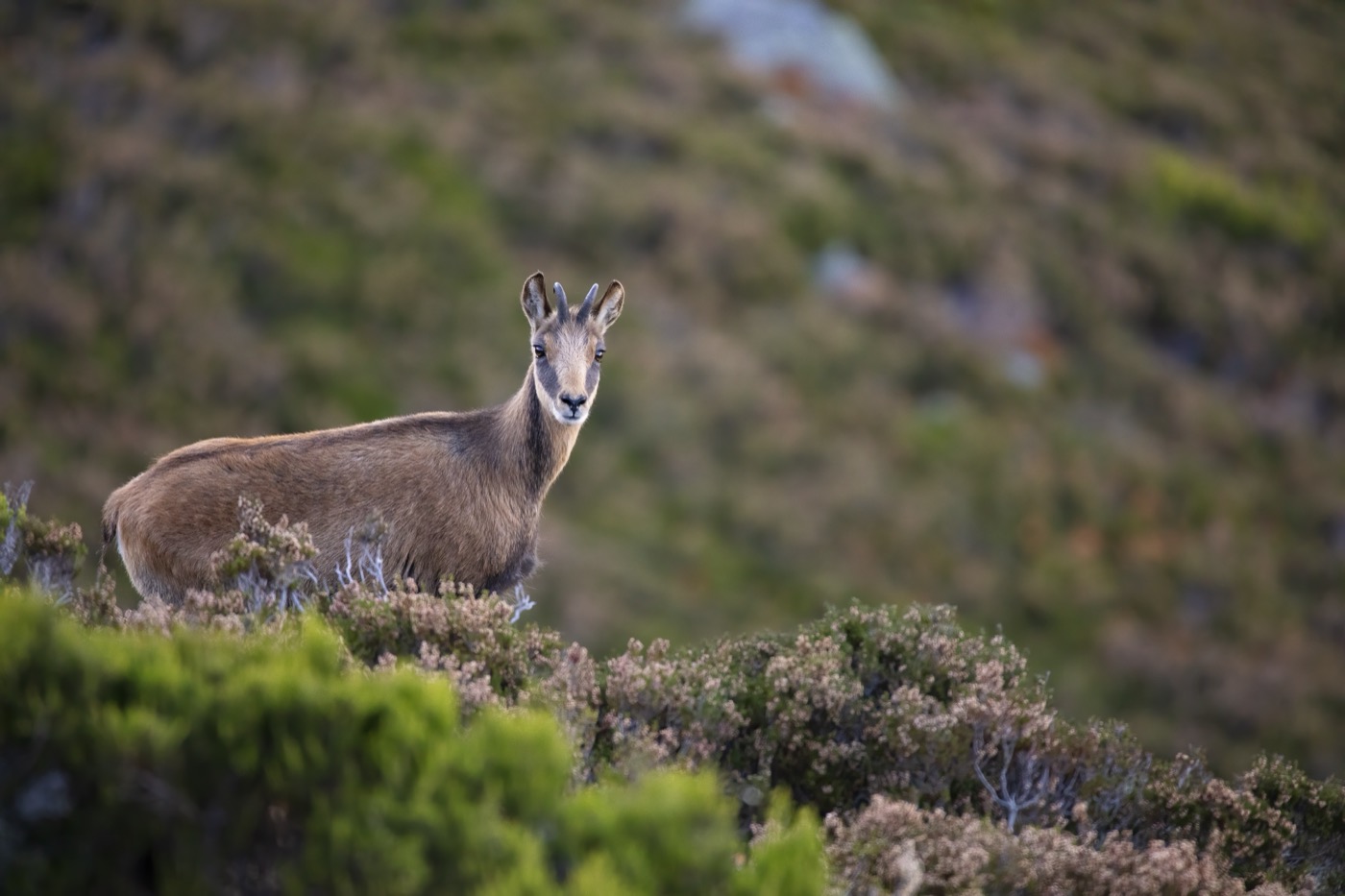
In the Geigelstein nature reserve between Schleching and Sachrang, and in the districts managed by the Forstbetrieb Ruhpolding, the chamois can be found all year round. In summer it stays in the rocky terrain and on the alpine pastures, in winter it moves down into more wooded slopes, where it is easier to spot from the trails. Its black, backward-curving horns and pale face mask with a dark eye stripe make it unmistakable.
 April to September
Alpine marmot
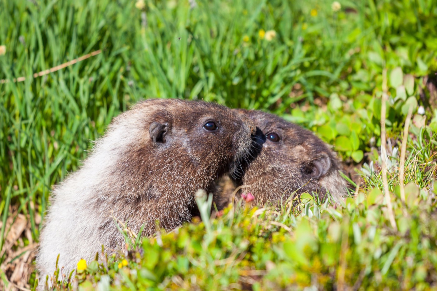
On the open alpine pastures of the Rossalm in the Geigelstein nature reserve, the Alpine marmot is one of the characteristic species. Its stocky build and shrill alarm whistle give it away from a distance. It is most active in the morning and late afternoon, retreating into its cool burrow during the midday heat.
 March to July
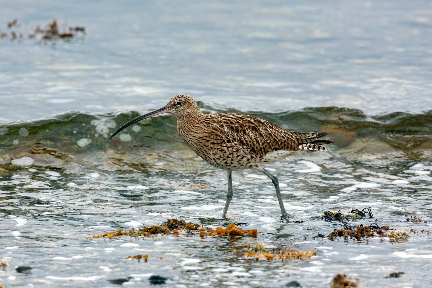
Eurasian curlew
In the wet meadows around the Achendelta and in the Grabenstätter Moos, the Eurasian curlew reclaims its breeding territory from late March onward. Its long, downward-curved bill and its mournful, far-carrying call give it away from a distance. Around 500 breeding pairs live in Bavaria, with egg-laying beginning no earlier than late March.
Pictures: Freepik
What to check before booking
- How far does the car get?
- Some alpine huts have a drive right to the door, for others the last stretch goes up on foot. There is often a barrier on the way, and a key that belongs to it. Some hosts bring the luggage up themselves.
- Is the hut reachable in winter?
- Many alps are open from early summer into autumn only, because nobody clears the track. Where winter lets are offered, the last part often goes by sledge, ski or snowshoe. The description says so when it applies.
- Where does the electricity come from?
- There are huts on the grid, huts with solar panels and huts with no connection at all. A solar system carries lights and chargers, rarely a hairdryer or a kettle. On some huts the wood range heats the water as well.
- Where does the water come from?
- Many alpine huts are fed by their own spring rather than a main from the valley. The water comes cold out of the mountain, usually from a tapped spring above the hut. How the supply is arranged at each hut is stated in the description.
- How is it heated, and who brings the wood?
- On many alpine huts the wood stove in the parlour is the only source of warmth. Some hosts leave the wood ready, with others you buy it or fetch it from the shed. Even in summer the nights up there turn cold.
- How far is the nearest shop?
- You almost always cook for yourself. The nearest shop is down in the valley, and the way there is part of the planning. Shop before you drive up, not after.
Who it suits
Made for
People who want quiet and can take what quiet also means, which is being on your own. Families and small groups get a whole house instead of a room, and that changes an evening. Anyone who likes cooking has the kitchen to themselves.
Less so for
Anyone who wants company in the evening is better off down in the valley. The way to a hut is rarely level, and few of them are step free. And if you have to be online reliably, ask about reception first, because many alps sit out of signal.
Where it comes from
Alpine pasture farming is about four thousand years old in the Alps. On the Dachstein the association ANISA uncovered the remains of huts from the middle and late Bronze Age; charcoal from a fire pit dates one of them to 1360 to 1170 BC. Alps first appear in writing in the eighth century, when the Notitia Arnonis assigns two of them to the church of Salzburg. The alpine pasture season, the summer between the drive up and the drive down, is listed by UNESCO as intangible cultural heritage on a Swiss nomination.
Good to know
Getting there is part of it
A private alpine or forest road with a barrier often leads up to the pasture. How far the car gets and where the key waits is worth settling before you set off.
Cattle around the house
On a working alp cattle graze right up to the hut. Dogs belong on a short lead there, and gates stay shut so the animals stay where they are.
Lighting the stove is part of the day
Where a wood stove or a range stands, it gets used morning and evening. If you have never done it, have the host show you the few steps when you arrive.
The water comes out of the mountain
Many huts hang on their own spring rather than a main from the valley. Going easy on water is not a gesture up there, it is the normal way to live.
Dark skies
Places certified by DarkSky International.
Winklmoosalm
The alp sits at 1,200 metres above Reit im Winkl, above the haze that hangs in the valley. The mountains also screen off the light of the towns around.
Getting there
- 1 h 00 minMünchen
- 1 h 45 minAugsburg
- 4 h 45 minFrankfurt am Main
- 6 h 30 minKöln
- 6 h 45 minBerlin
- 8 h 30 minHamburg
Good to know
Quiet zones on the Chiemsee
Since 2005 the Chiemsee has had designated quiet zones for birds and fish. Some apply year round, others from March 1 to July 31, affecting mainly the shores of the Herreninsel and the Sassau peninsula. The boundaries are marked with buoys, and maps are available from the local municipalities and the lake authority in Prien.
Observation towers instead of the core zone
The core zone of the nature reserve at the mouth of the Tiroler Achen remains off-limits; on the water, a line of buoys marks the boundary. Two freely accessible observation towers stand ready instead, one at the Lachsgang near Übersee for the west side of the delta, one at the Hirschauer Bucht for the east side. Both are free of charge and equipped with telescopes.
Behavior in the protected areas
In the region's nature reserves the rules are: stay on the marked trails, keep dogs on a leash, do not collect plants or mushrooms, and do not fly drones or kites. At the Achendelta, access to the delta's core is closed off so that breeding birds remain undisturbed. The specific rules in force are posted at the entrances to each area.
Fire in the forest
Under Article 17 of the Bavarian Forest Act, open fires in the forest and within 100 meters of it require official permission. Smoking in the forest is prohibited from March 1 to October 31. Grilling therefore belongs at the designated sites run by the municipalities and campgrounds.
To the islands without a car
From Prien station, the meter-gauge Chiemsee-Bahn has run the not quite 1.8 kilometers down to the harbor at Prien/Stock since 1887, in summer pulled by the 1887 steam locomotive Laura. Regular service runs from late May to late September. From Stock, the boats of the Chiemsee-Schifffahrt serve the Herreninsel and the Fraueninsel; bicycles and dogs are carried on certain routes.
Trails, bikes, and horses
Article 28 of the Bavarian Nature Conservation Act permits hiking, horseback riding, and travel by non-motorized vehicles on private paths in the open countryside, with pedestrians given priority. In the forest, cycling and horseback riding are allowed only on roads and suitable paths, and farmland may be entered only on existing paths during the working season. Trail markings may only be put up with the approval of the lower nature conservation authority, so the signposted routes can be relied on.
