Camping in the Bliesgau
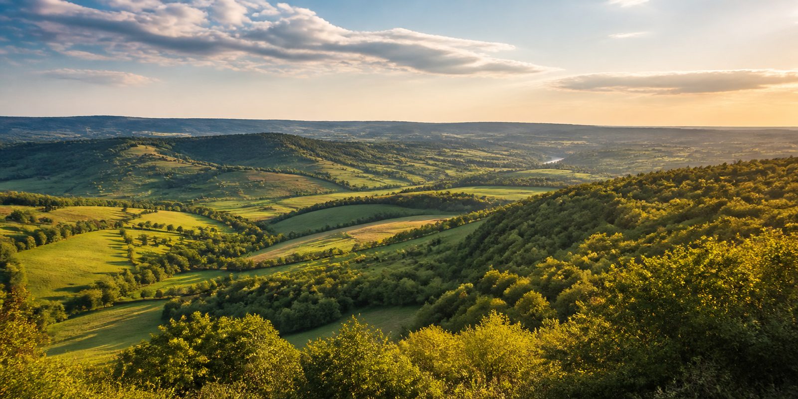
The Bliesgau forms the southeastern corner of Saarland and has been recognized as a UNESCO Biosphere Reserve since May 2009, covering 36,152 hectares, about 14 percent of the state's area. Seven municipalities share the reserve: Gersheim, Mandelbachtal, Kirkel, Kleinblittersdorf, Blieskastel, St. Ingbert, and parts of Homburg. The region takes its name from the Blies, a river that flows through shell limestone soils past extensive orchard meadows and the Bliesaue floodplain; about 80 percent of Saarland's entire little owl population breeds in these meadows. Near Gersheim, almost half of all orchid species native to Germany grow on a 32 hectare calcareous grassland that has been protected since 1957. The region's landmark is the Gollenstein near Blieskastel, at 6.58 meters the largest menhir in Central Europe and about 4000 years old. Since the early 21st century, beavers have also returned to live along the Blies, after having long been considered extinct here.
The year in this region
September: Orchard harvest and apple juice pressing
In September and October, many landowners in the Bliesgau bring their windfall fruit to the press house in Kleinblittersdorf, where about 50 liters of juice are pressed from 100 kilograms of apples. The Bliesgau Obst association, which also helps with the winter pruning, coordinates the harvest campaigns and later markets the juice as a regional product.
In the middle of the month the sun rises at 7:07 AM and sets at 7:46 PM. That leaves 12 hours and 40 minutes of daylight.
What nature does this month
- Apple picking starts around September 27 (usually between September 19 and October 9)
Water and air: Open-Meteo, measured averages. How busy: share of school holidays 2027 across all sixteen federal states. Nature dates: German Weather Service, phenological observations 2014 to 2026 at 23 stations in the region, typical day.
Tours in this region
Marked tours that fit into a day from a site, and one multi day tour per kind.
- Hiking
Der Bliesgauer
Up out of the Bliestal onto the ridge at the edge of the Schornwald, then for kilometres along forest edges, across old orchard meadows and past six Bliesgau villages. The ground is mostly natural, with hardly any asphalt. In Herbitzheim stands the church of St. Barbara, a round concrete building whose windings taper upward like the longitudinal section of a snail shell, and near Wolfersheim an old limestone quarry lies beside the path.
15.9 kmLoop tour
- Hiking
Bliessteig
From the Blies near Saargemünd to Bexbach, straight through the Bliesgau biosphere reserve. In the south the route crosses shell limestone, floodplain woods along the river and open meadows with long views, with the baroque town of Blieskastel in between. Near Kirkel and Homburg the rock becomes red sandstone. Shortly before the finish comes the high point, the Höcherberg at 518 metres.
105.2 kmMulti day tour
- Hiking
Bliesgau Blicke
Out of Gersheim across the bridge over the Blies and through the village, past the church and Spohns Haus, then onto field tracks towards the Lachenhof and up onto the ridge. Up there are dry stone walls of limestone and thin grassland where wild orchids flower in early summer. The view carries far across the Bliesgau.
6.3 kmLoop tour
- Hiking
Kirkeler Felsenpfad
Through mixed deciduous forest on the Hirschberg, past sandstone formations weathered out of the rock over millions of years. At the Wasserfelsen water seeps from the wall and drips all year round, and in winter icicles hang there. At the end the Hollerkanzel juts above the slope.
4.1 km
- Hiking
Orchideenpfad in Gersheim
Narrow paths across the dry grassland near Gersheim, on poor limestone soil in a mild, almost Mediterranean pocket of climate. About half of all German orchid species grow here. Stations along the way also cover butterflies, grasshoppers and the calcareous spring fen at the lower end of the loop.
2.2 kmLoop tour
- Hiking
Natura Trail Mandelbachtal
From Ormesheim the route runs through the Bettelwald and the Allmendwald, over the shell limestone slopes near Bebelsheim and Wittersheim and down to Gräfinthal. The ground alternates between soft forest tracks and asphalt. From the Heidenkopfturm, on a clear day, the view reaches as far as the Vosges.
20 kmLoop tour
- Cycling
Bliesgau-Radweg
Mostly asphalt: down along the Blies through Blieskastel and Gersheim, then up onto the ridge between the Bliestal and the Mandelbachtal. Up there it runs long through cool forest. At Reinheim lies the archaeological park, where a Celtic princess grave and a Roman villa have been excavated right on the French border.
36.3 km
Tours: © OpenStreetMap contributors, ODbL. Lengths computed from the mapped course, as of September 12, 2026.
Animals you can meet here
 February to August
White stork
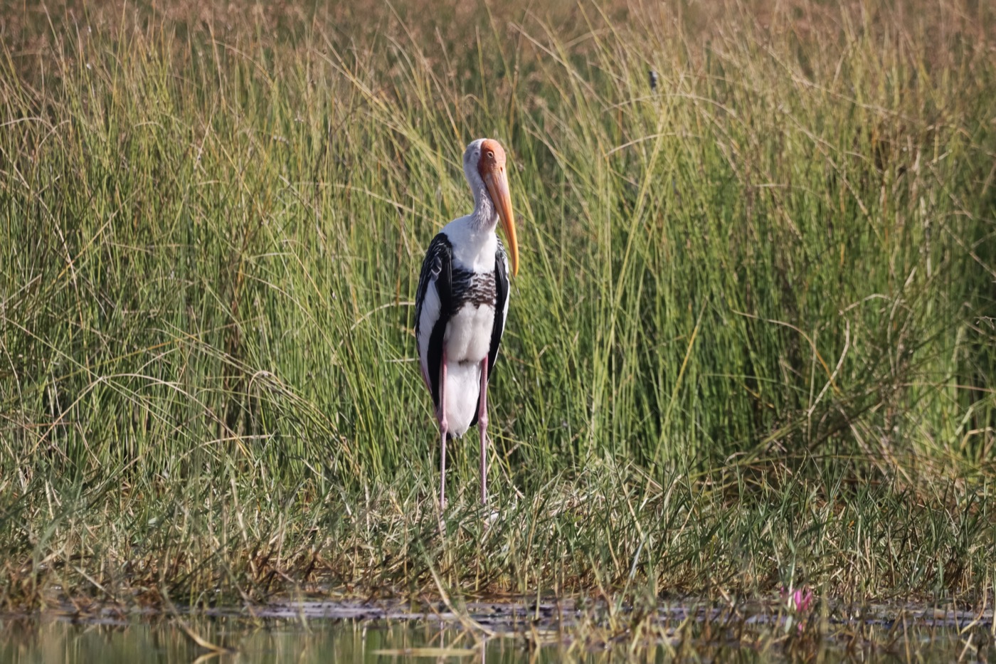
In the wetland below Beeden, nine pairs of white storks breed, with their nests at the Fischerhütte. From February the adult birds return from their winter quarters and stride through the meadows foraging, their white plumage and long red bill visible from afar. The chicks usually hatch around Easter and can be watched at the nests well into August.
 April to September
Eurasian beaver
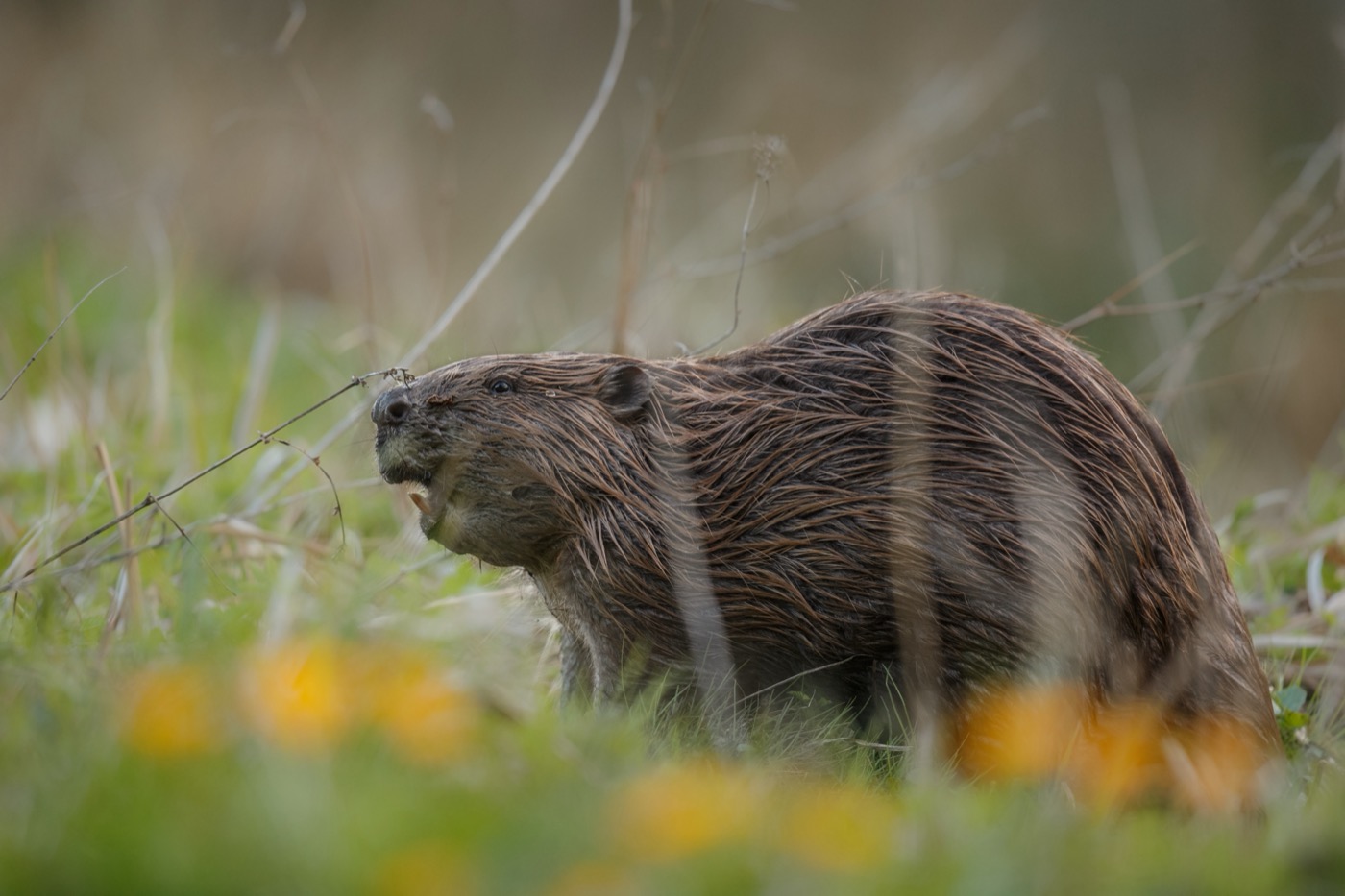
In the floodplain forests along the Blies within the biosphere reserve, the beaver has lived again since the early 21st century, after long being considered extinct here. At dusk it moves through the water with its broad, scaly tail, leaving cone-shaped gnawed tree trunks along the banks as its clearest sign. From April into autumn it hauls freshly stripped branches back to its lodge to feed itself and its young.
 November to May
Little owl
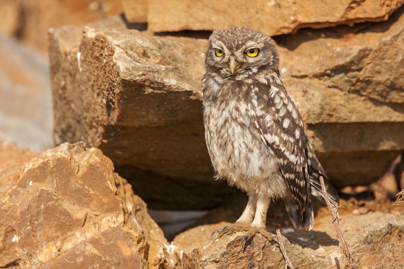
The orchard meadows around Gersheim and Mandelbachtal hold about 80 percent of the entire little owl population of Saarland, living in the tree cavities of the old standard fruit trees. Without leaves on the branches, the small, round-headed bird with yellow eyes is easier to spot in winter than in the leafy summer, when it mostly stays hidden in the cavities. Anyone walking attentively through the meadows at dusk often hears its distinctive call first, before spotting it among the branches.
- March to June
Great crested newt
In the Schwefelspfuhl near Walsheim in Mandelbachtal, the great crested newt lives alongside alpine and smooth newts in one of the Bliesgau's rain-fed Mardellen ponds. Once the nights turn milder in early spring, it migrates to this small pond, the males then grow a jagged dorsal crest and a silvery sheen along the tail, which they use to court the females in the water. Mating ends with the females wrapping their eggs one by one in the leaves of water plants.
Pictures: Freepik
Getting there
- 0 h 30 minSaarbrücken
- 2 h 00 minFrankfurt am Main
- 3 h 00 minKöln
- 4 h 45 minMünchen
- 6 h 30 minHamburg
- 7 h 15 minBerlin
Good to know
No fires in the core zones
The ordinance for the Bliesgau biosphere reserve bans lighting fires and camping in the ten core zones. Among them are the Taubental near Kirkel and the Baumbusch. These areas may only be entered on the paths.
Leashed dogs in the core zones
Dogs may not run free in the ten core zones of the Bliesgau biosphere reserve. Together they cover around 1,200 hectares of woodland, the largest being the Taubental. Walkers stay on the paths with their dog.
Navigation restrictions on the Blies
Between Bexbach and the state border near Habkirchen, canoeing is closed to paddlers during the core bird breeding season, from April 15 to August 15. Put-in points include Reinheim below the Bliesbrücke bridge and the customs museum in Habkirchen. Non-swimmers and solo trips are not allowed on the river, and a life jacket and buoyancy aid are required.
Historic weirs on the Blies
The river holds two historic mill weirs, the Haseler Wehr from 1748/50 and the Holzauwehr from 1779/81, both now regarded as cultural landmarks of Saarland's economic history. Canoeists therefore have to portage at several points, including just before Habkirchen, at Bliesmengen-Bolchen, after Blies-Schweyen, and before Sarreguemines.
RV site at Ommersheimer Weiher
In Mandelbachtal, right on the ten hectare Ommersheimer Weiher lake, there are two RV sites with paved surfaces, lighting, a CEE power hookup, and a freshwater fill-up point. Pets are allowed, and a playground and a restaurant are located nearby.
Stork nesting near Beeden
Nine pairs of white storks have settled in the wetland below Beeden, nesting near the Fischerhütte, a fishing hut by the water. Visitors get the best view of the birds from the path, without entering the nesting sites. In most years, the chicks hatch around Easter.
Protected landscapes
- Biosphere reserve
- Bliesgau
Names and boundaries: © OpenStreetMap contributors.
About this region
The Bliesgau forms the southeastern corner of Saarland, a biosphere reserve shaped by traditional orchard meadows and the Blies river. Seven municipalities from Gersheim to St. Ingbert share the reserve. When a site is open is shown in each listing's calendar.
It gets busiest from April to June, when the orchards bloom, and in summer, with canoe trips on the Blies. Late autumn and winter are quieter. Most hosts are open from spring through October.
