Treehouses in the Bavarian Forest
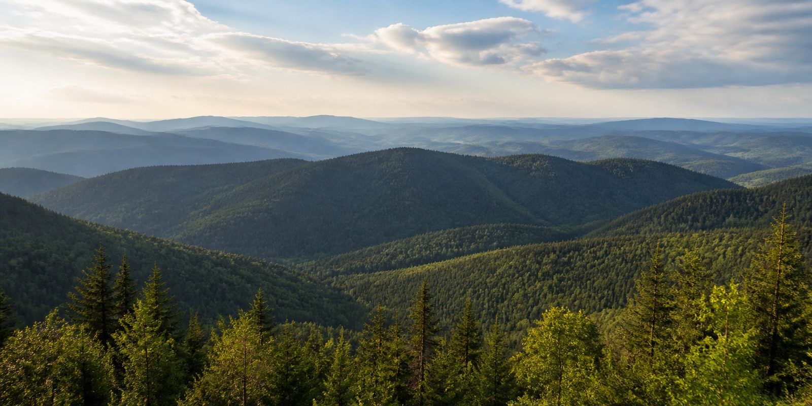
On the slopes beech, silver fir and spruce grow into one another, and a treehouse puts the bed right into that layer. What stands outside the window therefore changes over the year, because the beech leaves close the view in May and open it again in late autumn. Building happens outside the protected zones, on private woodland in the surrounding villages, many of which lie between 600 and 1,000 metres, so the view runs across wooded ridges rather than roofs. By day that height carries on in Neuschönau, where a walkway has crossed the forest at canopy level since 2009 and ends on a tower above the crowns.
The year in this region
September: Red Deer Rut Begins Mid-September
According to the national park administration, the red deer rut begins in mid-September and lasts about four weeks. In the nine-hectare Scheuereck deer enclosure near Lindberg, the action can be watched from a viewing platform open year-round, reachable by the Waldbahn train and the Igelbus shuttle bus. The same period brings the national park administration's mushroom exhibition, held in 2026 on September 19 and 20 in the Arberlandhalle in Bayerisch Eisenstein.
In the middle of the month the sun rises at 6:43 AM and sets at 7:22 PM. That leaves 12 hours and 39 minutes of daylight.
Water and air: Open-Meteo, measured averages. How busy: share of school holidays 2027 across all sixteen federal states. Nature dates: German Weather Service, phenological observations 2014 to 2026 at 131 stations in the region, typical day.
Tours in this region
Marked tours that fit into a day from a site, and one multi day tour per kind.
- Hiking
Goldsteig N17
Section Rachel - Lusen
From the Rachel, at 1453 metres the second highest mountain in the Bayerischer Wald, the way passes the Rachelkapelle and the Rachelsee across to the Lusen. The final climb takes the Himmelsleiter, a staircase of granite blocks, and ends in the block field on the summit. Standing deadwood and young forest grow close together.
14 km
- Hiking
Gunthersteig
The trail takes up the route of the hermit Gunther, from Kloster Niederaltaich on the Danube by way of Rinchnach and Zwiesel to Dobrá Voda in Bohemia. It starts in the orchards of the Lallinger Winkel and then goes into beech and spruce forest. Guntherstein and Frauenbrünnl lie on the way.
71.2 kmMulti day tour
- Hiking
Baierweg
An old trade road between the Danube and Bohemia, laid out by the counts of Bogen and still marked with their blue lozenge on white. From Straubing the route runs by way of Kollnburg, Kötzting and Neukirchen beim Heiligen Blut to Furth im Wald. The lozenge turns up on trees and house walls.
112.5 kmMulti day tour
- Cycling
Regental-Radweg
The Regen leads the route from the border at Bayerisch Eisenstein down to Regensburg. Between the town of Regen and Miltach it swings over the hills, elsewhere it keeps to the valley, and near Cham it crosses the wide meadows of the Regentalaue. At the end the Regen flows into the Danube.
169.6 kmMulti day tour
- Mountain biking
Trans Bayerwald Nordroute
Section 4
The fourth stage of the northern route runs from Mitterfirmiansreut to Spiegelau, on forest tracks and quiet roads along the national park. The Freilichtmuseum Finsterau and the Nationalparkzentrum Lusen, with its animal enclosure and treetop walk, lie on the way. Technically it stays calm, but the climbing is constant.
55.4 km
- Cross country skiing
Bayerwaldloipe
One continuous track links the cross-country areas between Lohberg below the Osser and Neureichenau below the Dreisessel. It is skied in one direction only. By way of Zwiesel, Sankt Oswald and Mauth it runs through forest, crosses the Große Ohe and climbs above 1100 metres near Bischofsreut.
11.1 km
Tours: © OpenStreetMap contributors, ODbL. Lengths computed from the mapped course, as of September 12, 2026.
Animals you can meet here
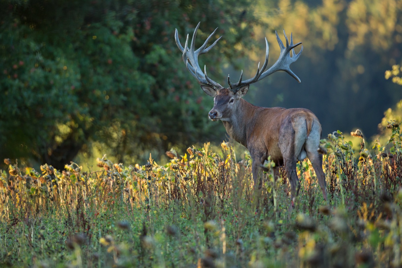 September to October
Red deer
In the nine-hectare Hirschgehege Scheuereck near Lindberg, red deer pass close to the year-round accessible viewing platform, and the same holds for the more than 200-hectare wildlife enclosure at the Nationalparkzentrum Lusen near Neuschönau. Free-ranging animals also move through the forests around Rachel, Lusen, and Großer Falkenstein. The rut begins in mid-September: the stags carry their full antlers, and their roaring carries far as they compete for the hinds.
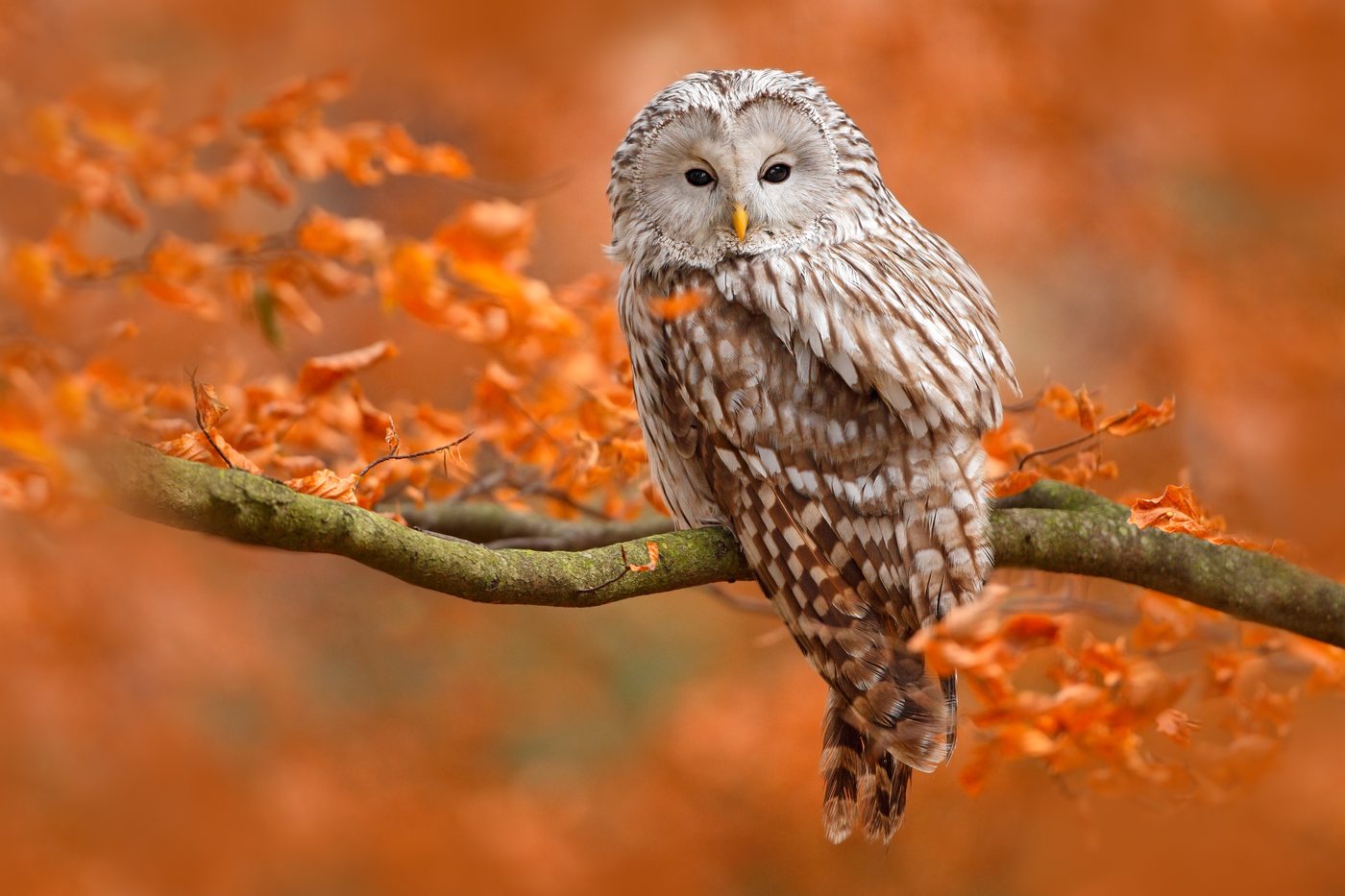 all year
Ural owl
The Ural owl holds its territories in the old, deadwood-rich beech and fir forests around Mittelsteighütte, Rachelsee, and Höllbachgspreng on the Falkenstein. Its long, finely barred tail and dark eyes set it apart from other large owls, and it has no ear tufts at all. It nests in broken-off tree stumps or in nest boxes put up for it, deep inside the dense mountain forest.
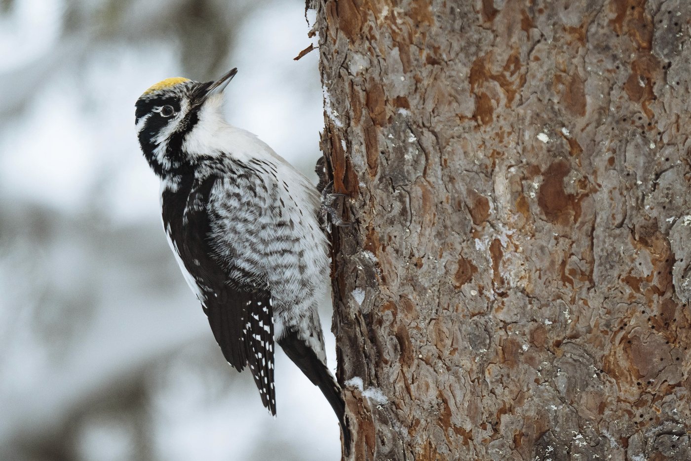 all year
Eurasian three-toed woodpecker
In the mountain spruce forests above roughly 1,200 meters and on the deadwood-rich ground around Lusen, Rachel, and Großer Falkenstein, the Bayerischer Wald ranks among the three best places to see this bird in Germany, according to NABU. Its black-and-white barred back and the male's yellow cap set it apart from other woodpeckers, and it carries no red at all. It strips the bark from dead spruces in characteristic rings to reach bark beetle larvae underneath.
 April to October
Ring ouzel
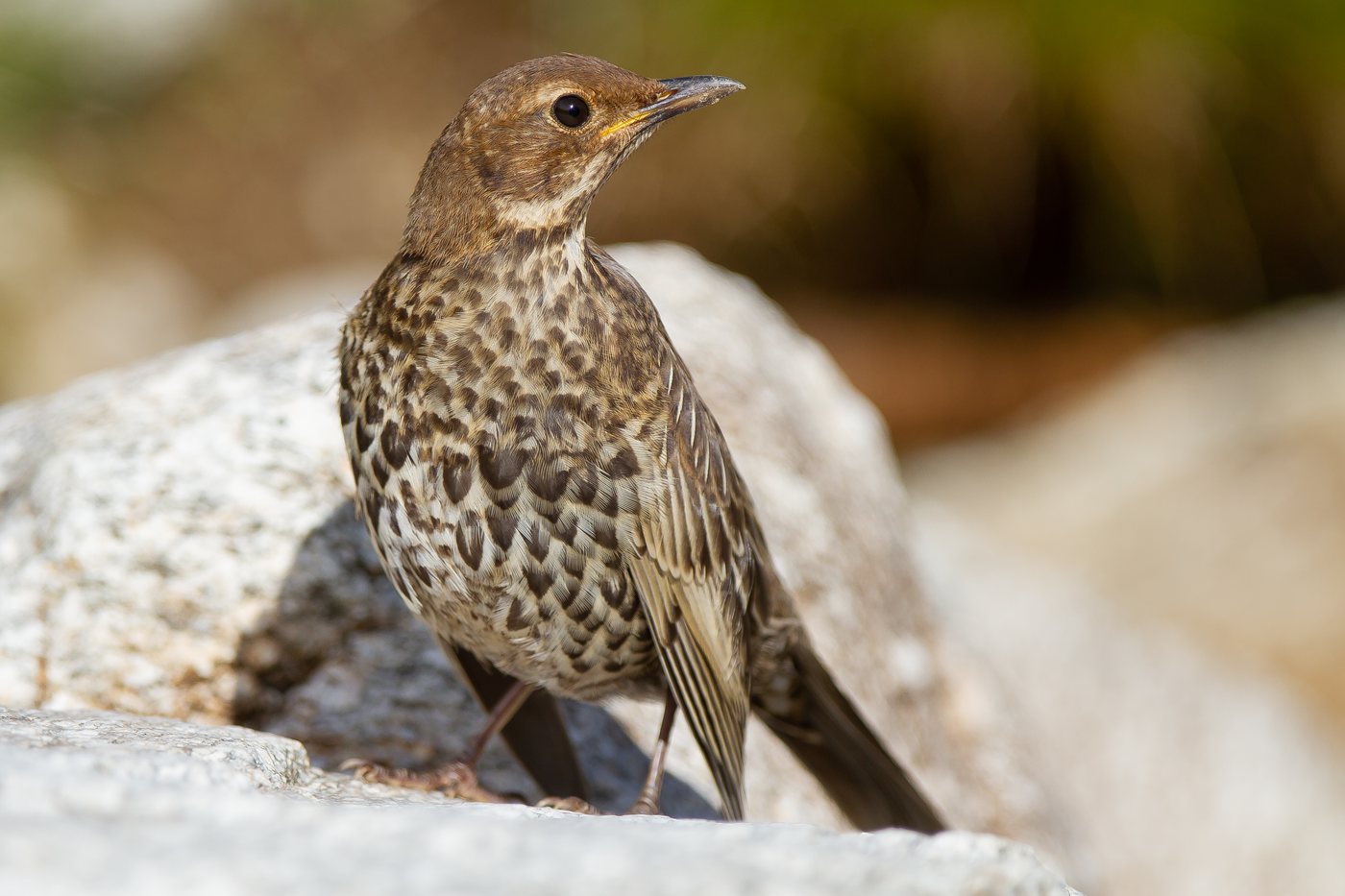
In the high country around Großer Arber, Rachel, and Lusen, the ring ouzel breeds along open mountain spruce forest, boulder fields, and the Schachten clearings, one of very few low-mountain-range sites outside the Alps for the alpestris subspecies. A white crescent on its breast sets the male apart from a blackbird and gives the bird its name. From April to October it can be seen here, moving between the open ground and stands of trees on the Schachten in search of food.
Pictures: Freepik
What to check before booking
- On stilts or in the tree?
- Both count as a tree house. On stilts it stands steady and carries more weight; among the branches it sits closer to the trunk. The photographs usually show the difference better than the text.
- How do you get up?
- Stair, ladder or rope bridge. With small children, heavy luggage or at night, that is the difference that counts.
- Where is the bathroom?
- On board or in the sanitary building at the foot of the tree. Anyone who gets up at night should know beforehand.
- Is it heated?
- That decides whether a booking in October still makes sense. Unheated houses close over the winter.
- How far away is the car?
- Some houses stand by the access road, others a few hundred metres into the wood. You carry the luggage yourself.
Who it suits
Made for
Couples who want one night that is different, and families with children who climb safely. Anyone who likes being out early gets the morning in the forest without having to camp for it.
Less so for
A tree house is not step free, and without a bathroom of its own every trip at night becomes a climb down. Anyone who needs space or travels with two weeks of luggage is better off at ground level.
Where it comes from
Tree houses to sleep in are young in Germany. The first tree house hotel in the country opened in 2005 at the Kulturinsel Einsiedel near Görlitz, after seven years of planning and building. Twenty-five individually designed houses stand there today, and almost every federal state now has some.
Good to know
The climb is part of it
Stair, ladder or rope bridge takes you up. A tree house is therefore not step free, and luggage goes up on your own back.
Dogs not everywhere
Where the way up is a ladder, dogs usually stay below. Hosts with a staircase often take them along.
You hear the rain
A wooden roof under a crown makes every shower audible. Light sleepers do better expecting it than being surprised by it.
Dark skies
Places certified by DarkSky International.
Sternenpark Bayerischer Wald
Certified in 2025, one of the youngest in the country. High up in the Bavarian Forest the sky is at its clearest in winter, when cold dry air sits over the ridges.
Getting there
- 1 h 00 minRegensburg
- 1 h 45 minMünchen
- 4 h 00 minFrankfurt am Main
- 5 h 45 minKöln
- 6 h 00 minBerlin
- 7 h 45 minHamburg
Good to know
Trail Rules in the Core Zone
More than half of the national park is open to walk freely year-round. On about 45 percent, mainly in the high elevations and moors, trail rules apply. There, from July 15 to November 15, all other trails and paths may also be used; outside that period, only the marked hiking, cycling, and cross-country ski trails are allowed. In winter, leaving the marked trails in the core zone is prohibited, and signs mark the zones on site.
Dogs Must Be Leashed
Dogs are allowed in the national park but must be kept on a leash. Off-limits to dogs are the open-air animal enclosure at the Lusen National Park Center, the Scheuereck deer enclosure, and the Grenzsteig trail, as well as the Baumwipfelpfad tree-top walkway, Hans-Eisenmann-Haus, and the Waldgeschichtliches Museum, the forest history museum. Dog stations with waste bins are located at both national park centers and in Spiegelau; bring your own bags.
No Open Fire in the Protected Area
Smoking and open fire are banned in the national park, as are drones and feeding animals. Grilling is allowed only at the designated play and grill areas, for which the administration issued new rules in May 2026. The ban on fire, smoking, and open flame also applies at the Scheuereck campsite.
Overnight Stays at Only Two Sites
Wild camping and overnight stays anywhere in the national park are prohibited. There are two official sites, each open from April 1 to November 15 and limited to a maximum of two nights: Scheuereck, with four camper van and four tent spaces, free of charge, and the main car park at the Falkenstein National Park Center, with five camper van spaces at 8 euros a night. Parking is allowed only at signposted car parks, with a fee of at most 5 euros a day.
Swimming and Boating Are Regulated
Swimming is not allowed in the national park, including at Rachelsee and in the mountain streams. Canoeing and kayaking on the Schwarzer Regen river are reserved for private individuals and are governed by a regulation of the Regen district dated May 2, 2011, as amended April 25, 2023. The district publishes day by day whether the river is currently open to boating, and separate rules apply to the Bärnloch and Nagerlbrücke sections.
GUTi and Waldbahn Instead of a Car
Overnight guests in 40 participating municipalities automatically receive the GUTi guest ticket at check-in, which makes bus and train travel free from the day of arrival to the day of departure, including on the Czech side. The Waldbahn train serves four lines with Zwiesel as its hub, the Igelbus shuttles connect the hiking trailheads around Lusen and Rachel, and the Falkensteinbus serves destinations in the north. Express bus lines 100 and 200/201 also run from Passau.
Protected landscapes
- National park
- Bayerischer Wald
- Nature park
- Bayerischer WaldOberer Bayerischer Wald
Names and boundaries: © OpenStreetMap contributors.
