Camping in the Altmühltal
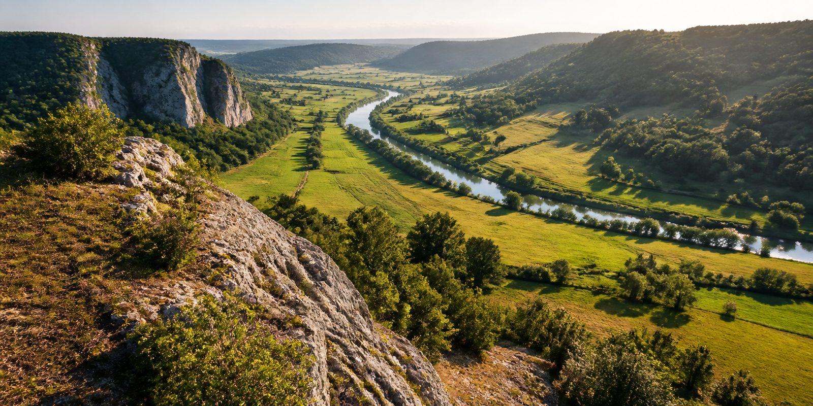
The Altmühltal is a White Jurassic limestone landscape. Free-standing dolomite crags and inselbergs rise above the valley floor, and above them lie juniper heaths and dry grassland with species that otherwise grow in the Mediterranean or the Alps. The bedrock below is karstified. It holds caves, sinkholes, spring pools and the stone runnels called Steinerne Rinnen. The Altmühl has the gentlest gradient of any river in Bavaria, and it runs through a valley far too large for it, because the Ice Age Urdonau scoured that valley out. Neither Alps nor lakes nor mountain forest define this region. The Plattenkalk does, and every Archaeopteryx find known so far has come out of it.
The year in this region
September: Geotope Day in the Fossil Region
Germany's national Geotope Day takes place every year on the third Sunday in September, organized by the Geotopes and Geoparks section of the DGGV geological society, the Academy of Geosciences in Hannover, and the Paleontological Society. Here it coincides with one of the world's most important fossil sites: every known specimen of the early bird Archaeopteryx comes from the Altmühl region. Good starting points are the quarries around Solnhofen and Mörnsheim, the Jura Museum at Willibaldsburg castle in Eichstätt, and the Weltenburger Enge, a Danube gorge near Kelheim, one of Germany's 77 National Geotopes.
In the middle of the month the sun rises at 6:50 AM and sets at 7:29 PM. That leaves 12 hours and 39 minutes of daylight.
Water and air: Open-Meteo, measured averages. How busy: share of school holidays 2027 across all sixteen federal states. Nature dates: German Weather Service, phenological observations 2014 to 2026 at 18 stations in the region, typical day.
Tours in this region
Marked tours that fit into a day from a site, and one multi day tour per kind.
- Hiking
Altmühltal-Panoramaweg
Between Gunzenhausen and Kelheim the trail keeps to the upper edges of the valley, on dry limestone with juniper heath and free-standing dolomite rocks. At Solnhofen stand the Zwölf Apostel, and the quarries beside them yielded the Archaeopteryx. Burg Prunn sits on the cliff above the Altmühl.
202.9 kmMulti day tour
- Hiking
Urdonautalsteig
Section 1 Dollnstein - Wellheim
From Dollnstein the trail leaves the Altmühl and turns into the Wellheimer Trockental, the dry valley the Urdonau once flowed through. Today the valley lies without a river. Juniper heath grows on the slopes, mixed woodland in the Beixenhart nature forest reserve, and rock noses keep pushing out of the trees.
16 km
- Cycling
Altmühltal-Radweg
From Rothenburg ob der Tauber over the Frankenhöhe, then all the way down the Altmühl to the Danube at Kelheim. The upper part rolls through open hill country, the lower one winds with the river between the Jurassic crags. Asphalt alternates with gravel, and climbs are rare.
244.8 kmMulti day tour
- Cycling
GeoRadweg Altmühltal Route 1
The northern geo route starts at the Ries crater near Nördlingen, struck by a meteorite just under fifteen million years ago, and ends at the Donaudurchbruch near Kelheim. On the way lie the quarries of Polsingen with their melted suevite, the Solnhofen limestone slabs and the baroque city of Eichstätt. At the end the walls stand seventy metres high.
197.2 kmMulti day tour
- Cycling
Fünf-Flüsse-Radweg
Section Hauptweg
Pegnitz, Vils, Naab, Danube and Altmühl: the route hangs on five river valleys and links Nürnberg, Amberg, Regensburg and Kelheim. In places it follows the old Ludwig-Donau-Main-Kanal. Part asphalt, part gravel, almost always down on the valley floor.
292.8 kmMulti day tour
- Cycling
Fränkischer WasserRadweg
Water sets the tone throughout: the Rothsee, the Große Brombachsee and the Altmühlsee lie on the route, and so does the Altmühl itself. Between the lakes it crosses open Franconian country, past Rothenburg ob der Tauber, Dinkelsbühl and Ansbach. The height differences stay small.
464 kmMulti day tour
- Mountain biking
Trails of Kelheim
Section UrTrails Altmühltal
The start is in the old town of Kelheim, and from there the climb goes up the Weltenburger Berg. Narrow trails such as Flow Joe and Fakir 2 link the slopes above the Donaudurchbruch. Under the tyres: roots and pale limestone grit.
5.7 km351 m ascent
Tours: © OpenStreetMap contributors, ODbL. Lengths computed from the mapped course, as of September 12, 2026.
Animals you can meet here
 all year
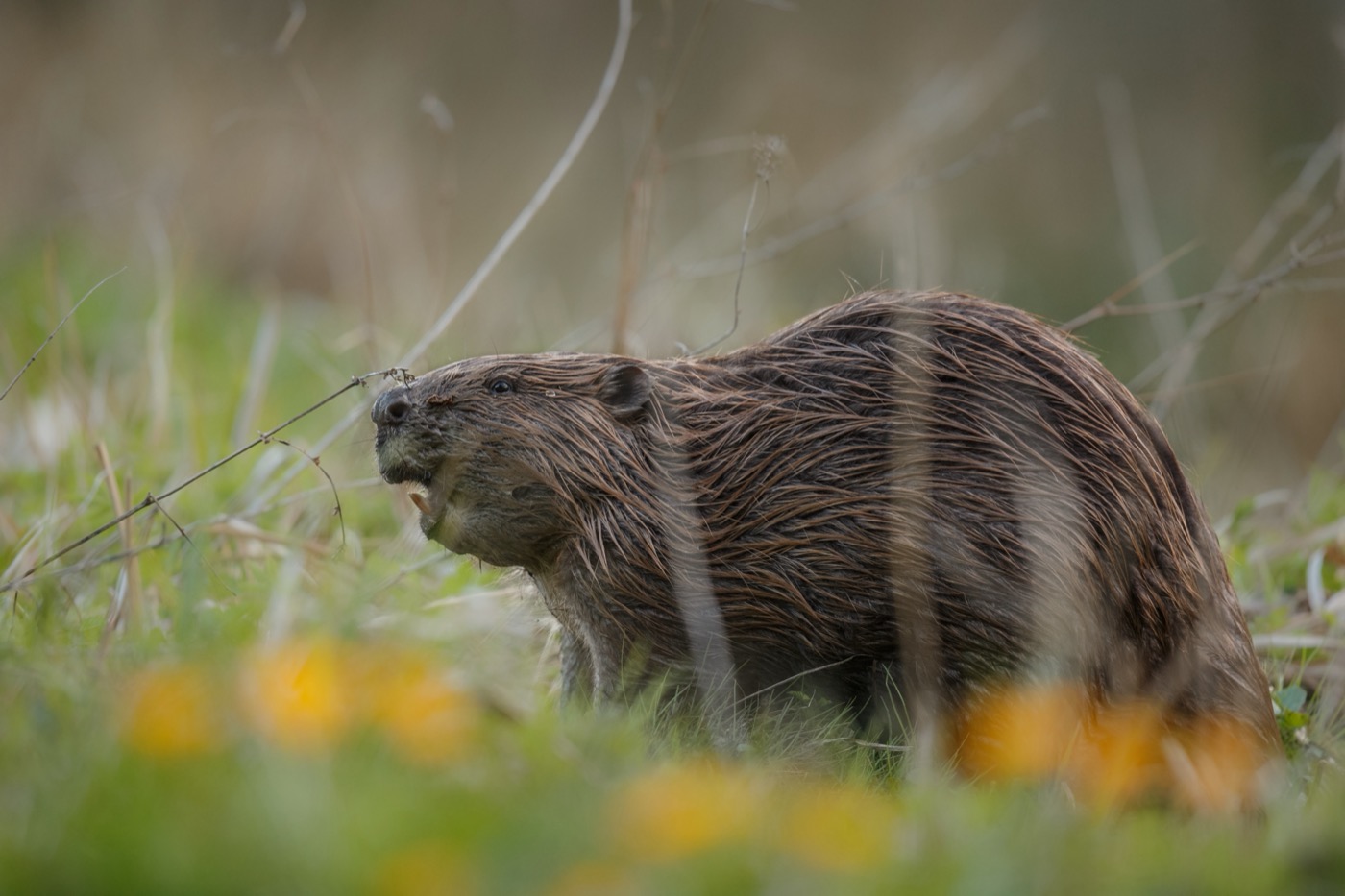
Eurasian beaver
Along the Altmühl itself and its old side channels, for example at the Altmühlaltwasser near Inching close to Eichstätt, freshly gnawed willows are the surest sign of its presence. The beaver only comes out at dusk and usually stays within 20 meters of the water while feeding. A family of four to five animals holds a territory of up to seven river kilometers.
 February to June
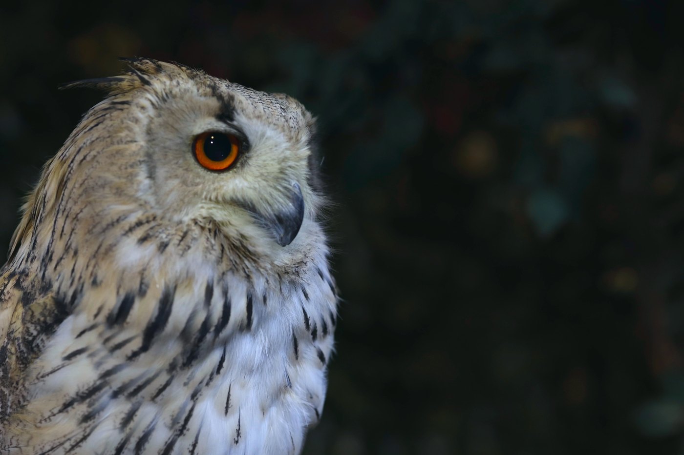
Eagle owl
The eagle-owl nests on the steep rock faces of the nature park and in disused quarries, for example at Blumenberg near Eichstätt and at Arzberg near Beilngries. From February to March its deep courtship calls can be heard at dusk, and breeding starts from late February. Later in spring the begging calls of the young birds can be heard on the same cliffs.
 all year
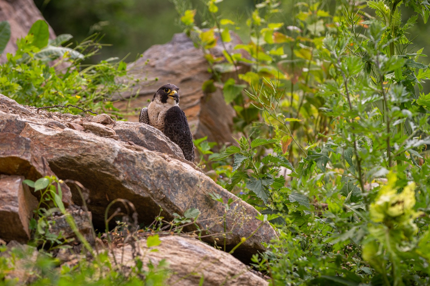
Peregrine falcon
The peregrine falcon nests on the high dolomite cliffs and disused quarries of the nature park, typically on rock faces at least 30 meters high such as in the climbing area around Dollnstein and Konstein. It is recognizable by its pointed, sickle-shaped wings and the fast stoop it uses to strike birds in flight. At least 300 pairs breed in Bayern, some of them on these cliffs in the lower Altmühltal.
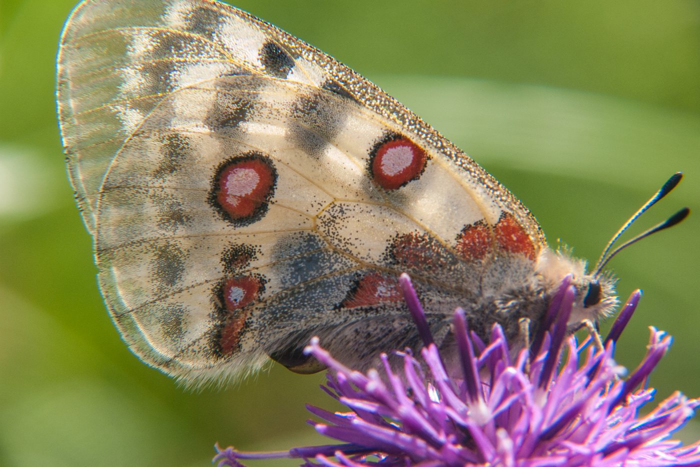 June to August
Apollo butterfly
The Apollo butterfly flies over sunny, rocky limestone slopes and the spoil heaps of old quarries, around Solnhofen and Mörnsheim, where white stonecrop grows in the rock crevices. It is recognizable by its white wings with black and red eyespots. It has only one generation a year, and outside the Alps it survives in Deutschland only along the Mosel and on the Fränkische Alb, whose Bayern stronghold lies in the Altmühltal.
Pictures: Freepik
Getting there
- 1 h 00 minNürnberg
- 1 h 15 minMünchen
- 3 h 00 minFrankfurt am Main
- 4 h 45 minKöln
- 5 h 00 minBerlin
- 6 h 45 minHamburg
Good to know
Altmühl Traffic-Light System, April 1 to June 15
During this period, the nature park divides the Altmühl into three sections, measures water levels in each, and sets a traffic light to green or yellow accordingly. The period covers the main spawning season for many fish species as well as the breeding and rearing season for waterbirds. Current water levels are published by the Bavarian flood warning service; paddlers are asked to use restraint at low water even outside these weeks.
Portage Around Weirs, Final Stretch on the Canal
Weirs on the Altmühl cannot be passed by boat; paddlers portage around them. Only craft under 1.5 meters wide are allowed on the river, oxbow lakes and side channels are closed to boats under Bavaria's boating regulation, and gravel banks and shallow-water zones must not be entered. The final 32 kilometers to Kelheim run along the Main-Danube Canal, where life jackets are required on board.
Climbing Under the Zone Plan and Nesting-Season Rules
A three-zone plan applies to the Dollnstein and Konstein area: no climbing in the quiet zone, only existing routes in the nature-priority zone, and free climbing in the climbing-priority zone. The nature park temporarily closes individual routes during the breeding season of sensitive species such as the eagle owl and peregrine falcon. Current notices for each crag are posted on juraclimbs.de; new routes in nature reserves require approval from the Kelheim district office.
Open Fire Only With Permission
Under Article 17 of the Bavarian Forest Act, anyone building an open fire site or lighting a fire in the forest, or within 100 meters of it, needs a permit. Smoking in the forest is banned from March 1 to October 31. For canoe touring on the Altmühl, camping is allowed only at designated sites, and all trash must be carried back out.
Overnight Stays Only at Designated Sites
Bavaria's right to roam, under Article 27 of the state nature conservation act, lets anyone enter open countryside free of charge, from forest and rock to wasteland, floodplains, and riverbanks. It does not cover overnight stays. The nature park designates campsites, tent sites, and RV sites, many of them right on the Altmühl and along the Altmühltal cycle path, including near Kipfenberg, Pappenheim, and at the Kratzmühle near Kinding.
Stay on the Trails, Give Way to the Sheep Flocks
Farmed and cultivated land may only be entered on existing paths while it is in use (Article 30 of the state nature conservation act); in the forest, cycling and horse riding are limited to roads and suitable tracks, and walkers have priority on private paths. Anyone out with a dog stays on the path for the same reason. Migratory sheep flocks graze the juniper heaths and keep the slopes open; the nature park's rangers ask visitors not to leave the marked trails and to avoid sensitive areas.
Protected landscapes
- Nature park
- Altmühltal
Names and boundaries: © OpenStreetMap contributors.
About this region
The Altmühltal lies in the Naturpark Altmühltal in Bavaria, shaped by dolomite cliffs, juniper heaths and caves. The Altmühl flows gently through the valley, good for beginners in a canoe. Along the river and the cycle path you find campsites, pitches and tent meadows.
The main season runs from May into early autumn, the busiest time; spring and late autumn are quieter. When a site is open is shown in each listing's calendar.
